OcuMap
Mobile Mapping Software
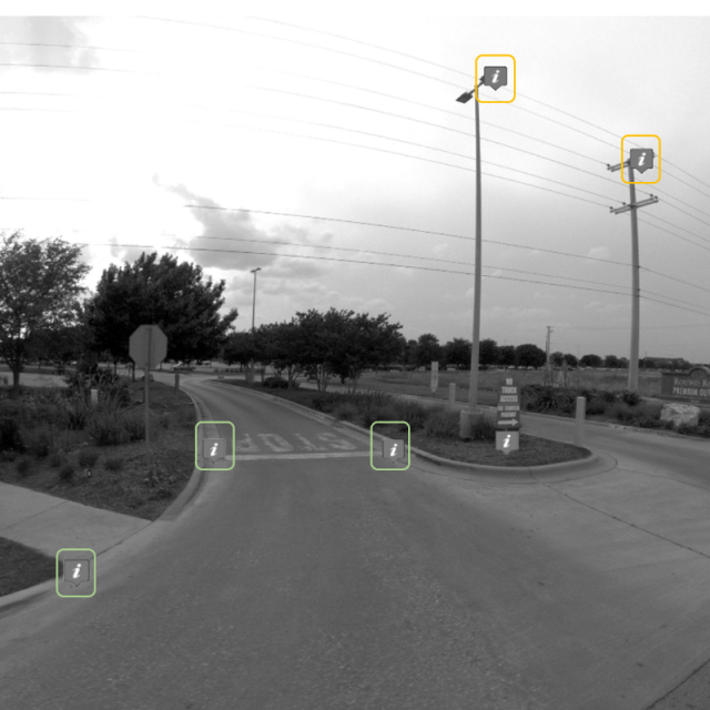
Street Level Mapping solution that supports Ladybug cameras, iStar, and all other panoramic imagery. Geotag defects and locate asset coordinates form inside images and 360 degree videos. Connect your GIS layers and share projects privately or publicly.
OcuMap Inc.
Houston, US
Description
OcuMap is single dashboard for visual asset inventory that enables documenting infrastructure conditions using videos, images and map data.
Specifications
-
Feature Extraction and Mapping
-
Mapping facilities
Y
Integration with 2D vector maps
Y
Integration with 3D vector maps
Y
Integration with point clouds
Y
-
Required Computer System
-
System includes hardware
N
Operating system(s)
iOS and Windows
-
Images and data
-
Input image formats
jpg, mp4
Export data formats
CSV
UAS Images
Y
-
Viewing System
-
Resolution
4K
-
General
-
Year of introduction
2016
Year of last update
2018
License configuration
SaaS
-
Measurement tools
-
Length
Y
-
More information
-
Main applications
Infrastructure Mapping, Visual Inspection and corridor mapping
Distinguishable features
360 geovideo, 3d measurements, web-based


