


ELCOVISION 10
ELCOVISION 10 is a leading software in full automatic 3D reconstruction from images. Introduced in 1986 as the world’s first PC based 3D photogrammetry software, it was also the first software which provided full automatic image orientation of terrestrial images and is now in its 9th generation. It has an extremely robust image orientation and the capability to generate superior pointclouds. Visit our website to download a evaluation version of ELCOVISON 10!

PMS Photo Mess Systeme AG
St. Margrethen, CH
Description
Since its market launch in 1986 as the world's first 3D photogrammetry system for PCs, ELCOVISION 10 has presented many groundbreaking innovations in the automatic 3D evaluation of images, such as in 2005 as the first 3D photogrammetry system with fully automatic image orientation for freehand images.
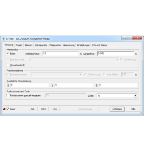
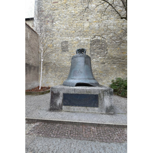
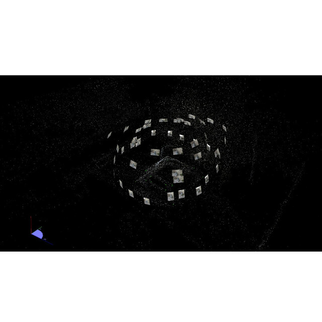
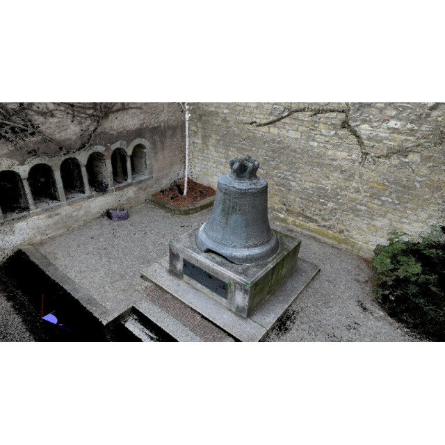
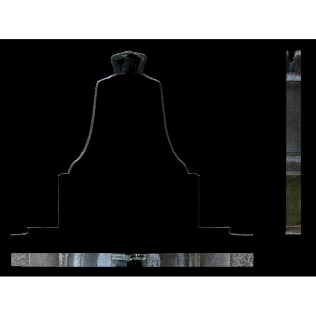
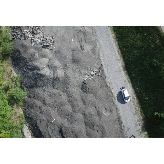
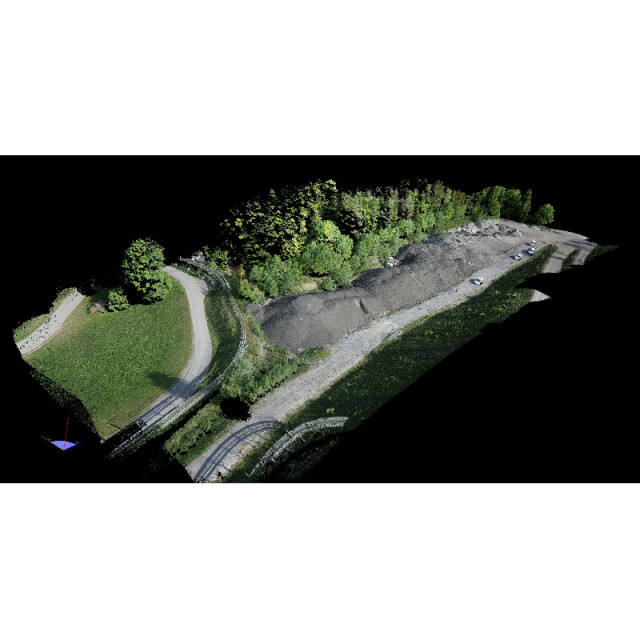
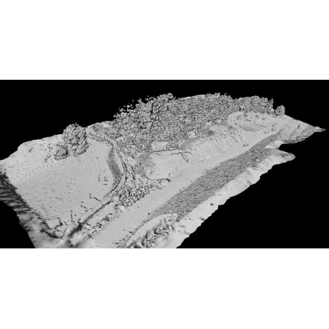
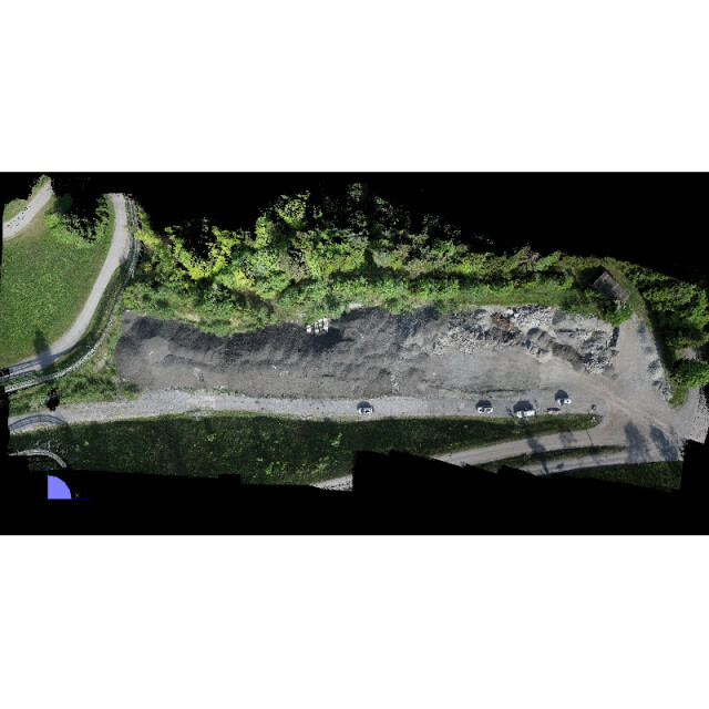
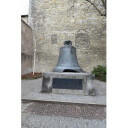
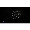
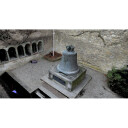
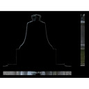
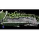
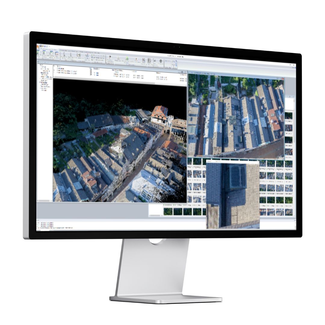
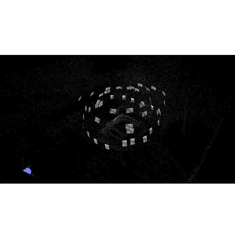
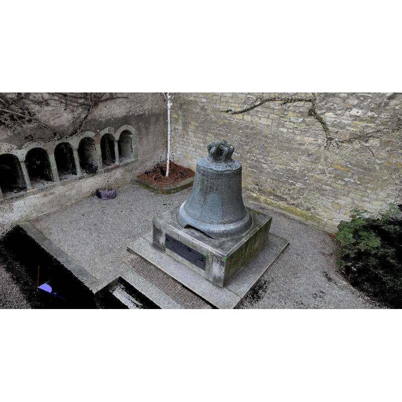
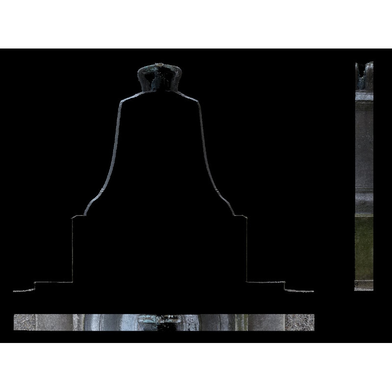
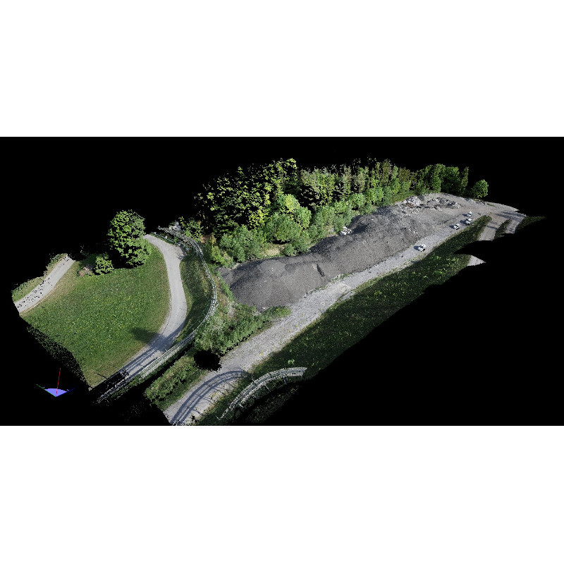
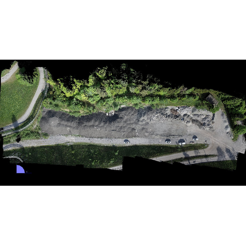
Now ELCOVISION 10 shows another innovation: The fully automatic generation of high density point clouds from images in almost laser scan quality. Even with surfaces that are almost homogeneous in color, even the smallest texture differences on the object are sufficient to produce almost noise-free 3D point clouds. Now you can even model difficult cases such as interiors or cars in 3D:
Photograph the object with any high-quality camera. You can use any camera with normal or fisheye lenses, even mobile phone cameras can deliver good results. If you are using a stereo camera such as the Leica BLK3D, you will automatically have a correctly scaled and orientated photo block.
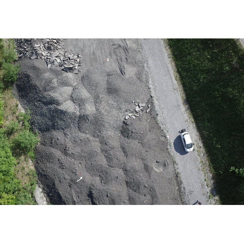
Take photos by hand, with a tripod, aerial photos of drones or from airplanes, ELCOVISION 10 processes all images, the only condition is that you have enough image overlap and the images have a reasonably good quality..
Do you have questions about this product?
- Questions about price, availability, and/or retailers
- Questions about technical specifications and usage
- Questions about suitability for your project or application
Specifications
-
Feature Extraction and Mapping
-
Semi-automatic line feature extraction
N
Semi-automatic building extraction
N
3D superimposition
Y
Integration with scanned maps
Y
Integration with 2D vector maps
Y
Integration with 3D vector maps
Y
Integration with point clouds
Y
Semi-automatic corner point extraction
Y
-
Required Computer System
-
System includes hardware
N
Operating system(s)
Windows 7,8x,10,11 64 Bit
CPU (min.)
Intel Core i5
CPU (preferred)
Intel Core i7, i9, AMD Ryzen
Min. RAM memory [Mb]
16
Preferred RAM memory [Mb]
64
64-bit version of software available
Y
Distributed processing capacity
N
GPU based calculations
Y
Min. data storage capacity [Gb]
5
Preferred data storage capacity [Gb]
100
Min. graphic card
GTX 1070
Hardware handling of big data sets
Any recent RTX 20xx or RTX 30xx with at least 8GB of Video Ram
Cloud processing
No
-
Images and data
-
Source data
All currently available cameras
Input image formats
Virtually all known image formats
Export data formats
dwg, e57,..pts, .xyz, .las, .laz, .spw, ply
Scanned analogue Aerial Photos
Y
Digital Aerial Nadir Frames
Y
Oblique Images
Y
Linear array sensors
N
Optical Satellite Images
N
UAS Images
Y
Radar Images
N
-
DEMs & Orthoimages
-
Automatic breakline extraction
N
Checking facilities (DEM editing)
N
Automatic contour generation
Y
Mosaicing of orthoimages
Y
True orthoimage generation
Y
Dense DSM creating capability
Y
Dense Image Matching
Y
Georeferencing / method of georeferencing
Control Points, GPS Data, Lokal System of coordiantes
Automatic matching
Yes
DSM to DTM filtering
Y
-
Viewing System
-
Resolution
Min. 1920*1080
-
General
-
Year of introduction
1986
Year of last update
2023
Regional settings available
Deutsch, English, French, Korean, Japanese
Modular
Yes
License configuration
Purchase
-
Orientation and triangulation
-
Relative
Y
Automatic aerotriangulation
Y
Automated blunder detection
Y
Self calibration
Y
images simultaneously processed
Y
Automatic Relative
Yes
Automatic interior
Y
-
Measurement tools
-
Length
Y
Area
Y
Volume
Y
lengte / area / volume
Y
Stereoscopic measurements
2 Image and multiple image measurement available.
Vegetation index calculation
No
Automatic classification
No
-
Image manipulation & processing
-
Automatic contrast manipulations
Y
Spatial convolution
Y
Resampling
Y
-
More information
-
Main applications
Terrestrial photogrammetry, UAV Photogrammetry
Distinguishable features
Extremely robust automatic orientation with up to 30° convergence angle between images, very high detailed pointclouds with virtually no noise.
Documents
Brochure
Elcovision10_English_V9.pdf
Other documents
-
Brochure ELCOVISION_10_V9_English.pdf296.59 KB
More from PMS Photo Mess Systeme AG
