iWBMSh STX
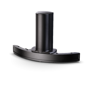
High-end Turnkey Multibeam Sonar System
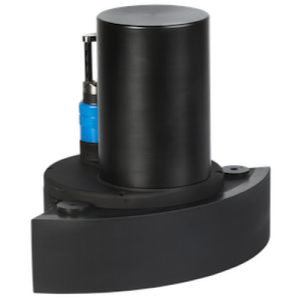
Introducing the first, go-anywhere, go-anytime ultra-high 3D resolution curved-array bathymetric mapping solution featuring industry-leading GNSS/INS positioning system from NORBIT. This most compact, highest resolution, tightly integrated, broadband multibeam sonar solution offering a curved array and GNSS/INS that is suited for the most demanding environments (Applanix OceanMaster). The iWBMSh STX is ready for rapid mobilization and delivers the highest XYZ performance for the price.

NORBIT Subsea
Trondheim, NO
Description
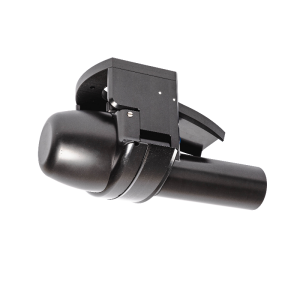
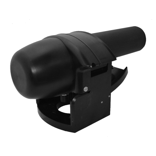
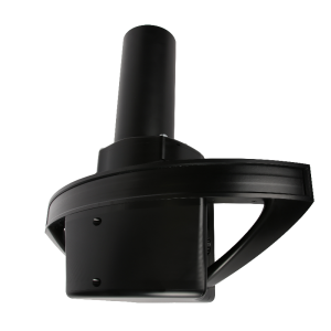
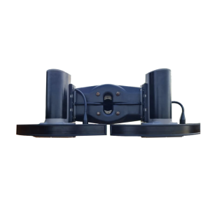
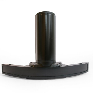
The iWBMSh STX is fully integrated with the highest performing sensors to work in the most challenging environments (under bridges or in rough sea conditions). Small form factor, low power draw and tight integration allow installation on any survey platform (permanent hull mount or pole mount) NORBIT STX uses rapid electronic transmit beam scanning to combine proven 2D bathymetry into 3D georeferenced bathymetry. For dredge application, a 4D experience is achieved by visualizing the change in 3D bathymetry as a function of time. Hands-free system tuning ensures quality data on the first survey.
Do you have questions about this product?
- Questions about price, availability, and/or retailers
- Questions about technical specifications and usage
- Questions about suitability for your project or application
Specifications
-
Physical properties of transducer head
-
Length [m]
0.445
Width [m]
0.227
Height [m]
0.236
Min. external power [V]
10
Max. external power [V]
28
Max. power consumption [W]
80
-
Speed of sound
-
Real-time correction of refraction at transducer head
Y
Real-time integration of SV-profile
Y
Explanation of SV-profile application process
3rd party software (QINSy, HYPACK, PDS2000, etc.)
-
Maintenance criteria
-
Mean time before failure [hr]
25000
Mean time to repair [hr]
25000
-
Interfaces
-
Compatible software
QPS, Hypack, EIVA, CARIS, PDS2000 and others
Compatible hardware
All mounting arrangents
-
Motion compensation
-
Motion sensors compatible to the system
incl. Applanix Oceanmaster OEM version
Required pitch uncertainty [deg]
0.01
Required roll uncertainty [deg]
0.01
Required heave uncertainty [m]
0.05
-
Mounting and deployment
-
Mounting
Hull mounted & Portable
Retractable
Y
-
Used Sonar Methods
-
Type of system
multibeam
Bottom Detection Method
Amplitude/phase/Blend
-
System Parameters
-
Min. frequency [kHz]
400
Max. frequency [kHz]
700
Number of selectable frequencies
81
Min. depth [m]
0.2
Max. depth [m]
275
Depth resolution [mm]
10
Max. Slant Range [m]
275
Max. swath as a function of depth
210
Max. pings / second
512
Ping frequency [Hz]
60
Min. beam width across track [deg]
0.9
Min. beam width along track [deg]
0.9
-
Bottom Coverage
-
Equal footprint spacing
Y
Max. number of points per ping for side scan operation
1024
-
Uncertainty
-
RMS of nadir depth measurement [m]
0.03
Intended S44 order
Special
Max. survey speed for specified RMS [kt]
8
-
More information
-
Distinguishable features
Curved Array, compact, tightly integrated, turnkey
-
General
-
Date of first release
2018
Documents
Brochure
PS-170005-9_iWBMSh-STX_12007-APBDD4_A4.pdf
