
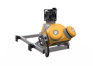
Trimble MX7
Highly portable mobile mapping system to capture precisely positioned street-level imagery
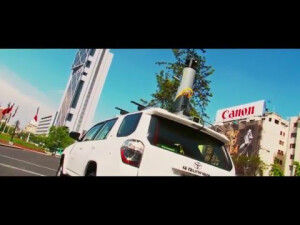
The Trimble MX7 mobile imaging solution allows you to capture environmental data for a complete job site or project area in a single site visit. Decision-makers can then use the captured data to undertake analyses and drive decisions based on the extracted information, from their office location.

Trimble, Inc.
Westminster, US
Description
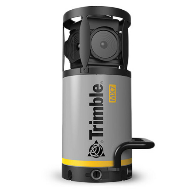
Equipped with a metric panoramic camera and a direct georeferencing system, the MX7 enables asset managers to build a complete inventory for municipal road networks, bridges, buildings, highways, and airport infrastructure. The Trimble MX7 mobile imaging solution allows you to capture environmental data for a complete job site or project area in a single site visit. Decision makers can then use the captured data to undertake analyses and drive decisions based on the extracted information, from their office location.
Do you have questions about this product?
- Questions about price, availability, and/or retailers
- Questions about technical specifications and usage
- Questions about suitability for your project or application
Specifications
-
General
-
Application
Outdoor
-
Positioning
-
GNSS receiver: Brand and model
Trimble AP15
Number of antennas
1
IMU: Brand and model
Applanix IN-Fusion™
IMU update rate [kHz]
0.2
Wheel sensor: Brand and model
No wheel sensors
-
Operation
-
Max. speed [km/hr]
110
Built-in Stabilisation
N
Main applications
Urban Infrastructure, Road Asset Management, Fiber to The Home Operations, Rail Infrastructure ,Construction Monitoring, Environmental Monitoring, Surveillance & Security, Site Inspection & Documentation, Taxation and Disputes
Distinguishing features
Capture 360-degree, geo-referenced images at highway speeds vastly reducing project operating costs whilst improving public safety. Use Trimble MX software to organize, visualize, interpret and efficiently extract structured data that can be integrated into a GIS and shared across your organization or via the Internet.
Training provided
Y
-
Camera System
-
Number of cameras
1
Spectral Bands [PAN, RGB, NIR, CIR]
RGB
FoV per camera [deg]
360
Maximum frames/sec. per camera
10
Export formats
pjr, jpeg
-
Dimensions & Environment
-
Weight [kg]
11.3
Min. Operation temp. [°C]
0
Max. Operation temp. [°C]
35
-
Included Processing Software
-
Recommended software (If no software included)
Applanix PosPac, Trimble Business Center, Trimble MX
-
Control Unit
-
WiFi
Y
Computer
BYO Tablet or Laptop
Size hard disk [GB]
2000
Documents
Brochure
migrationfnulqb.pdf
271.88 KB


