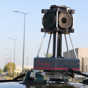
Road-Scanner 4
Road-Scanner is the first-class mobile mapping and scanning system developed by Siteco. It comes from the consolidated technical competence of Siteco in the field of mapping and surveying applied to road inventories, infrastructure monitoring, as-built surveys, pavement management systems for roads and airports and any other service connected to engineering and constructions.
Siteco Informatica
Bologna, IT
Description
The 4th generation high-performance Mobile Mapping System. Road-Scanner is the first-class Mobile Mapping and Scanning System developed by Siteco. It comes from the consolidated technical competence of Siteco in the field of mapping and surveying applied to road inventories, infrastructure monitoring, as-built surveys, Pavement Management Systems for roads and airports and any other service-connected to Engineering and Constructions.
Specifications
-
General
-
Year of initial introduction
2014
Year of last update
2016
Application
Outdoor
-
Positioning
-
GNSS receiver: Brand and model
Trimble Applanix or IXBLUE
Number of antennas
2
Update rate of GNSS receiver
100
IMU: Brand and model
APPLANIX LV510 or IXBLUE
IMU update rate [kHz]
200
Wheel sensor: Brand and model
APPLANIX or BEI
Number of wheel sensors
1
-
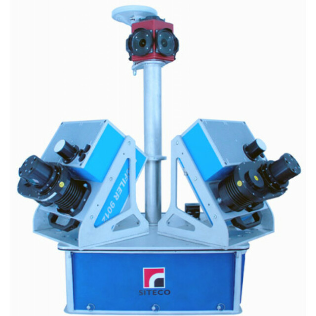
Lidar Sensor
-
Brand
Various (Z+F, FARO, Riegl)
Number of laser scanners
3
Laser safety classification
1
Max Range [m]
800
Scans per second
200
Export formats
All worldwide used
Range precision (1 σ)
0.001
-
Operation
-
Max. speed [km/hr]
150
Built-in Stabilisation
N
Operating time [hr]
5
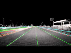
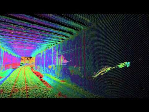
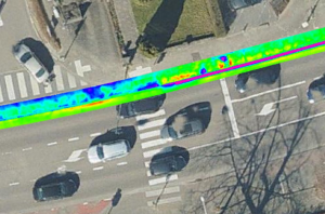
Main applications
High Grade SurveyInfrastructure and Rail MappingAs built SurveyGIS and Asset managementTunnel and Underground Survey
Distinguishing features
Up to 3 million point per second.No calibration procedures when installing the sensors. Easy to ship wordwide. Supports export free Positioning Systems. Eye safe. Connectable with almost any sensors (GPR, Profilometer, LCMS, etc).
Training provided
Y
-
Camera System
-
Brand and model
PointGrey Lady Bug
Number of cameras
8
-
Dimensions & Environment
-
Size with case
approx. 60x60x60 cm
Weight [kg]
50
Min. Operation temp. [°C]
-20
Max. Operation temp. [°C]
55
Max. humidity [%]
95
-
Included Processing Software
-
Photogrammetry Software
Yes - Road Sit Survey
Laser Point Clouds Software
Yes - Road Sit Survey
-
Control Unit
-
Computer
Acer MicroPC
Processor
i7
Size hard disk [GB]
2000
WiFi
N
I/O port(s)
LAN, PPS + serial, COM port, USB 3.0, VGA


