
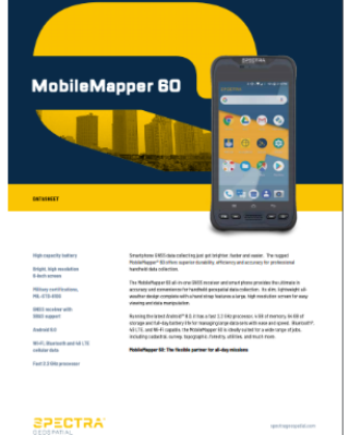
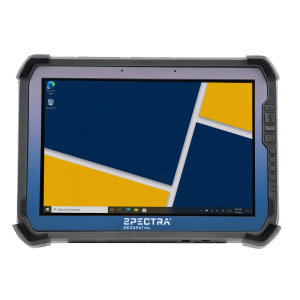
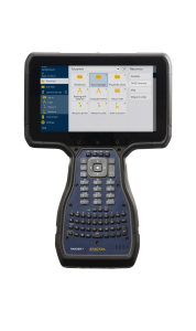
MobileMapper 60
Smartphone GNSS data collecting just got brighter, faster and easier.
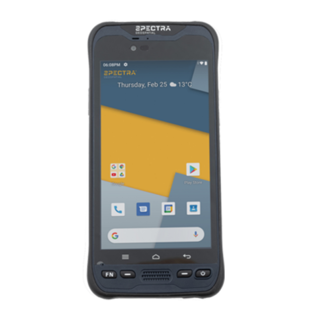
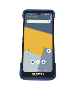
The rugged MobileMapper® 60 offers superior durability, efficiency and accuracy for professional handheld data collection. The MobileMapper 60 all-in-one GNSS receiver and smartphone provides the ultimate in accuracy and convenience for handheld geospatial data collection running the latest Android™️ 10.

Spectra Geospatial
Carquefou (Nantes),, FR
Description
The rugged MobileMapper® 60 offers superior durability, efficiency and accuracy for professional handheld data collection. The MobileMapper 60 all-in-one GNSS receiver and smartphone provides the ultimate in accuracy and convenience for handheld geospatial data collection. Its slim, lightweight all-weather design complete with a hand strap features a large, high resolution screen for easy viewing and data manipulation.
Running the latest Android™️ 10, it has a fast 2.2 GHz processor, 4 GB of memory, 64 GB of storage and full-day battery life for managing large data sets with ease and speed. Bluetooth®, 4G LTE, and Wi-Fi capable, the MobileMapper 60 is ideally suited for a wide range of jobs, including cadastral, survey, topographic, forestry, utilities, and much more.
MobileMapper 60 works with Penmap for Android. A hyrbrid survey & GIS app for data collection and stake out. Learn more
MobileMapper 60: The flexible partner for all-day missions
Do you have questions about this product?
- Questions about price, availability, and/or retailers
- Questions about technical specifications and usage
- Questions about suitability for your project or application
Specifications
-
General
-
Main design elements
hardware and software
Year of introduction
2019
Total Weight [kg]
0.385
Width [m]
0.0934
Height [m]
0.196
Depth [m]
0.0172
Resolution: horizontal pixels
1080
Resolution: vertical pixels
1920
Display: width [m]
0.075
Display: height [m]
0.133
Touchscreen
Y
-
More information
-
Main applications
GIS data collector. Data controller for SpectraGeospatial GNSS receivers
Distinguishable features
Large sunreadable display, <2m GNSS accuracy
-
Software
-
Name of GIS package
MpbileMapper Field
Zooming
Y
Panning
Y
Map rotation
Y
Editing of points
Y
Editing of lines
Y
Editing of polygons
Y
Editing of attributes
Y
Query
Y
Sketching of notes on map
N
Display of external data and photos
Y
Measurements: length
Y
Measurements: area
Y
Import/Export Formats
SHP, MIF, CSW, DXF
Name of survey data collection software
Survey Mobile
-
Connectivity
-
User Interfaces
Touch panel + Android keys+ Programable keys + vol
Wireless Data Transfer
Cellular/WiFi/Bluetooth
Bluetooth
Y
Ports
USB 3.0 (Type C)
WiFi
Y
-
GNSS Receiver
-
Compatible GNSS correction signals
SBAS
GNSS Systems Supported
GPS, Glonass, Beidou, QZSS, SBAS
Number of Channels
72
Integrated SBAS
Y
Update Rate [Hz]
1
Stand alone positional accuracy [m]
2
-
Computer
-
Hard Disk
Nand Flash
Processor
Qualcomm Snapdragon 626
RAM [MB]
4000
Hard Disk [MB]
64000
Types of Replaceable Memory
Micro SDCard up to 128 GB
Audio: speaker
Y
Range measurement
N
Operating System
Android 10
Built-in Camera: megapixels
13
Audio: microphone
Y
-
Horizontal uncertainty
-
code: SBAS (constant part) [m]
2
-
Operation Characteristics
-
Integrated sensors
Compass, IMU, NFC
Operating temperature: min. [°C]
-20
Operating temperature: max. [°C]
55
Water and dust proof [IP]
IP67
Humidity resistance
95% non condensing
Shock proof
1.2m on concrete (MIL-STD-810G)
Operation time per battery [hr]
15
Battery Field Replaceable
Y
Pole mount available
Y
Documents
Brochure
MM60-v2-Datasheet-EN.pdf

