
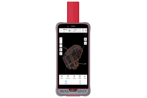
Description
Specifications
-
More information
-
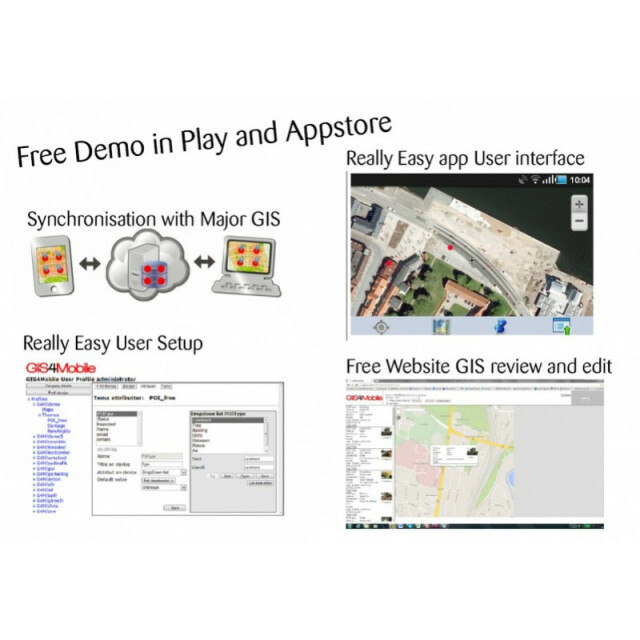
Main applications
All geografical field uses Asset tracking and management Easy Crowd sourcing of field data
Distinguishable features
Cache feature for viewing, editing and input data without data connection Cheap flexible solution Synchronization with all major GIS
-
Software
-
Name of GIS package
GIS4Mobile
Zooming
Y
Panning
Y
Map rotation
N
Editing of points
Y
Editing of lines
Y
Editing of polygons
Y
Editing of attributes
Y
Query
Y
Sketching of notes on map
Y
Display of external data and photos
Y
Measurements: length
Y
Measurements: area
N
Import/Export Formats
All major GIS systems
-
Connectivity
-
Wireless Data Transfer
WIFI, Internet
Bluetooth
N

