RDPS - Rapidly Deployable Positioning System
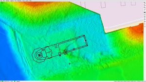
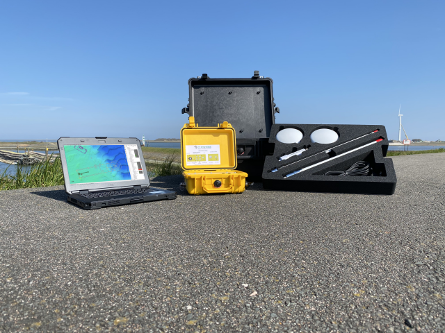
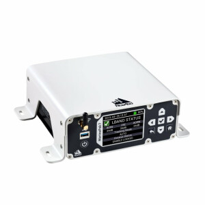
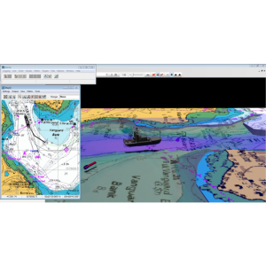
The Rapidly Deployable Positioning System (RDPS) is a portable system for precise positioning operations. A single RDPS will assure you of exact positioning of any vessel, including vessel to vessel telemetry. Simply position the antennas outside and connect GeoGNSS RDPS. The notebook running Viking will connect to the Wi-Fi antenna and gather all data. The GeoGNSS RDPS has a wide input DC power supply enabling many options for power sourcing. The RDPS comes with highly accurate (RTK, Marinestar) DGNSS, GNSS compass, AIS, UHF telemetry, industrial Wi-Fi, rugged notebook, Viking positioning software, and all required adapters, cables and antennas.
CT Systems
Hippolytushoef, NL
Description
Kit Includes:
Rugged GeoGNSS (RTK & Marinestar options)
Dell Rugged Laptop
Viking Offshore Software
Dual GNSS RTK Antenna
PoE Industrial WiFi antenna
Internal AIS receiver & Antenna
Stainless Steel Mounting
Cable Kit
UHF Antenna (optional)
Rugged Peli Carrying case for all equipment
RDI Option:
The Remote Data Interface (RDI) is an optional extension to the RDPS. The RDI also consists of a rugged Peli Case with an internal industrial device server coupled with industrial Wi-Fi. The RDI enables remote and direct access to additional sensors and positioning equipment.
Specifications
-
General
-
Year of current version
2024
-
More information
-
Distinguishable features
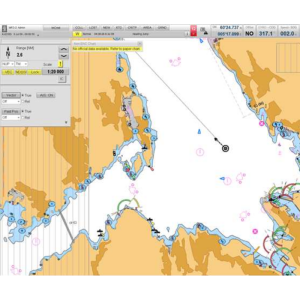
The Viking Offshore software package is a specialized version of our regular Navigation package for Offshore usage, with improved redundancy and backup features. It is capable of instant switching to a secondary systems in case of failure or loss of quality. Viking Offshore also includes all the specialized Viking modules for Offshore operations. Anchoring/Tug Management Module Distance Warning/Windmill Module Backup Support
-
Basics
-
Software solution
Y
Combined software/hardware solution
Y
Hardware requirements
Pentium 4, 1GB, 1024 x 786
-
Features
-
Functions for on board use of SOLAS vessels
N
Functions for leisure market
N
Derivatives available for shore based use
Y
All official data formats accepted
Y
Compliance and approvals
IHO Standard S-57 Ed. 3.1.1: ENC data format, IHO Standard S-52 Ed. 6.0: Colours & Symbols, IHO Standard S52 Annex A: presentation Library
Integration
ARPA targets, AIS targets
-
Interfacing
-
Max. number of NMEA0183 serial interfaces
10
Max. number of NMEA 2000 CAN Bus serial interfaces
2
Max. number of analogue interfaces
16
Special interface for gyro compasses
Y
Possibility of secondary displays
Y
-
Additional functions
-
Map projection adjustable
Y
Head up display
Y
Relative motion display of AIS and radar targets
Y
Integrated sailing directions database
N
Trial manoeuvre mode
N
Tidal calculations overlay
N
Weather overlay
N
Conning display
Y
Online help functions
N
User interface in multiple languages
Y
General print functions
Y
Print functions of ISM-required route planning documents
N
-
Support
-
Documentation in multiple languages
Y
24/7 Provision of chart data service
N
Remote wireless maintenance
Y
Related products


