
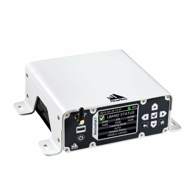
MarinePak7 Marine GNSS Receiver
Marine-certified Global Navigation Satellite System (GNSS) receiver with NovAtel OEM technology
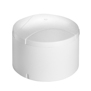
The MarinePak7 is a marine-certified Global Navigation Satellite System (GNSS) receiver with NovAtel OEM technology that delivers precise positioning and timing for demanding nearshore marine applications.

NovAtel
Calgary, CA
Description
Purchase our MarinePak7, built purposely for high accuracy on the water, and enjoy Oceanix Nearshore Correction Service included for a year!*
Engineered specifically for harsh marine environments, the MarinePak7 is a marine GNSS receiver built to receive Oceanix Correction Services for nearshore applications with accuracy levels up to 2.5 centimetres (95%). The receiver features an intuitive user interface that reduces training and setup time.
The MarinePak7 supports multi-constellation GNSS signals and RTK corrections transmitted via mobile phone networks and MSK Beacon corrections. Combined with SPAN GNSS+INS technology for attitude and heave measurements, this marine GNSS receiver delivers a robust, reliable and assured position at sea.
Several optional features are available with the MarinePak7, including GNSS heading, interference mitigation and UHF radio corrections. Users can add a removable battery to make the MarinePak7 a completely portable solution. With the battery, the marine receiver continues to operate when no direct power source is available and during periods of power loss.
Features
- Built to endure challenging marine environments
- Multi-constellation, multi-frequency GNSS signal tracking
- GNSS+INS capabilities for velocity, attitude and heave measurements
- Multi-channel L-Band supports Oceanix Correction Services
- Reception of MSK Beacon corrections for safe navigation
- Capable of PPP or RTK positioning
- GNSS Heading
- Internal or removable battery for a completely portable solution
Attributes
| System Type | Enclosed with IMU GNSS+INS enabled |
|
| General Info | Length (mm) | 198 |
| Width/Diametre (mm) | 254 | |
| Height (mm) | 80 | |
| Weight (kg) | 3 | |
| Typical Power Consumption (W) | 12 | |
| Signal Tracking | GPS | L1 C/A, L1C, L2C, L2P, L5 |
| GLONASS | L1 C/A, L2 C/A, L2P, L3, L5 | |
| BeiDou | B1l, B1C, B2l, B2a | |
| Galileo | E1, E5 AltBOC, E5a, E5b | |
| NavIC (IRNSS) | L5 | |
| SBAS | L1, L5 | |
| QZSS | L1 C/A, L1C, L2C, L5 | |
| L-Band (primary RF only) | Up to 5 channels | |
| Number of Com Ports | RS-232/RS-422 selectable | 3 |
| USB2.0 (host) | 1 | |
| Ethernet | 1 | |
| Wi-Fi | 1 | |
| Event Input | 1 | |
| Event Output | 1 | |
| Pulse Per Second output | 1 | |
| Performance | Accuracy | (RMS) |
| Single Point L1 | 1.5 m | |
| Single Point L1/L2 | 1.2 m | |
| SBAS | 60 cm | |
| DGPS | 40 cm | |
| Oceanix | 3 cm (95%) | |
| RTK | 1 cm + 1 ppm |
*NovAtel standard terms and conditions of sale apply. Subscription promotion must be redeemed before June 30, 2023. Promo valid between November 22, 2022 and June 30, 2023. Not applicable for precision agriculture, defense, or government applications. Contact NovAtel sales for more information.
Do you have questions about this product?
- Questions about price, availability, and/or retailers
- Questions about technical specifications and usage
- Questions about suitability for your project or application
Specifications
-
General
-
Type
-
Basics
-
Operating system
-
Features
-
Compliance and approvals
Integration
Documents
Brochure
001915796fe5a2e54fc20?authid=WtjVb9SWF5TW
Videos


