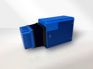
Underwater LiDAR SL4
High Speed Scanning with Remote Diagnostics
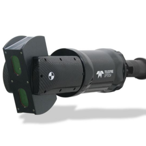
3D at depths new SL4 offers the same high performing Subsea LiDAR as the SL3 but improves collection times with 30x30 sector scanning speeds 6 x times faster than the SL3 from our new inhouse designed subsea electronics. Also benefiting from 3D at Depth's new Pan and Tilt combination the SL4 is a clear choice for remote operations with faster collection times and higher remote diagnostic capabilities.
3D at Depth
United States
Description
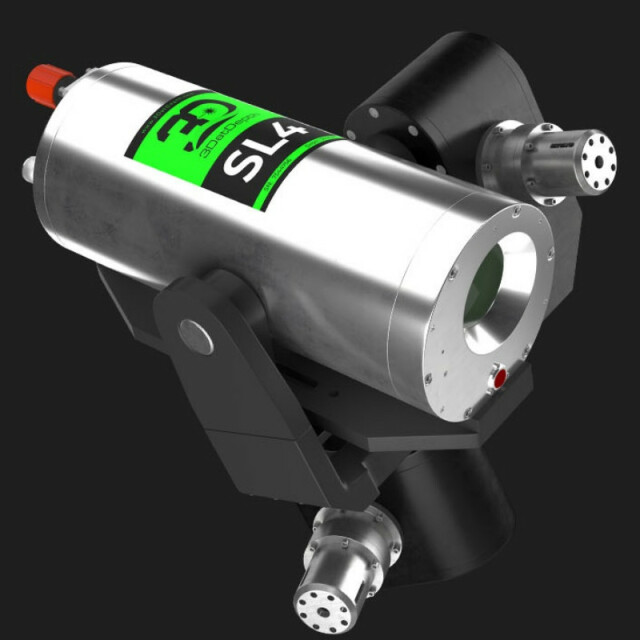
Our Subsea LiDAR (SL) SL3 laser system is powered by proprietary point cloud processing software with in-house patented technology and customized optical design. Each pulse can receive over 10 multi returns per pulse which are filtered through software. The result delivers precise, accurate, millimetric 3D point clouds with reflectivity. (Reflectivity and longer-range measurement repeatability are unique features attributed to 3D LiDAR datasets and are essential for more precise 3D modeling, analysis, and visualization.) The steerable, long-range beam up to 45 meters, places photons where you want them when you want them. Each base image is made up of 2.1 million measurements per sector to provide highly accurate 3D LiDAR point cloud data which can be measured, analyzed, and exported into any existing GIS, CAD, and analysis software.
The SL3 has an embedded MEMS inclinometer to calibrate pitch and roll and create real-world reference frames. This overcomes the inability to “level” a subsea sensor. The system also comes with an onboard computing subsystem and 1TB internal solid-state drive for fast performance and flexibility
For real-time data QC and data preprocessing, the system includes a computer with 3D at Depth software for collection (3D Collect), viewing (QuickView), and the creation of LAS and E57 files (3D Cloud). RIATT is a proprietary compression format that allows operators to move data across low bandwidth networks – from vessels to onshore processing teams. An integrated rotational stage provides a 90-degree x 360-degree field of view while mounted on an ROV or tripod. A graphical operator interface provides real-time quick views of the results and exports to industry-standard point cloud formats instantly.
With the SL3, you can significantly reduce the time for standard tasks such as spool piece metrology, other subsea construction survey tasks, inspection, and engineering measurements while dramatically improving data quality. Fast, high accuracy 3D data collection for field surveys, as-builts, and metrologies, movement, and engineering measurements are all possible with the same tool. Each SL system can be easily integrated and deployed on a wide range of systems including tripods, ROVs, AUVs, surface vessels, and diver systems. The rugged design supports a variety of subsea workflows and environments at depths up to 3000m, with capabilities of depths up to 4000m upon request.
Specifications
-
Application
-
Main applications
-
General
-
Lidar type
