
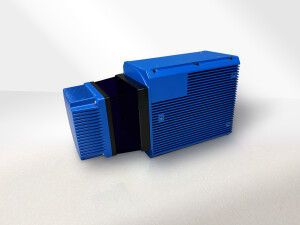
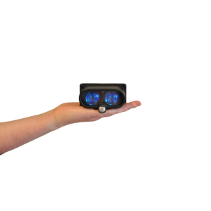
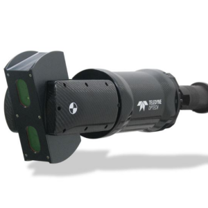
Lidar Sensors
Lidar, which is an abbreviation of light detection and ranging, is a technology that uses the reflections of a laser to determine the range, the position and the shape of objects in its sight. Traditionally, an oscillating mirror and a mechanical rotating sensorhead are used to change and measure the direction of the emitted and received laser pulses in the sensed environment. Lidar sensors are widely used in the mapping and surveying industry and are used to generate 3D representations of the environment. Developments in (and demand from) the robotics and autonomous vehicle industry have led to smaller, lighter, more versatile and cheaper sensors. Some examples of these developments are non-scanning lidar and solid-state scanners:
- Optical phased array (OPA) scanners, where no moving parts (like a mirror or rotating optical sensor) are used to steer the laser beam.
- Flash lidar, where not a mirror is used, but the entire view is illuminated and sensed with a flash, creating a raster like 3D image.
- Micro-electromechanical system (MEMS), where no mechanical parts other than the mirror has moving parts, bridging the gap between solid-state scanners and mechanical scanners."
Showing 1-5 of 5 results

Need some help? Ask a Geo-matching expert!
Our team and network of 1000+ manufacturers and developers is here to assist you.