
Leica HxMap - 3D Modelling Workflow for Airborne Data
Thu, Feb 25, 2021 at 9:00 AM (UTC)
1 hour
Join the webinar on 25 February to learn about the 3D city modelling module in Leica HxMap. Felix Rohrbach, product manager, will provide detailed insights into the 3D modelling functionality and an overview of its key features. For a deeper understanding of the 3D editor, application engineer, René Rothe, will demo the workflow.
Key take-aways
- Understand how to generate, edit and texture buildings in one unified software application
- Explore editing of building geometries in 2D and 3D
- Learn how to take advantage of collected sensor data when editing
- Gain knowledge on how to work efficiently using the building object list
- Learn to edit in stereo imaging mode using nadir or oblique imager
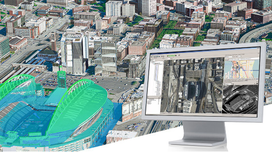
HxMap is the high-performance processing workflow for Leica Geosystems airborne sensors that provides a unified platform to process imaging and LiDAR data and create 3D building models.
Presenters:
- Felix Rohrbach, Product Manager HxMap, Hexagon
- René Rothe, Application Engineer HxMap, Hexagon
The webinar will be recorded and shared with everyone who registered.
Related products