Intergeo Presentation: Comparison of 3 LiDAR Captures (roadway) from Drone & Rotary Platforms, and At Varying Altitudes
Thu, Oct 15, 2020 at 11:15 AM (UTC)
1 hour
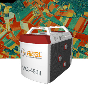
A two-mile transportation mapping project for the Oklahoma Department of Transportation (US) provided the perfect opportunity to perform extensive quantitative and qualitative testing of LiDAR point-clouds captured from three independent aerial platforms. LiDAR was captured from a UAV flown 250 feet up with a RIEGL VUX; from a rotary platform with dual RIEGL VUX LR sensors at 500 feet up; and with a RIEGL 480i from a rotary platform flown 600 feet up.

A two-mile transportation mapping project for the Oklahoma Department of Transportation (US) provided the perfect opportunity to perform extensive quantitative and qualitative testing of LiDAR point-clouds captured from three independent aerial platforms. LiDAR was captured from a UAV flown 250 feet up with a RIEGL VUX; from a rotary platform with dual RIEGL VUX LR sensors at 500 feet up; and with a RIEGL 480i from a rotary platform flown 600 feet up. All surfaces were compared against precision control provided by Oklahoma DOT, and further compared against the other datasets. The testing provided considerable information about the performance of all three datasets, and for the applicability of these data for low-altitude corridor applications. The data was also useful for comparison of LiDAR performance on hard surfaces (pavement), in areas of dense vegetation; and on open, bare earth surfaces. The results gained from all three LiDAR sources will be discussed in detail.
Presentation host: MR. MARK MEADE, RIEGL USA, Inc.

Related products