
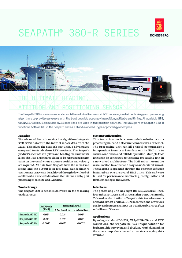
Seapath 380-R
The ultimate heading, attitude and positioning sensor
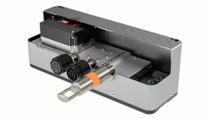
The Seapath 380-R series uses a state-of-the-art dual frequency GNSS receiver, inertial technology and processing algorithms to provide surveyors with the best possible accuracy in position, attitude and timing. All available GPS, GLONASS, Galileo, Beidou and QZSS satellites are used in the position solution. The MGC part of Seapath 380-R functions both as IMU in the Seapath and as a stand-alone IMO type approved gyrocompass.

Kongsberg Discovery
Horten, NO
Description
Function
The advanced Seapath navigation algorithms integrate RTK GNSS data with the inertial sensor data from the MGC. This gives the Seapath 380 unique advantages compared to stand- alone RTK products. The Seapath product’s accurate roll, pitch and heading measurements allow the RTK antenna position to be referenced to any point on the vessel where accurate position and velocity are required. All data from Seapath have the same time stamp and the output is in real-time. Subdecimetre position accuracy can be achieved through download of satellite orbit and clock data from the internet and by post processing of satellite and IMU data.
System configuration
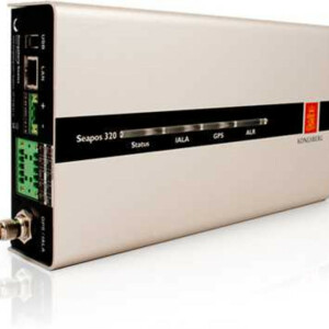
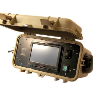
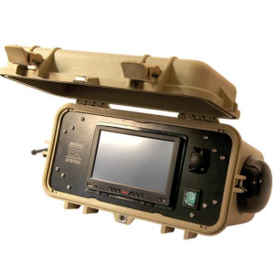
This Seapath series is a two-module solution with a processing unit and a HMI unit connected via Ethernet. The processing unit run all critical computations independent from user interface on the HMI unit to ensure continuous and reliable operation. Multiple HMI units can be connected to the same processing unit in a networked architecture. The HMI units present the vessel motion in a clear and easy-to-understand format. The Seapath is operated through the operator software installed on one or several HMI units. This software is used for performance monitoring, configuration and troubleshooting of the system.
Interfaces
The processing unit has eight RS-232/422 serial lines, four Ethernet LANs and three analog output channels. This makes distribution of Seapath data to various users onboard almost endless. DGNSS corrections of various quality and sources are input on a configurable RS-232/422 serial line or Ethernet.
Applications
By using standard DGNSS, XP2/G2/G4/G4+ and RTK corrections, the Seapath 380 is a unique solution for hydrographic surveying and dredging work demanding the most comprehensive and accurate surveying data available.
Do you have questions about this product?
- Questions about price, availability, and/or retailers
- Questions about technical specifications and usage
- Questions about suitability for your project or application
Specifications
-
General
-
Type of application
Marine
Documents
Brochure
kongsberg-datasheet-seapath380-r-march20.pdf
767.47 KB

