
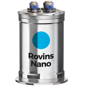
Rovins
FOG-based high-performance inertial navigation system for subsea vehicles
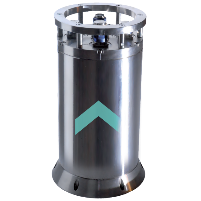
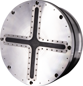
Rovins is a combined survey-grade full featured inertial navigation system for water depths up to 3,000 m. Designed specifically for offshore survey and construction works, Rovins, thanks to its advanced Kalman filter, improves the efficiency of all operations where accurate position, heading and attitude are key benefits. Rovins is offered in stand alone or «DVL ready».

Exail
Saint Germain en Laye, FR
Description
Rovins is a combined survey-grade full featured inertial navigation system for water depths up to 3,000 m. Designed specifically for offshore survey and construction works, Rovins, thanks to its advanced Kalman filter, improves the efficiency of all operations where accurate position, heading and attitude are key benefits. Rovins is offered in stand alone or «DVL ready».
Features
- All-in-one high-accuracy 3D positioning with heading, roll and pitch, ROT and 3D speeds.
- Unique FOG strap-down technology.
- Multiple interfaces (DVL, USBL, LBL, Ramses, GPS, depth sensor).
- Solution DVL Ready.
- Octans footprint compatible.
- Post-processing software option.
- OEM version available (C5, see Phins Compact Serie).
Benefits
- Accurate georeferenced position and attitude at high frequency.
- High reliability and low maintenance.
- Flexible and scalable configuration for all deployment scenarios and mission sequences.
- Immediate availability for all vehicles.
- Ultimate sub-metric performance using sparse array.
- Outstanding image georeferencing
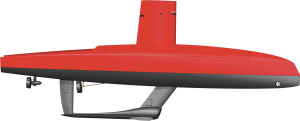
Application
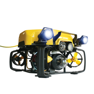
- ROV positioning.
- Multibeam sonar.
- Out-of-straightness.
- Subsea construction.
Do you have questions about this product?
- Questions about price, availability, and/or retailers
- Questions about technical specifications and usage
- Questions about suitability for your project or application
Specifications
-
Other specifications
-
Typical application
ROV/AUV positioning - Multibeam sonar motion reference - Subsea construction
Distinguishable features
- Accurate georeferenced position and attitude for all subsea vehicles at high frequency- No spinning element hence maintenance free- Flexible and scalable configuration for all deployment scenarios- Immediate availability and performance for all vehicles- Ultimate sub-metric performance using sparse array transponders and on-the-fly calibration- Immediate compatible
-
Environmental
-
Max. rotation speed [deg/s]
750
-
Software
-
Integrity monitoring of position input
Y
Integrity monitoring of log input
Y
Maximum latency of position input [ms]
10
Maximum latency of log input [ms]
100
Name
Inside Processing
Filtering
Y
-
Doppler log aided uncertainty
-
Pitch [deg]
0.01
Roll [deg]
0.01
Surge/sway [m]
0.025
Decrease in position accuracy [m/hr]
0.05
Heading [deg]
0.02
-
GNSS aided uncertainty
-
Heave: constant part [m]
0.05
Heave: variable part [%]
5
Increase in position uncertainty w.r.t. stand-alone GPS [m]
0.8
-
General
-
Year of initial development
2008
Height [m]
0.374
Width [m]
0.213
Length [m]
0.213
Weight [kg]
15
Min. Voltage (DC)
20
Max. Voltage (DC)
32
Power consumption [W]
15
Splashproof casting
Y
Water resistant casting
Y
Water resistance [m]
3000
Mean time between failures [hr]
80000
Type of accelerometer
Pendulum
Type of gyro
Fiber Optic Gyroscope
Removable from base plate
Y
Type of application
Marine
Moving parts
N
-
Unaided uncertainty
-
Pitch [deg]
0.01
Roll [deg]
0.01
Heave [m]
0.01
Surge/sway [m]
0.025
Decrease in position accuracy [m/hr]
0.05
Heading [deg]
0.05
-
Data formats
-
RTCM
Y
Other
ASCII, IXBLUE STD BIN etc… more than 130 output protocols
NMEA formats
Any
-
Inertial Measurement Unit
-
gyro bias [deg/hr]
500
Calibration procedure
Factory calibration
Documents
Brochure
datasheet-rovins-2023.pdf
215.67 KB
