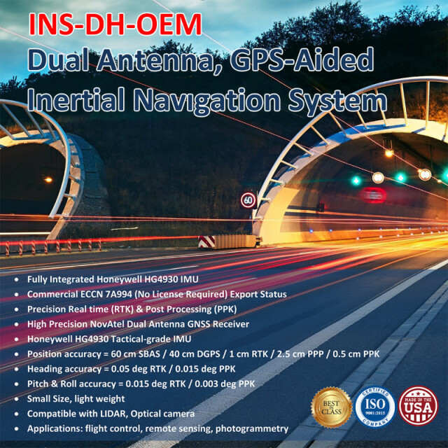


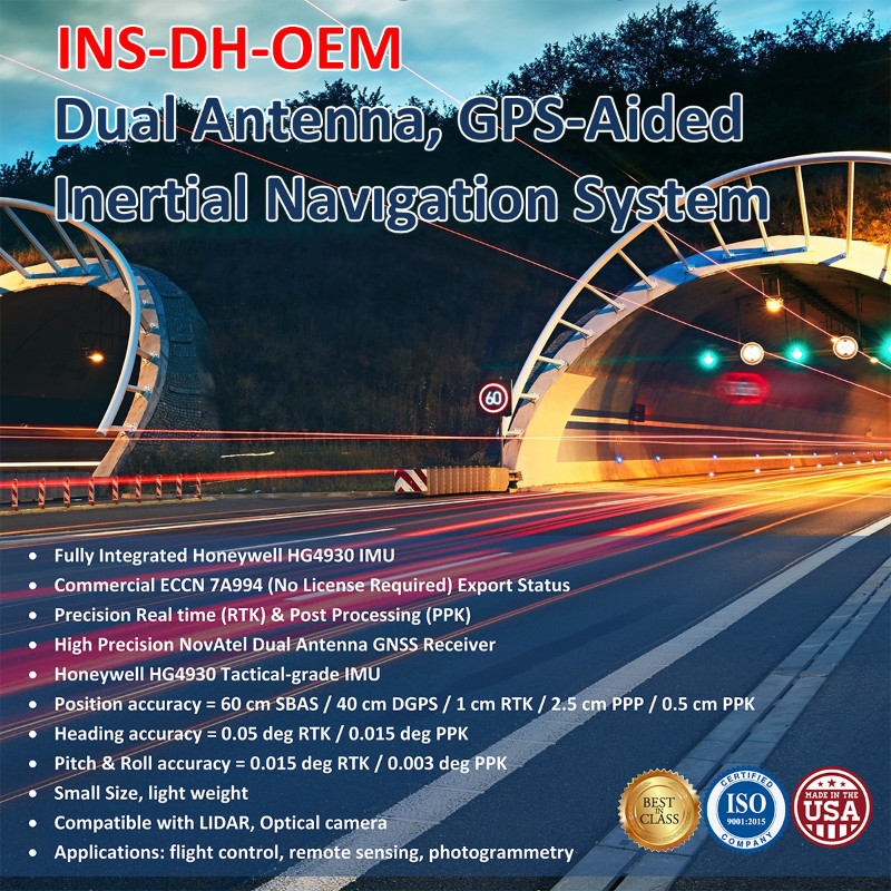
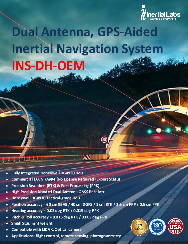
INS-DH-OEM
The new generation of dual GNSS antenna, fully-integrated, combined GPS, GLONASS, GALILEO and BEIDOU GNSS and high-performance strapdown system, that determines position, velocity and absolute orientation (Heading, Pitch and Roll) for any device on which it is mounted.
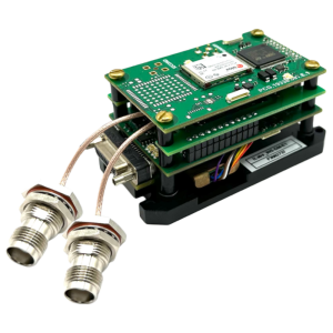
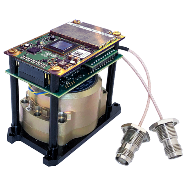
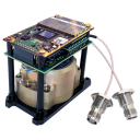
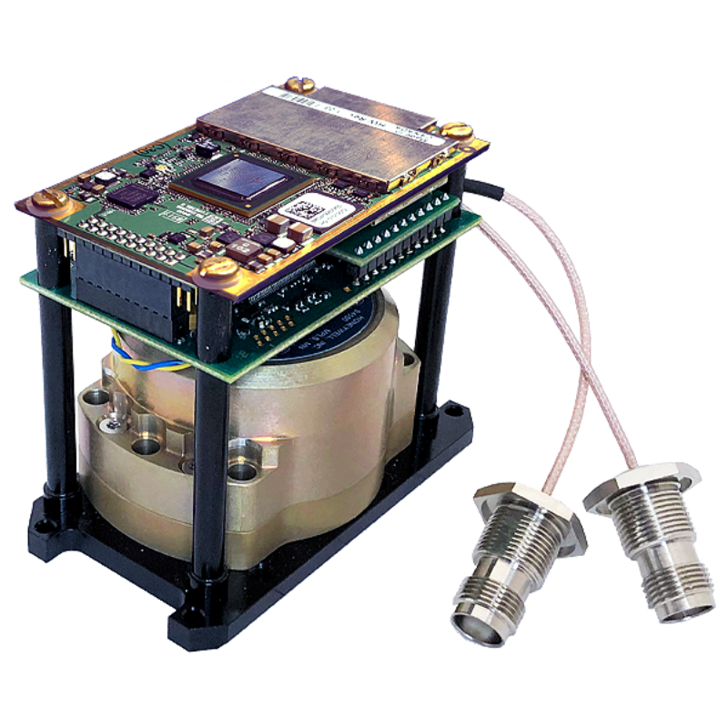
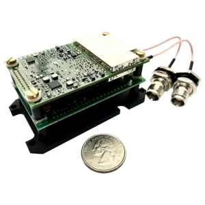
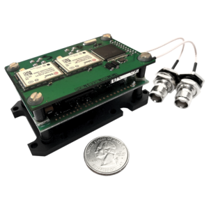
The Inertial Labs INS-DH-OEM utilizes an advanced dual antenna GNSS receiver, a Honeywell HG4930 IMU which has 3-axes each of calibrated in full operational temperature range Advanced MEMS Accelerometers and new generation of tactical grade MEMS Gyroscopes to provide accurate Position, Velocity, Heading, Pitch and Roll of the device under measure. INS-DH-OEM contains Inertial Labs new on-board sensors fusion filter, state-of-the-art navigation and guidance algorithms and calibration software.

Inertial Labs, Inc.
Paeonian Springs, US
Description
The Inertial Labs GPS-Aided Inertial Navigation System (INS-DH-OEM) is an OEM version of the new generation of dual GNSS antenna, fully integrated, combined GPS, GLONASS, GALILEO and BEIDOU GNSS and high-performance strapdown system, that determines position, velocity and absolute orientation (Heading, Pitch and Roll) for any device on which it is mounted. Horizontal and Vertical Position, Velocity, Dual Antenna Heading, Pitch & Roll are determined with high accuracy for both motionless and dynamic applications with IMU input from the Honeywell HG4930 aided by the NovAtel Dual Antenna Receiver.
KEY FEATURES, BENEFITS & FUNCTIONALITY
- Commercially exportable Dual Antenna GPS-Aided Inertial Navigation System
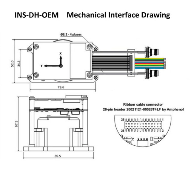
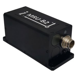
- Small size & lightweight: 85.5 x 67.5 x 52.0 mm size and 280-gram weight
- Honeywell HG4930-CA51 IMU
- Dual Antenna NovAtel GNSS Receiver for Highly Accurate Heading & Position
- GPS, GLONASS, GALILEO, BEIDOU and QZSS constellations
- SBAS, DGPS, RTK and PPP correction signals
- Compatibility with most commercially available LiDARs (Velodyne, RIEGL, FARO etc.)
- High-precision trigger for optical cameras
- Up to 600Hz IMU; 200Hz INS and up to 100Hz GNSS data rate
- GNSS measurements and IMU raw data for post-processing
- Advanced, extendable, embedded Kalman Filter-based sensor fusion algorithms
- State-of-the-art algorithms for different dynamic motions of Vessels, Ships, Helicopters, UAV, UUV, UGV, AGV, ROV, Gimbals
- and Land Vehicles
- Full temperature calibration of all sensing elements
Do you have questions about this product?
- Questions about price, availability, and/or retailers
- Questions about technical specifications and usage
- Questions about suitability for your project or application
Specifications
-
Other specifications
-
Export restrictions
ITAR Free
Graphical user interface
Y
Typical application
Vessels, Ships, Helicopters, UAV, UUV, UGV, AGV, ROV, Gimbals and Land Vehicles
Distinguishable features
Commercially exportable High Performance Dual Antenna GPS-Aided Inertial Navigation System
-
Environmental
-
Min. operating temperature [°C]
-40
Max. operating temperature [°C]
85
-
Software
-
Name
Inertial Labs GUI
Filtering
Y
Adaptable input signals
Y
Integrity monitoring of position input
Y
Integrity monitoring of log input
Y
-
GNSS aided uncertainty
-
Heading [deg]
0.05
Pitch [deg]
0.03
Roll [deg]
0.03
-
General
-
Type of application
Air, Land, Marine
Year of initial development
2020
Height [mm]
52
Width [mm]
67.5
Length [mm]
85.5
Weight [kg]
0.28
Min. Voltage (DC)
9
Max. Voltage (DC)
34
Power consumption [W]
3.9
Splashproof casting
Y
Mean time between failures [hr]
100000
Type of accelerometer
MEMS
Type of gyro
MEMS
Moving parts
N
-
GNSS Positioning Sensor
-
Number of integrated GNSS receivers and antenna ports
2
No. channels p receiver
2
Tracked satellite signals
GPS L1 C/A, L1C, L2C, L2P, L5; GLONASS L1 C/A, L2 C/A, L2P, L3, L5; BeiDou B1, B2; Galileo E1, E5 AltBOC, E5a, E5b; NavIC (IRNSS) L5; SBAS L1, L5 QZSS L1 C/A, L1C, L2C, L5; L-Band up to 5 channels; DGPS
SBAS differential signals
L1, L5
RTK Network Compatibility
RTCM 2.1/2.3/3.0/3.1
Update rate [ Hz ]
100
Cold start [ seconds ]
39
Hot start [ seconds ]
20
-
Data formats
-
NMEA formats
Binary, TSS-1, NMEA 0183 ASCII characters
RTCM
Y
-
Inertial Measurement Unit
-
Accelerometer bias [µ-g]
25
gyro bias [deg/hr]
0.25
Calibration procedure
Full temperature calibration of all sensing elements
-
GNSS positional accuracy
-
Horizontal Position Accuracy [ RMS in cm ]
120
Horizontal Position Accuracy (SBAS) [ RMS in cm ]
60
Horizontal Position Accuracy (RTK) [ RMS in cm ]
1
Documents
Brochure
ins-dh-oem-datasheet-rev1-8-march-2021.pdf
1.61 MB


