
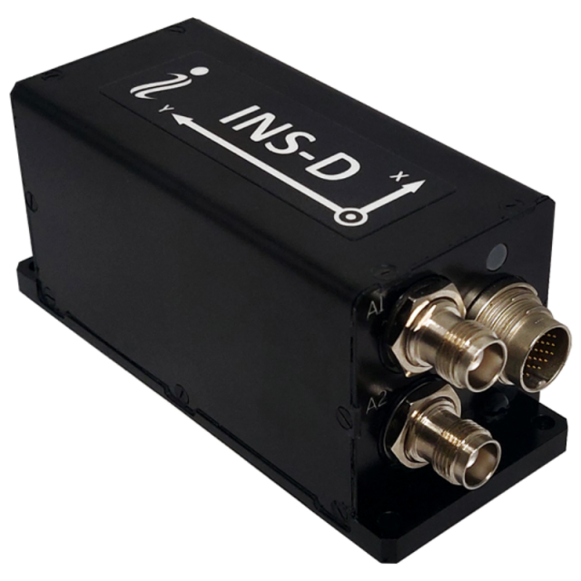
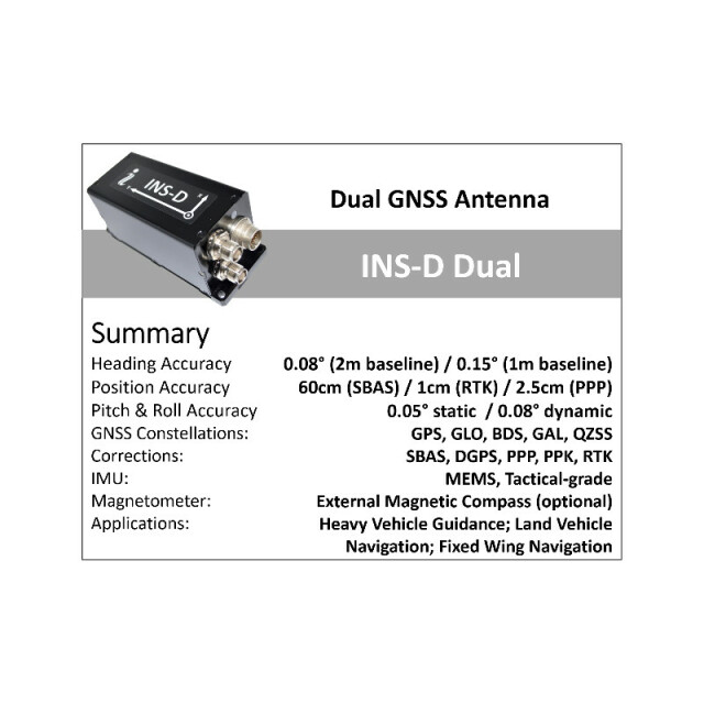


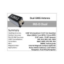


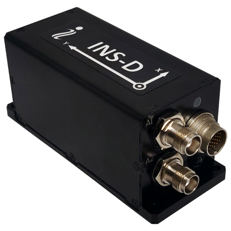
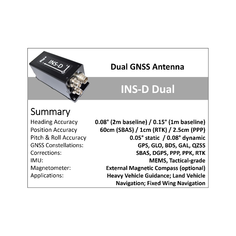


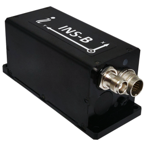
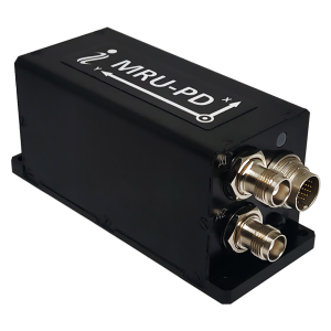
INS-D – Dual GNSS Antenna Inertial Navigation System
Compact, affordable, Dual GNSS antenna, GPS/Glonass/Beidou/Galileo-Aided Inertial Navigation System (INS-D)
The Inertial Labs Dual Antenna GPS Inertial Navigation System "INS-D" is the new generation of fully-integrated, combined GPS, Glonass, Galileo, QZSS, Beidou and L-Band navigation and high-performance strapdown system, that determines position, velocity and absolute orientation (High precision Heading, Pitch and Roll) for any device on which it is mounted. Horizontal and Vertical Position, Velocity and Orientation are determined with high accuracy for both motionless and dynamic applications.

Inertial Labs, Inc.
Paeonian Springs, US
Description
- Affordable price
- Excellent accuracy in GPS-Denied environments (Tactical-grade IMU + Fluxgate compass + Aiding data)
- GPS, GLONASS, GALILEO, BEIDOU, SBAS, DGPS, RTK supported signals
- Tactical-grade IMU (1 deg/hr gyroscopes and 5 micro gaccelerometers Bias in-run stability)
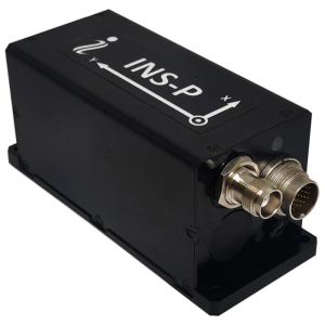
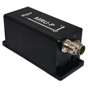
- Fluxgate gyro-compensated compass to maintain free-inertial Heading (INS-P model)
- Single and Dual antenna GNSS receivers
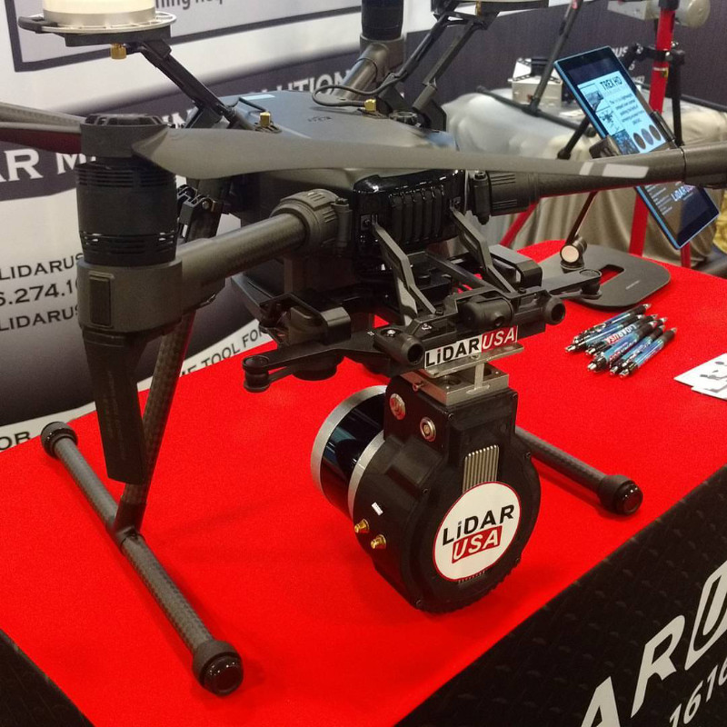
- Compatibility with LiDARs (Velodyne, RIEGL, FARO) and optical cameras
- Odometer, Wheel sensor, Airspeed sensor, Wind sensor, Doppler shift from locator aiding data
- 1 cm + 1 ppm RTK Horizontal Position Accuracy
- 2.5 cm TerraStar-C PRO Horizontal Position Accuracy
- 0.05 deg GNSS Heading and <0.4 deg Free-inertial Heading accuracy (3 sigma)
- Advanced, extendable, embedded Kalman Filter based sensor fusion algorithms
- State-of-the-art algorithms for different dynamic motions of Vessels, Ships, Helicopters, UAV, UUV, UGV, AGV, ROV, Gimbals and Land Vehicles
- Implemented ZUPT, GNSS tracking angle features
- Full temperature calibration of all sensing elements
- Environmentally sealed (IP67), compact design, MIL-STD-810G/DO-160E
Do you have questions about this product?
- Questions about price, availability, and/or retailers
- Questions about technical specifications and usage
- Questions about suitability for your project or application
Specifications
-
Other specifications
-
Export restrictions
No
Graphical user interface
Y
Typical application
Helicopters, UAV, UUV, UGV, AGV, ROV, Gimbals and Land Vehicles
Distinguishable features
Tactical-grade IMU, Dual Antenna GNSS receiver, Aiding Data
-
Environmental
-
Non-operating shock tolerance [g]
3000
Operating shock tolerance [g]
1500
Min. operating temperature [°C]
-40
Max. operating temperature [°C]
75
Max. rotation speed [deg/s]
950
-
Software
-
Name
GUI Software
Filtering
Y
Adaptable filter strength
Kalman
Adaptable input signals
Y
Integrity monitoring of position input
Y
Integrity monitoring of log input
Y
Max. number of position input signals
10
Max. number of log input signals
10
Maximum latency of log input [ms]
3
Maximum latency of position input [ms]
3
Uncertainty indicators given in output
Yes
Uncertainty of time stamp for output [ms]
3
-
Doppler log aided uncertainty
-
Heading [deg]
0.05
Pitch [deg]
0.08
Roll [deg]
0.08
Heave [m]
0.05
Surge/sway [m]
0.1
Decrease in position accuracy [m/hr]
6
-
GNSS aided uncertainty
-
Heading [deg]
0.05
Pitch [deg]
0.08
Roll [deg]
0.08
Heave: constant part [m]
0.05
Heave: variable part [%]
5
Surge/sway [m]
0.1
Increase in position uncertainty w.r.t. stand-alone GPS [m]
1
-
General
-
Type of application
Air, Land, Marine
Year of initial development
2014
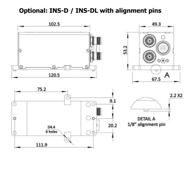
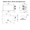
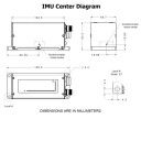
Height [m]
0.053
Width [m]
0.05
Length [m]
0.12
Weight [kg]
0.32
Min. Voltage (AC)
9
Max. Voltage (AC)
36
Min. Voltage (DC)
9
Max. Voltage (DC)
36
Power consumption [W]
2.6
Splashproof casting
Y
Water resistant casting
Y
Water resistance [m]
0.5
Mean time between failures [hr]
100000
Type of accelerometer
MEMS
Type of gyro
MEMS
Removable from base plate
N
Moving parts
N
Height [mm]
53.2
Width [mm]
49.3
Length [mm]
120.5
-
EM log aided uncertainty
-
Heading [deg]
0.05
Pitch [deg]
0.08
Roll [deg]
0.08
Heave [m]
0.05
Surge/sway [m]
0.1
Decrease in position accuracy [m/hr]
6
-
GNSS Positioning Sensor
-
Number of integrated GNSS receivers and antenna ports
2
No. channels p receiver
555
Tracked satellite signals
GPS L1/L2/L5; GLONASS L1/L2; BeiDou B1/B2/B3, QZSS L1/L2/L5; GALILEO E1/E5
SBAS differential signals
Yes
RTK Network Compatibility
Yes
Update rate [ Hz ]
200
Cold start [ seconds ]
50
Hot start [ seconds ]
30
-
Unaided uncertainty
-
Heading [deg]
0.05
Pitch [deg]
0.08
Roll [deg]
0.08
Heave [m]
0.05
Decrease in position accuracy [m/hr]
6
Surge/sway [m]
0.1
-
Data formats
-
NMEA formats
NMEA 0183
RTCM
Y
Other
Binary, ASCII
-
Inertial Measurement Unit
-
Accelerometer bias [µ-g]
5
gyro bias [deg/hr]
1
Calibration procedure
Calibration is not required
-
GNSS positional accuracy
-
Horizontal Position Accuracy [ RMS in cm ]
100
Horizontal Position Accuracy (SBAS) [ RMS in cm ]
60
Horizontal Position Accuracy (RTK) [ RMS in cm ]
1
Documents
Brochure
ins-datasheet-rev6-6-september-2021-0.pdf
1.26 MB
Other documents
-
Inertial labs GPS-Aided INS for Remote Sensing (3)765.54 KB


