
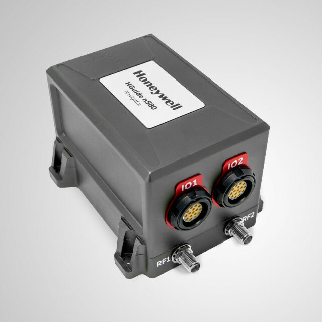
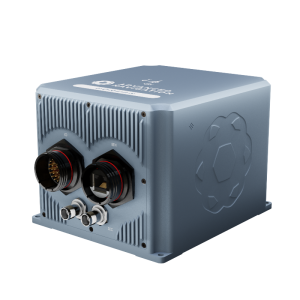
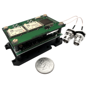
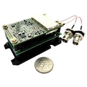
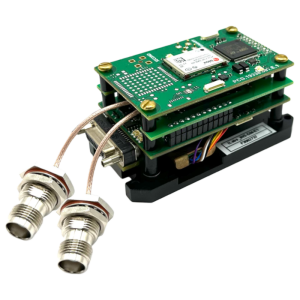
HGuide n580 Inertial/GNSS Navigator
Small, light-weight, self-contained, all-attitude Inertial/GNSS Navigator
The HGuide n580 is a small, lightweight, self-contained, all-attitude Inertial/GNSS Navigator for applications where accurate, continuous position and attitude navigation data is required even during regular prolonged GNSS outages. The HGuide n580 contains Honeywell’s leading-edge HG4930 IMU technology and provides a powerful dual-antenna, multi-frequency, multi-GNSS RTK capability.
Honeywell
Minneapolis, US
Description
The HGuide n580 is a small, light-weight, self-contained, all-attitude Inertial/GNSS Navigator which can be used in a wide variety of platforms, applications and industries where continuous navigation information is a critical component.
The HGuide n580 contains Honeywell’s leading-edge HG4930 IMU technology and provides a powerful dual-antenna, multi-frequency, multi-GNSS RTK capability. Honeywell’s integration expertise blends the IMU and GNSS data to provide accurate, robust navigation service to your application with all the functionalities that you need.
The HGuide n580 output data includes time-stamped position, velocity, angular rate, linear acceleration, roll, pitch and heading information. In dual-antenna mode, the device supports GNSS-based heading measurements
View the HGuide n580 on the Honeywell Website.
Specifications
-
Other specifications
-
Export restrictions
not ITAR controlled
Typical application
Whether the platform is autonomous or manned and operates in the land, sky, or sea the HGuide n580 is designed to meet the needs of a range of industries including: Agriculture, Automotive, Communication, Construction, Energy, Inspection, Mapping, Marine (Surface & Subsea), Mining, Robotics, Surveillance, and Transportation.
Distinguishable features
The HGuide n580 transmits high accuracy navigation outputs and status information upon power-up and continues to do so even if exposed to harsh environments. The user has the option to configure many aspects of the system including measurement frames, lever arms, and output messages.
-
Environmental
-
Min. operating temperature [°C]
-40
Max. operating temperature [°C]
71
-
GNSS aided uncertainty
-
Heading [deg]
0.05
Pitch [deg]
0.015
Roll [deg]
0.015
-
General
-
Type of application
Air, Land, Marine
Height [m]
0.09
Width [m]
0.09
Length [m]
0.06
Weight [kg]
0.495
Min. Voltage (DC)
9
Max. Voltage (DC)
36
Power consumption [W]
7
Splashproof casting
Y
Water resistant casting
Y
Removable from base plate
Y
-
GNSS Positioning Sensor
-
Number of integrated GNSS receivers and antenna ports
2
Tracked satellite signals
GPS L1 C/A, L1C, L2C, L2P, L5; GLONASS L1 C/A, L2 C/A, L2P, L3, L5; BeiDou B1, B2; Galileo E1, E5 AltBOC, E5a, E5b; NavIC (IRNSS) L5; SBAS L1, L5 QZSS L1 C/A, L1C, L2C, L5; L-Band up to 5 channels
RTK Network Compatibility
Y
-
Unaided uncertainty
-
Heading [deg]
0.06
-
Data formats
-
RTCM
Y
-
GNSS positional accuracy
-
Horizontal Position Accuracy (SBAS) [ RMS in cm ]
0.06
Horizontal Position Accuracy (RTK) [ RMS in cm ]
0.01


