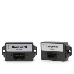
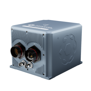
HGuide n380 Inertial Navigation System
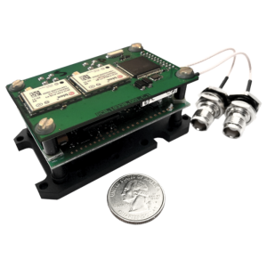
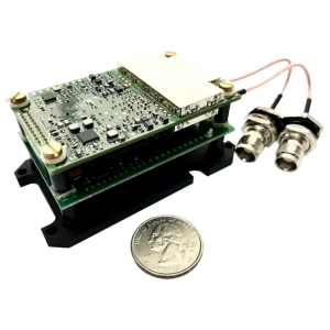
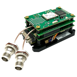
The HGuide n380 is an incredibly small, light-weight, self-contained, all-attitude Inertial Navigation System designed for applications where robust, continuous position and attitude navigation data is required.
Honeywell
Minneapolis, US
Description
The HGuide n380 is an incredibly small, light-weight, self-contained, all-attitude Inertial Navigation System designed for applications where robust, continuous position and attitude navigation data is required.
The HGuide n380 contains Honeywell’s leading-edge i300 inertial measurement unit (IMU) and provides a powerful dual-antenna, multi-frequency, multi-constellation RTK capability.
Honeywell’s integration expertise blends the IMU and GNSS data to provide accurate, robust navigation service to your application with all the functionalities that you need.
The HGuide n380 output data includes time-stamped position, velocity, angular rate, linear acceleration, roll, pitch and heading information. In dual-antenna mode, the device supports GNSS-based heading measurements and initialization.
KEY HONEYWELL ADVANTAGES
- Honeywell proven navigation algorithms for air, land and sea.
- World-class inertial sensor development, calibration, and compensation.
- Proven reliability, dependability, and ruggedness.
- Accepts RTCM3 GNSS corrections.
- Highest performing Inertial Navigation System of its size, weight and price.
- Configuration flexibility. Only purchase the features you need.
- Multiple configurable communication ports.
- The HGuide n380 is not ITAR controlled. Its Export Control Classification Number (ECCN) is 7A994.
View the HGuide n380 on the Honeywell Website.
Specifications
-
Environmental
-
Non-operating shock tolerance [g]
40
Operating shock tolerance [g]
2.2
Min. operating temperature [°C]
-40
Max. operating temperature [°C]
71
-
General
-
Type of application
Air, Land, Marine, Space
Year of initial development
2020
Height [mm]
48
Width [mm]
60
Length [mm]
90
Weight [kg]
0.32
Min. Voltage (DC)
9
Max. Voltage (DC)
36
Power consumption [W]
3.5
Splashproof casting
Y
Water resistant casting
Y
Water resistance [m]
2
Mean time between failures [hr]
24
Moving parts
N
-
GNSS Positioning Sensor
-
Tracked satellite signals
GPS L1, L2, L5; GLONASS L1, L2, L3; BeiDou B1, B2; Galileo E1, AltBOC, E5a, E5b; NavlC (IRNSS) L5; SBAS L1, L5 QZSS L1, L2, L5
Cold start [ seconds ]
45
Hot start [ seconds ]
20


