
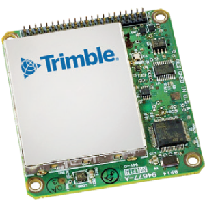
Applanix APX-18 UAV
More than Just an IMU, A Complete Soultuion
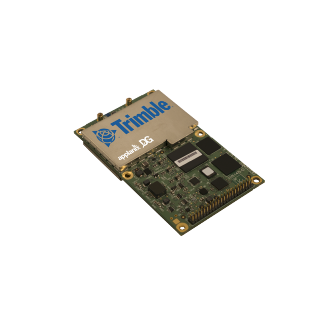
The Trimble APX-18 UAV is an OEM GNSS-inertial solution with dual GNSS antenna input, designed to georeference LiDAR and other imaging data when collected from Unmanned Aerial Vehicles (UAVs) at low speeds or when hovering.

Trimble Applanix
Richmond Hill, CA
Description
Comprised of a small single OEM board containing a precision GNSS receiver with two antenna heading and inertial sensor components plus POSPac UAV Differential GNSS-inertial office software, the Trimble APX-18 UAV produces a highly accurate position and orientation solution for directly georeferencing LiDAR point clouds and imagery.
Do you have questions about this product?
- Questions about price, availability, and/or retailers
- Questions about technical specifications and usage
- Questions about suitability for your project or application
Specifications
-
Other specifications
-
Graphical user interface
Y
Typical application
APX-18 UAV produces a highly accurate position and orientation solution for directly georeferencing LIDAR point clouds and imagery at low speeds or when hovering.
Distinguishable features
An OEM GNSS Inertial solution with dual GNSS antenna input,designed to georeference LIDAR and other imaging data when collected from Unmanned Aerial Vehicles (UAV) at low speeds or when hovering.
Export restrictions
Export friendly and is exportable worldwide.
-
Environmental
-
Min. operating temperature [°C]
-40
Max. operating temperature [°C]
75
-
Software
-
Name
POSPac UAV
Filtering
Y
Adaptable input signals
Y
Integrity monitoring of position input
Y
-
GNSS aided uncertainty
-
Heading [deg]
0.08
Pitch [deg]
0.025
Roll [deg]
0.025
-
General
-
Year of initial development
2016
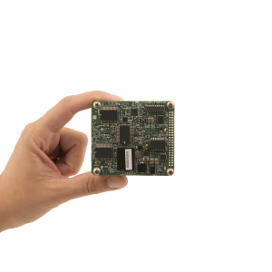
Height [m]
0.015
Width [m]
0.1
Length [m]
0.06
Weight [kg]
0.062
Min. Voltage (DC)
3.3
Power consumption [W]
1.5
Splashproof casting
N
Water resistant casting
N
Type of application
Air
-
GNSS Positioning Sensor
-
Tracked satellite signals
GPS L1, GPS L2, GPS L5, GLONASS L1, GLONASS L2, GLONASS L3, Galileo E1, Galileo E2, Galileo E5, Galileo E6, BeiDou B1, BeiDou B2, BeiDou B3
SBAS differential signals
Y
RTK Network Compatibility
Y
Update rate [ Hz ]
200
-
Data formats
-
NMEA formats
Yes
RTCM
Y
Other
binary
-
Inertial Measurement Unit
-
Calibration procedure
Applanix SmartCal
-
GNSS positional accuracy
-
Horizontal Position Accuracy [ RMS in cm ]
2
Horizontal Position Accuracy (SBAS) [ RMS in cm ]
50
Horizontal Position Accuracy (RTK) [ RMS in cm ]
2
Documents
Brochure
apx-18-uav.pdf
360.22 KB
Videos


