

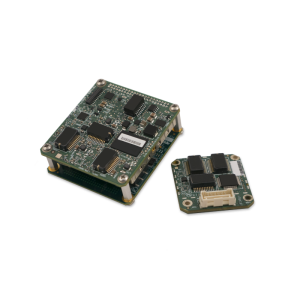
Description
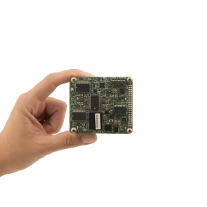
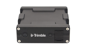
APX-15 UAV is a GNSS-inertial OEM solution designed to reduce the cost and improve the efficiency of mapping from small Unmanned Aerial Vehicles. Measuring just 6 cm x 6.7 cm and weighing only 60 grams, the Applanix APX-15 UAV provides unparalleled performance in an extremely small package.
Do you have questions about this product?
- Questions about price, availability, and/or retailers
- Questions about technical specifications and usage
- Questions about suitability for your project or application
Specifications
-
Other specifications
-
Graphical user interface
Y
Typical application
Direct Georeferencing of airborne sensor data collected from a UAV. Includes Orthophoto production, Topographical Mapping, Digital Terrain Model generation, Reconnaissance, Surveillance.
Distinguishable features
The Applanix APX-15 UAV is a GNSS-Inertial OEM solution designed to reduce the cost and improve the efficiency of mapping from small Unmanned Aerial Vehicles.
Export restrictions
The APX-15 UAV is export friendly and is exportable worldwide.
-
Environmental
-
Min. operating temperature [°C]
-40
Max. operating temperature [°C]
75
-
Software
-
Name
POSPac UAV
Filtering
Y
Adaptable input signals
Y
Integrity monitoring of position input
Y
-
GNSS aided uncertainty
-
Heading [deg]
0.08
Pitch [deg]
0.025
Roll [deg]
0.025
-
General
-
Year of initial development
2014
Height [m]
0.015
Width [m]
0.06
Length [m]
0.067
Weight [kg]
0.06
Min. Voltage (DC)
8
Max. Voltage (DC)
32
Power consumption [W]
3.5
Splashproof casting
N
Water resistant casting
N
Type of application
Air
-
Inertial Measurement Unit
-
Calibration procedure
Applanix SmartCal
Documents
Brochure
apx-15-uav.pdf
410.67 KB

Other documents
-
Delair-Tech's DT18/DT26X LongRange UAVs Now Integrated with Applanix' APX-15UAV & AP20 for Highly Accurate and Cost Effective Aerial Mapping764.88 KB
-
4D- IT Scan-Copter – UAV-Based High-Resolution LiDAR1.03 MB
-
Think 3D and Applanix Combine on Unique Solution for UAV-based Airborne LiDAR Mapping1.61 MB
-
Centimeter-Level Robust Gnss-Aided Inertial Post-Processing for Mobile Mapping Without Local Reference Stations880.69 KB
-
Spectrum UAV & Applanix Develop the UAV DG-1 Photogrammetry System793.36 KB


