


Onboard360
CARIS Process
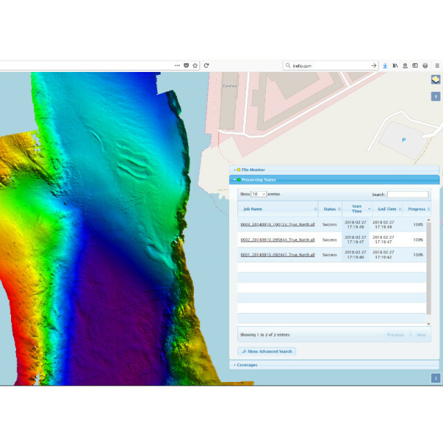
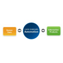
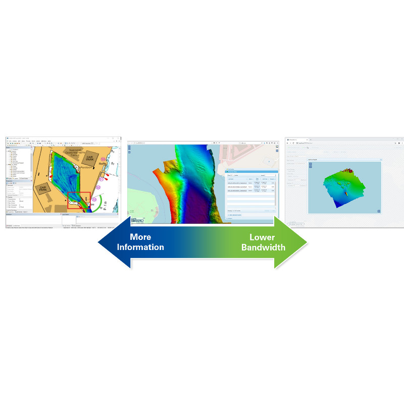
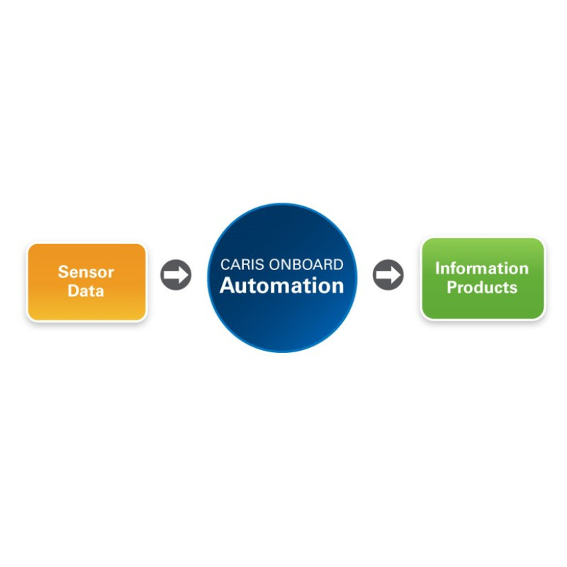
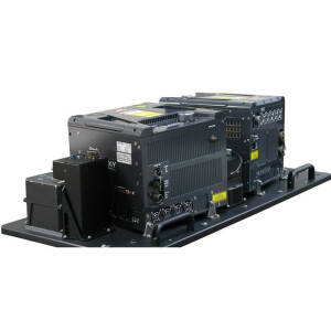
A near real-time sonar data processing and mapping application, Onboard360 is designed to work with survey platforms by automatically converting data as it becomes available to reduce the product creation timeline and increase quality control. Built using web-services, Onboard360 streams processed survey data to real-time quality control both on the vessel, and for remote monitoring, providing relevant information for survey operations when it matters.
Teledyne Geospatial
Vaughan, CA
Description
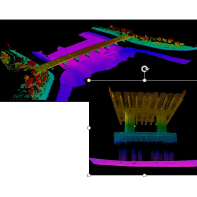
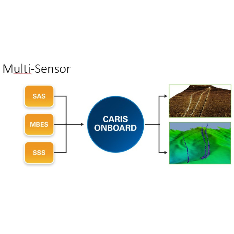
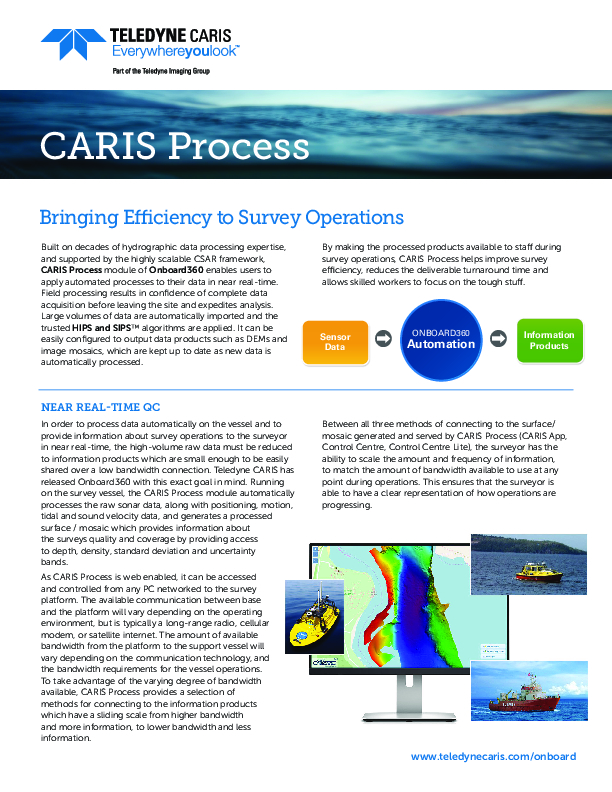
Built on decades of hydrographic data processing expertise, and supported by the highly scalable CSAR framework, CARIS Onboard enables users to apply automated processes to their data in near real-time, resulting in minimized data conversion and processing times. Large volumes of data are automatically imported and the trusted HIPS and SIPS™ algorithms are applied. It can be easily configured to output data products, such as DEMs and image mosaics, which are kept up to date as new data is automatically processed.
By making the processed products available to staff during survey operations, CARIS Onboard helps improve survey efficiency, reduces the deliverable turnaround time, and allows skilled workers to focus on the tough stuff.
Do you have questions about this product?
- Questions about price, availability, and/or retailers
- Questions about technical specifications and usage
- Questions about suitability for your project or application
Specifications
-
Hardware/software requirements
-
RAM [MB]
8000
HD{GB}
1
Field of Use
Automation, Hydrography, Oceanography, Exploration and Productions, Scientific
Languages Supported
English
Processor
[]
-
General
-
Year of last update
2020
Year of initial introduction
2015
Modules
CARIS Process
Supported Systems (SB, MB, SSS, Lidar etc.)
Single Beam, Multibeam, Side Scan Sonar, LiDAR, Synthetic Aperture Sonar (SAS), Interferometric
-
Processing
-
Sound velocity correction
Multiple profile correction support
Sound velocity correction type
Distance + Time
Tidal reduction
RTK-tide
Support tidal reduction network
Y
Gridding/Interpolation techniques
Swath Angle, Uncertainty, CUBE
Grid attributes {Std., Mean, Max, etc.}
Deep, Density, Depth, Mean, Std Deviation, Shoal, Uncertainty, Hypothesis Count, Hypothesis Strength
Lay-back correction
Y
Siant range correction
Y
Mosaic creation
Y
Mosaic creation algorithms
Weighted Blending
SSS Targeting
N/A
Video integration
N
Number of video channels
0
Assessment of bathymetry IHO Cat S-44
N
Type of automatic cleaning algorithm(s)
CUBE
Multibeam water column imaging support
N
Multibeam Backscatter Processing Functionality
Y
Mulitbeam Calibration mehods
Manual
Manual editing capability
N
-
Geodetic Functionality
-
Supported coordinate systems
EPSG
Geographical Coordinates {Lat, Long}
Y
Ground Coordinates {E,N}
Y
Seven Parameter shift supported
Y
Supported vertical reference frames
Any
Separation model for vertical datum shift support
Y
Local datum support
Y
Ellipsoidal reference support (GRS80)
Y
-
Product Generation
-
Automatic top of pipe calculation
N
Slope analysis
N
Dynamic event numbering
N
Automatic cross profile creation
N
Volume calculation
N
Contouring
N
Sounding Selection methods
N
Export/Exchange options
ASCII, CSAR grid/point cloud, HTF, FAU, GSF, UNISIPS, XML, BAG, TIFF/GeoTIFF, ESRI ASCII, USGS DEM, DXF, CARIS Map, GML, KML/KMZ, CARIS HOB, S-57 000, ESRI Shape
Combining bathymetry / terrestrial point clouds
N
-
Visualisation and Editing
-
2D Editing
N
2D Visualization
Y
Fly-throughs support
N
3D fly-through movies {*.mov etc}
Y
Area based 3D editing
N
Area based 3D View
Y
3D View max number points
Depends on PC
3D Integrated models
No
Sounding cleaning algorithms
CUBE, CARIS Mira AI
4D support
N
4D fly through movies {*.mov etc.}
N
-
Files and Registering
-
Input Formates {XTF, XYZ, GSF etc}
Atlas SDA/ASD/ACF, Bathyswath SXI/SXP/SXR, Chirpscan 3D BRF, CMAX CMX/CM2, Coda, Edgetech Midas/JSF/EGG260, Eiva SBD, Elac XSE, Furuno, GeoAcoustics RDF/RFF, GSF, Hypack RAW/HSX/HS2, Imagenex D1P/83P/83M, Klein, Kongsberg ALL/OUT/RAW/DEPTH, Kraken TIL, LADS CAF, MarineSonics MST, ProSAS IMG, QMIPS DAT, Seabeam, SEGY Singlebeam, SHOALS OUT/HOF/TOF, SPAWAR DAT, Teledyne TDY, Teledyne Reson S7K/PDS, Winfrog RAW, XTF
Max. Number of Soundings
Infinite
Supported Hydrographic Systems
Eiva, Hypack, SIS, QPS, PDS2000
Background format support {Google, Bing, OGC, CAD etc.}
DXF/DWG, BSB/KAP, BAG, DGN, DEM, ECW, ESRI ASC/ADF/FLT, ESRI Shape, GRIB, GML, GIF, CHR, Intergraph COT/CRL/RLE/CIT, JPEG/JP2, Mapinfo MIF, SID, NOAA NGS BIN, NTF, NetCDF NC/GMT, PNG, S-57 000, TIF/TIFF, VPF DHT/LAT/LHT, BMP, Gridded XYZ, OGC WMS/WMTS/WCS, TMS, Kongsberg SIS Grid
Documents
Brochure
onboard360-caris-process-datasheet.pdf
423.05 KB
Other documents
-
Industry Brings Innovation to Inspire the New Generation222.01 KB
-
Improved Operational decision Making for USV Fleet Surveys with CARIS Onboard1.12 MB
-
Scalable Bandwidth for Monitoring Survey Quality1 MB
-
Improving Survey Efficiency through Real-time Survey Visualization2.08 MB
-
One-Source Solution3.36 MB
-
Aiding AUV Operational Decisions2.68 MB


