

NaviSuite Kuda – Post-Processing
Unmatched software with deep feature list for shallow water data acquisition & processing – Supports all relevant instruments – Unlimited remote displays – Tracking of a subsea object.
EIVA
Skanderborg, DK
Description
Unmatched capabilities at affordable prices for hydrographic surveys
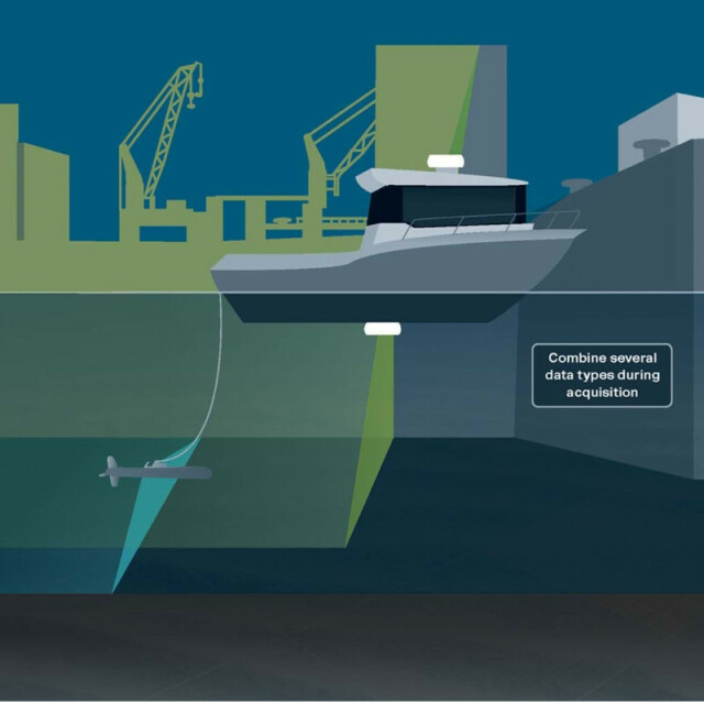
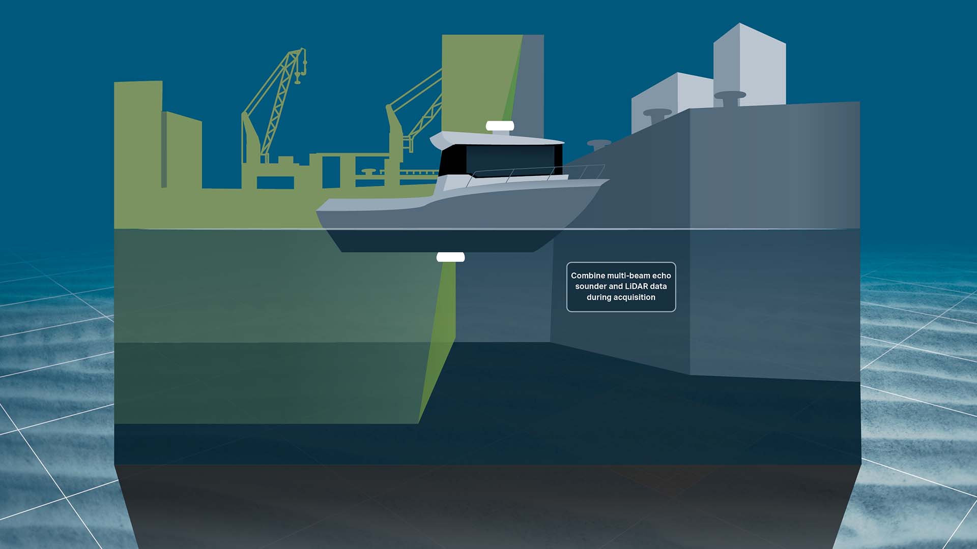
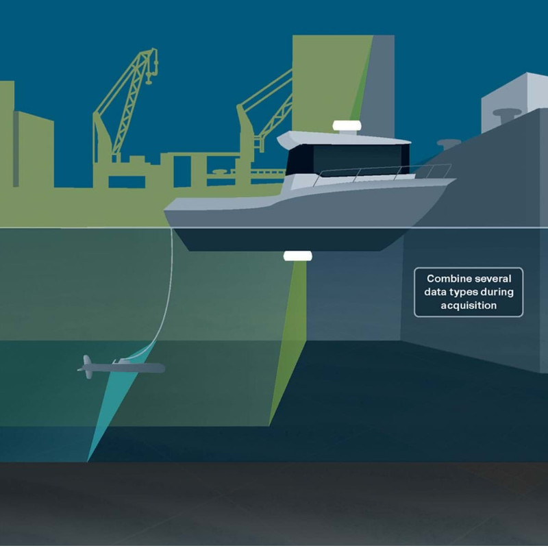
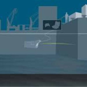
The NaviSuite Kuda software is dedicated to USV- and vessel-based hydrographic surveys, offering you all the necessary tools to carry out cost- and time-efficient bathymetric operations. With a variety of variants of this software bundle available, you can pick the one best tailored to your needs and budget.
The software provides high-performing features focusing on simplicity, automation and autonomy, while also enabling you to carry out remote operations
Depending on the variant, these features can include automatic generation of runlines; vessel/USV autopilot control; registration of objects/observations of interest; automatic data cleaning during acquisition and post-processing; volume and difference calculation; as well as automatic, remote/onboard data processing. The end-result is extensive deliverables and visualisations with high-quality bathymetric data.
The NaviSuite Kuda software bundle includes four variants. The NaviSuite Kuda Pro + Processing variant is dedicated to large setup with larger vessel(s) and more complex survey spreads and allows for…
- Navigation, survey planning as well as data acquisition and processing with all relevant types of hydrographic survey equipment, such as multi-beam echo sounders (incl backscatter), LiDARs, cameras sidescan sonars, sub-bottom profilers and magnetometers
- Unlimited local and remote displays
- The possibility of tracking one subsea object
Visit eiva.com to check out an overview of what you get with the different variants.
Do you have questions about this product?
- Questions about price, availability, and/or retailers
- Questions about technical specifications and usage
- Questions about suitability for your project or application
Specifications
-
Hardware/software requirements
-
RAM [MB]
8000
HD{GB}
50
Field of Use
Surface-based hydrographic/bathymetric operations
Languages Supported
English
Use of GPU
Y
Processor
64 bit
Stereo Display
Y
-
General
-
Year of last update
2022
Year of initial introduction
2015
Modules
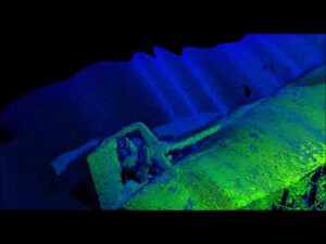
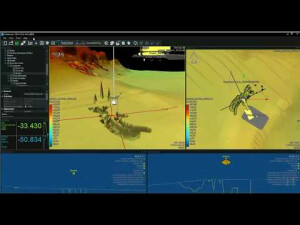
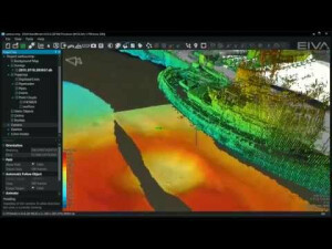
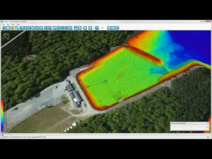
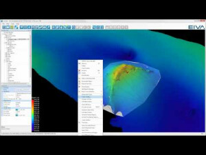
The EIVA NaviSuite Kuda post-processing package consists of two primary software applications: NaviEdit, which is the time series editor; NaviModel, which is the spatial package that provides 2D/3D/4D processing of video/imagery, sonar, LiDAR, camera and 3D drawings.
Supported Systems (SB, MB, SSS, Lidar etc.)
More than 500 different instrument drivers (single beam and multi-beam echo sounder, backscatter, side-scan, SAS, LiDAR, camera, magnetometer, subbottom profiler, etc)
-
Processing
-
Sound velocity correction
Multiple profile correction support
Sound velocity correction type
Distance + Time, Combined
Support tidal reduction network
Y
Gridding/Interpolation techniques
Several, including TIN, TRN and Delaunay
Grid attributes {Std., Mean, Max, etc.}
Average, depth, std.dev, min, max, intensity, density, slope, backscatter intensity, etc
Lay-back correction
Y
Siant range correction
Y
Mosaic creation
Y
Mosaic creation algorithms
EIVA own development and Geocoder
SSS Targeting
Yes
Video integration
Y
Number of video channels
999
Assessment of bathymetry IHO Cat S-44
Y
Type of automatic cleaning algorithm(s)
EC-3D, CUBE/CHRT, Spike shooting, Plane Editing
Multibeam water column imaging support
Y
Multibeam Backscatter Processing Functionality
Yes
Mulitbeam Calibration mehods
Automatic and Manual
Manual editing capability
Y
Tidal reduction
RTK-tide, Tide
-
Geodetic Functionality
-
Supported coordinate systems
Many, including EPSG database look-up
Geographical Coordinates {Lat, Long}
Y
Ground Coordinates {E,N}
Y
Seven Parameter shift supported
Y
Supported vertical reference frames
Any
Separation model for vertical datum shift support
Y
Local datum support
Y
Ellipsoidal reference support (GRS80)
Y
-
Product Generation
-
Automatic top of pipe calculation
N
Slope analysis
Y
Dynamic event numbering
Y
Automatic cross profile creation
Y
Volume calculation
Y
Contouring
Y
Sounding Selection methods
Y
Export/Exchange options
Many, including: ASCII, CARIS CSAR, ESRI Shape, AutoCAD, FAU, BAG, TIFF/GeoTIFF, USGS DEM, KML, LAS
Combining bathymetry / terrestrial point clouds
Y
-
Visualisation and Editing
-
2D Editing
Y
2D Visualization
Y
Fly-throughs support
Y
3D fly-through movies {*.mov etc}
Y
Area based 3D editing
Y
Area based 3D View
Yes
3D View max number points
Unlimited
3D Integrated models
Yes, eg .3ds, .STEP, .obj, .fbx
Sounding cleaning algorithms
EC-3D, CUBE, statistical filters
4D support
Y
4D fly through movies {*.mov etc.}
Yes, including multi-model comparisons
-
Files and Registering
-
Input Formates {XTF, XYZ, GSF etc}
Many, including: SBD, XTF, GSF, .all, and many producer-specific/proprietary.
Max. Number of Soundings
Unlimited
Supported Hydrographic Systems
Many packages supported, including EIVA NaviSuite Kuda Core/Pro (acquisition), QPS/Qinsy (Gsf format), Kongsberg SIS, and Teledyne Reson 7K. Many sonar producer-specific acquisition packages. XYZ input format for working on processed data.
Background format support {Google, Bing, OGC, CAD etc.}
Many, including: WMS, TMS, AutoCAD, Microstation, Google, Bing, ESRI, geo-referenced images GeoTiff/JPEG/PNG, etc.
Documents
Other documents
-
How custom software development made EIVA the single supplier to a large survey company477.85 KB
Videos