

Delph Suite
Delph Suite (including Delph Seismic and Delph Sonar) is a complete and modular software solution with a dedicated acquisition, processing and interpretation components. It operates with side-scan sonar systems, seismic systems and sub-bottom profilers. Delph software is a major leap forward in providing geologists, geophysicists and hydrographers with a highly optimized workflow.

Exail
Saint Germain en Laye, FR
Description
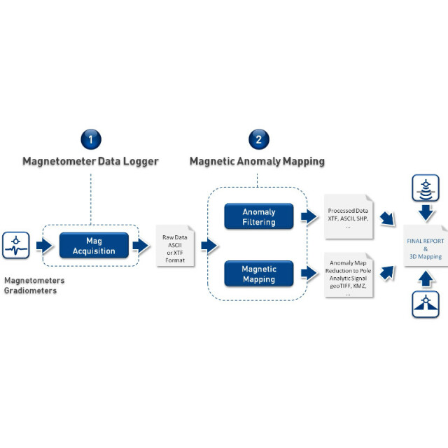
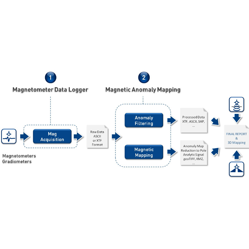
Delph Seismic, Delph Sonar and Delph Mag are complete software packages with dedicated acquisition, processing and interpretation components. They operate with side-scan sonar systems, seismic systems, sub-bottom profilers, magnetometers and gradiometers. Delph Suite is a major leap forward in providing geologists, geophysicists and hydrographers with a highly optimized workflow. It offers greater flexibility, a major boost in productivity, and top-level multi-sensor data quality control (QC).
Do you have questions about this product?
- Questions about price, availability, and/or retailers
- Questions about technical specifications and usage
- Questions about suitability for your project or application
Specifications
-
Hardware/software requirements
-
Field of Use
• COASTAL MANAGEMENT • GEOPHYSICAL EXPLORATION • GEOTECHNICAL INVESTIGATION • STRUCTURAL GEOLOGY • MARINE GEOLOGY • HYDROGRAPHIC SURVEY • PIPELINE INSPECTION
Languages Supported
English
Processor
[]
-
General
-
Year of last update
2019
Year of initial introduction
2010
Area of Application
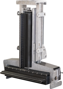
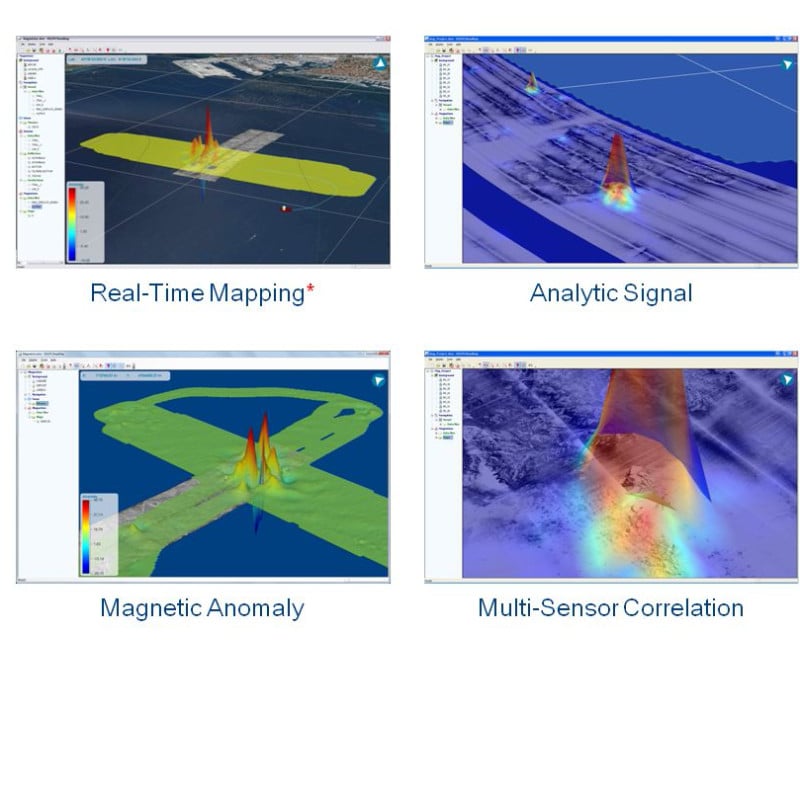
iXBlue delivers a unique operational solution for the mapping of buried objects (pipelines, cables, wrecks, UXO) : DELPH Mag Locator software maps magnetic anomalies in real-time and post-processing. Although requiring no prior expertise in magnetic science, it will provide an accurate magnetic anomaly map in real-time or post-processing.
Operator license needed
yes
Product Video (YouTube/Vimeo URL)
http://delph.ixblue.com/contents/videos/
Product Video 2 (YouTube/Vimeo URL)
http://delph.ixblue.com/sonar/sas/
Supported operation system
Windows
-
Processing
-
Sound velocity correction
Sound velocity correction type
Tidal reduction
Mulitbeam Calibration mehods
-
Geodetic Functionality
-
Supported coordinate systems
All
Geographical Coordinates {Lat, Long}
Y
Ground Coordinates {E,N}
Y
Seven Parameter shift supported
Y
Supported vertical reference frames
DELPH Sonar features all necessary tools to accurately geo-reference survey data. Built-in speed & heading filtering. System geometry (offsets) and layback correction. Filtering of the sensor heading. Accurate use of the sensor heading or computed course-over-ground. Batch import / export of corrected navigation.
Separation model for vertical datum shift support
Y
Local datum support
Y
Ellipsoidal reference support (GRS80)
Y
-
Product Generation
-
Automatic top of pipe calculation
Y
Slope analysis
Y
Automatic cross profile creation
Y
Volume calculation
Y
Contouring
Y
Sounding Selection methods
Y
Export/Exchange options
DELPH Sonar Interpretation can post-process any side-scan sonar data records. Native input & output of SEGY data Support for proprietary data formats: Edgetech® JSF data format Klein® SDF data format Marine Sonics® MST and SDS data formats More data formats on request
Combining bathymetry / terrestrial point clouds
Y
Documents
Brochure
migrationzt9s0m-0.pdf
904.23 KB
