

NaviSuite Kuda – Acquisition
Unmatched software with deep feature list for shallow water data acquisition – Supports all relevant instruments – Unlimited remote displays – Tracking of a subsea object.
EIVA
Skanderborg, DK
Description
Unmatched capabilities at affordable prices for hydrographic surveys
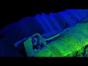
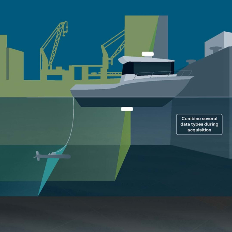
The NaviSuite Kuda software is dedicated to USV- and vessel-based hydrographic surveys, offering you all the necessary tools to carry out cost- and time-efficient bathymetric survey operations. With a variety of variants of this software bundle available, you can pick the one best tailored to your needs and budget.
The software provides high-performing features focusing on simplicity, automation and autonomy, while also enabling you to carry out remote operations
Depending on the variant, these features can include automatic generation of runlines; vessel/USV autopilot control; registration of objects/observations of interest; automatic data cleaning during acquisition and post-processing; volume and difference calculation; as well as automatic, remote/onboard data processing. The end-result is extensive deliverables and visualisations with high-quality bathymetric data.
The NaviSuite Kuda software bundle includes four variants. The NaviSuite Kuda Pro variant is dedicated to large setup with larger vessel(s) and more complex survey spreads and allows for…
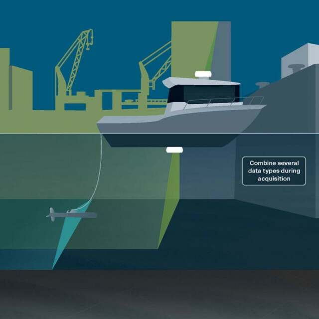
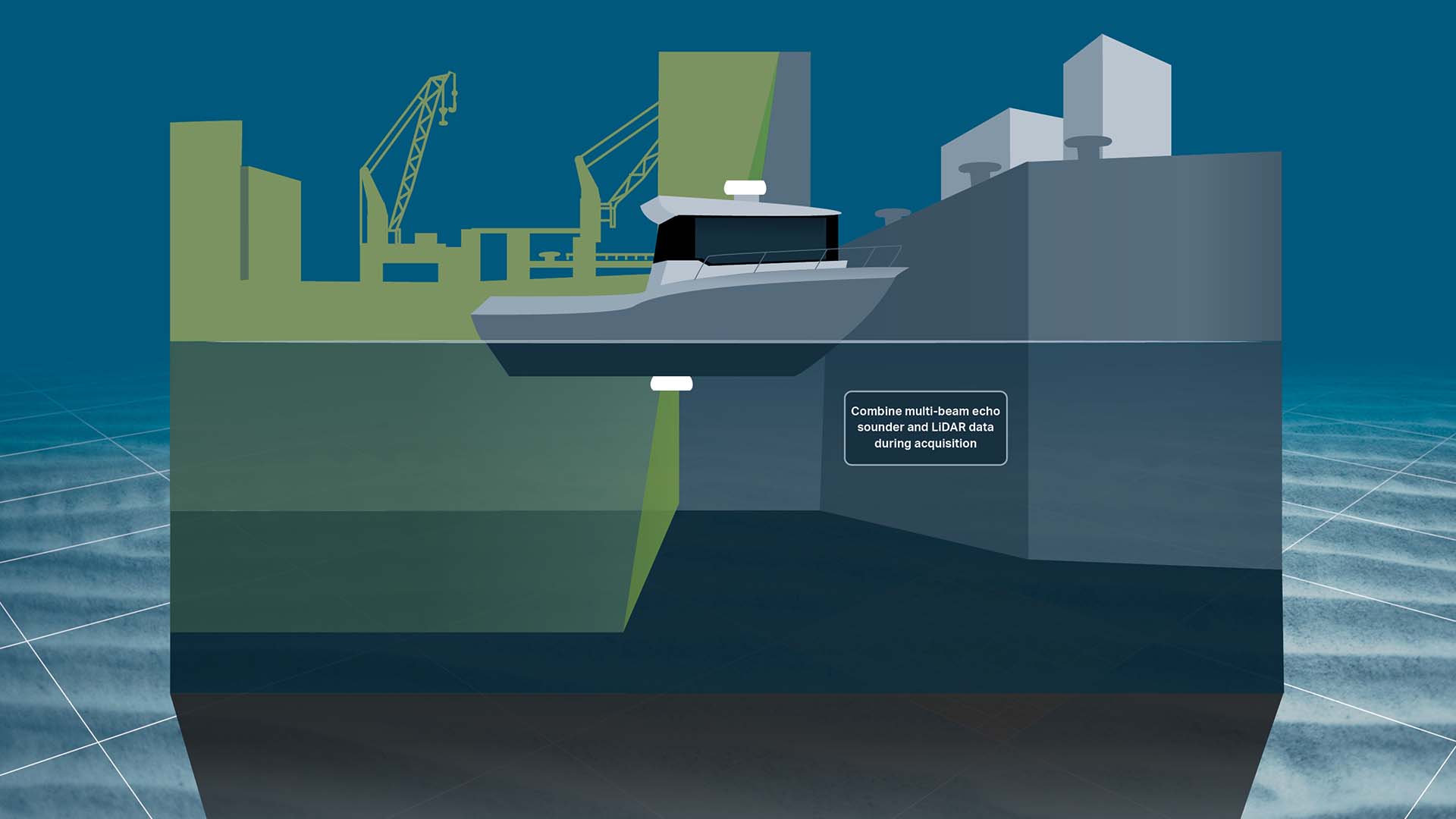
- Navigation, survey planning as well as data acquisition with all relevant types of hydrographic survey equipment, such as multi-beam echo sounders (incl backscatter), LiDARs, cameras sidescan sonars, sub-bottom profilers and magnetometers
- Unlimited local and remote displays
- The possibility of tracking one subsea object
Visit eiva.com to check out an overview of what you get with the different variants.
Do you have questions about this product?
- Questions about price, availability, and/or retailers
- Questions about technical specifications and usage
- Questions about suitability for your project or application
Specifications
-
General
-
Year of initial development
2015
Year of latest version
2022
Operating System
Windows 10, Windows 11
Area of Application
The EIVA NaviSuite Kuda survey acquisition package allows for vessel and USV hydrographic surveys, covering survey planning, navigation and positioning. This includes remote control and real-time onboard cleaning control.
-
Geodetic Functionality
-
Supported coordinate systems
Most EPSG and local variants
Supported datum transformations
Most EPSG and local variants
Geographical coordinates (Lat, Long)
Y
Ground coordinates (E,N)
Y
Seven Parameter shift supported
Y
Time-dependent Transformation Parameters (14param)
Y
Supported vertical reference frames
ITRF
Ellipsoidal reference support (GRS80)
Y
Separation model for vertical datum shift support
Y
Local datum support
Y
Supported map projections
Most EPSG and local variants
-
Data / System Support
-
Recorded data storage formats
EIVA NPD, SBD, generic ASCII
Supported Hydrographic Systems
NaviSuite integrates fully with all major systems both in- and output
Supported AUVs
Dedicated to surface vessels
Supported ROVs
+500 sensor drivers give platform independency for a single subsea object
Supported ROTVs
+500 sensor drivers give platform independency for a single subsea object
Supported underwater positioning systems
USBL, LBL, INS etc. Eg Sonardyne, Kongsberg, iXBlue, Edgetech, NAUTRONIX, etc
Supported multibeam systems
All major systems, eg NORBIT, Teledyne Reson, R2Sonic, Kongsberg, Imagenex, Edgetech, Klein, WASP and Tritech
Supported surface positioning systems
GPS, tracking systems and others
Supported singlebeam systems
NMEA, Deso, Kongsberg. All ASCII-based formats
Supported sidescan sonar systems
Solstice, Klein, EdgeTech, Ping DSP and others
Supported magnetometer systems
Geometrics, OFG and other major systems
Supported gyrocompass systems
NMEA and all other generic formats
Supported motion sensor systems
Teledyne TSS, SBG, iXBlue, Applanix POSMV and all other generic formats
Supported imaging systems
Voyis, BlueView, Cathx and similar laser and point imaging systems
Supported sub-bottom Profiler systems
SegY format
Supported ADCP systems
Sonardyne and Teledyne RD Instruments
Supported (underwater) laser scanner systems
Voyis, Cathx, 3D at Depth
Supported INS
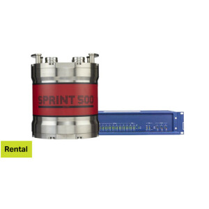
Sonardyne SPRINT-Nav/SPRINT-Nav Mini, Kongsberg, iXBlue, etc
Metadata management
Y
Time synchronization methods
ZDA/PPS, Network and ATTU
Supported total station systems
AGA, Geodimeter, Trimble, Leica, Topcon, etc
-
Online capabilities
-
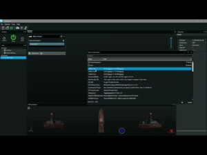
Helmsman display
Y
Max. number cloned displays
One/unlimited depending on variant
Supported background formats
DXF, DWG, DGN, Geo images, WMS, TMS
Available real-time cleaning techniques
EC-3D, Kalman Filter, etc
Type of navigation screens
Navigation display and survey control
Survey data types real-time navigation display
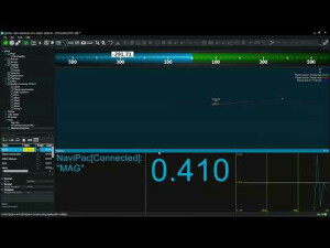
All relevant sensor data in table or graph (2D/3D) MBE/SS/backscatter as waterfall, profile, coverage, DTM and points. Position track and scatter plot
Max number of online displayed ROVs
1
Max number of online displayed surface vessels
1
Computed orientation solution
Y
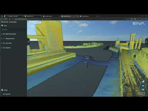
3D real time display
Y
Supported 3D display data
Y
Real time tidal correction methods
Tidal table or GPS based
RTK GPS height correction
Y
Real time video integration
Y
Real-time Pipe detection
N
Real time IHO / IMCA TPU support
Y
SSS waterfall display
Y
SSS target annotations
Y
Backscatter display
Y
Online filtering options
EC-3D, Kalman, Spline, opening angle, min slant range etc
Status Views equipment
All-green status indicator. Input monitor for sensor status. All relevant sensor data in table or graph views
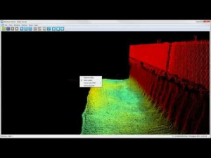
Multibeam bathymetry coverage
Yes both as point clouds and terrain models
Multibeam water column display
N
GIS integration
For data background charts - WMS ad TWMS
Remote control
Y
Real-time DTM vizualization
Y
Online eventing
Y
Real-time DTM comparison
Y
-
Hardware requirements
-
RAM
8000
HD (GB)
50
Languages Supported
English
Processor (CPU)
64-bit
Documents
Other documents
-
How custom software development made EIVA the single supplier to a large survey company (2)477.85 KB