HYPACK SURVEY
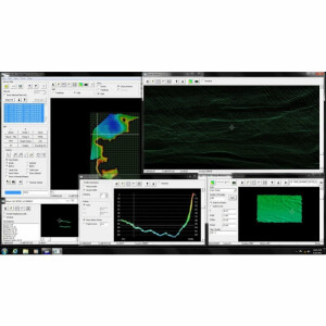
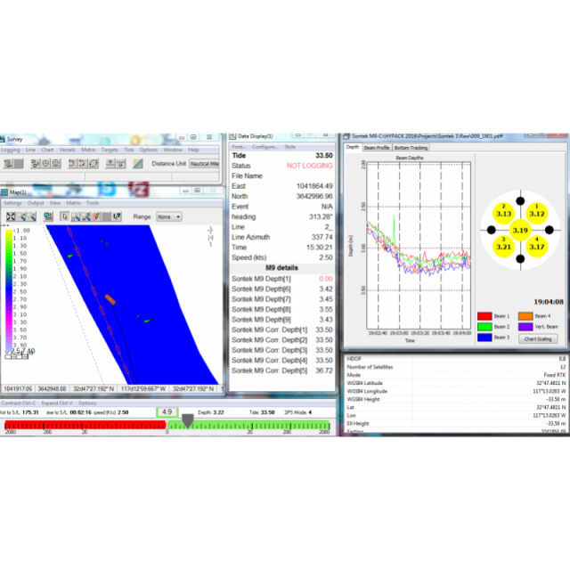
HYPACK® SURVEY Provides All of the Tools Necessary for Planning and Acquiring Data for Your Hydrographic, Side Scan and Magnetometer Operations.
With over 400 device drivers for these sensors, virtually all sensors on the market today can be connected and used for your survey

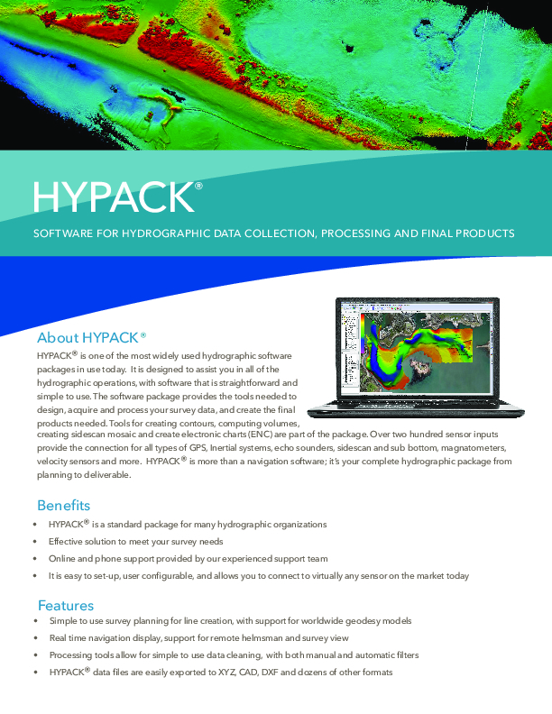
HYPACK, A Xylem Brand
Middletown, US
Description
Also included are generic device drivers, where users can create their own driver for data collection. The software produces RAW and HSX files that can be used for data processing in HYPACK MAX, HYPACK OFFICE or HYPACK ACOUSTIC
Do you have questions about this product?
- Questions about price, availability, and/or retailers
- Questions about technical specifications and usage
- Questions about suitability for your project or application
Specifications
-
General
-
Year of initial development
1984
Year of latest version
2022
Operating System
Windows 10 and 11
Area of Application
Hydrographic Surveys, Barge Positioning, Construction, archeology, Navigation, Offshore Surveys
-
Geodetic Functionality
-
Supported coordinate systems
More than 20, WGS, Airy, Clarke, GRS, user defined
Supported datum transformations
more than 20; CONUS, OSTN97, 15
Geographical coordinates (Lat, Long)
Y
Ground coordinates (E,N)
Y
Seven Parameter shift supported
Y
Time-dependent Transformation Parameters (14param)
Y
Supported vertical reference frames
Yes
Ellipsoidal reference support (GRS80)
Y
Separation model for vertical datum shift support
Y
Local datum support
Y
Supported map projections
TM, UTM, LCC, LCC2, Oblique, Polar
-
Data / System Support
-
Recorded data storage formats
RAW, HSX (HYPACK file formats)
Supported Hydrographic Systems
HYPACK Survey supports a wide range of hydrographic equipment, from manufactures including Atlas, Benthos, C-Max, Edgetech, Klein, Marine soni, Reson, Marine Magnetics, Sontek, NMEA supported output strings
Supported AUVs
OceanServer, Hydriod, ECA, Teledyne
Supported ROVs
ISE
Supported underwater positioning systems
ORE TrackPoint, Sonardyne, IXsea
Supported multibeam systems
not support in HYPACK Survey module
Supported singlebeam systems
Odom, Reson, Simrad, Kongsberg, any NMEA DBT, DBS output string syatem
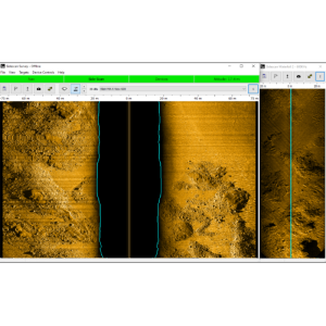
Supported sidescan sonar systems
Benthos, Klein, Edgetech, Marine Sonic, Tritech, Imagenex
Supported magnetometer systems
Marine Marnetics, Geomatics, Ixsea, JW Fisher, Quantro
Supported gyrocompass systems
KVH, Novatel, SBG, Applanix, NMEA output device
Supported motion sensor systems
Applanix SBG, TSS, Novetel Span
Supported imaging systems
Imagenex, Tritech
Supported sub-bottom Profiler systems
All Analog sonars, Edgetech, Innomar, Knudsen, SDI, SyQuest
Supported ADCP systems
Sontek, RDI, Nortek
Supported (underwater) laser scanner systems
Not supported in HYPACK Survey
Supported INS
Applanex, SBG, Novetel SPAN
Metadata management
N
Time synchronization methods
PPS, ZDA, GGA, HYPACK veritime
Supported total station systems
Leica, Trimble, Topcon
-
Online capabilities
-
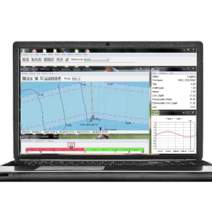
Helmsman display
Y
Max. number cloned displays
5
Supported background formats
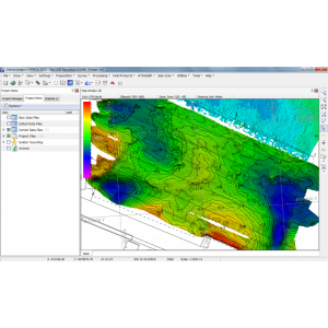
NOAA and ENC catalog, Bing Maps, USGS imagery maps, Raster format, C-Map, DIG, DGN, DXF, DWG, S57,S63,GeoTiff
Available real-time cleaning techniques
None
Type of navigation screens
Main screen, Helmsman displays, user configuration of all views
Survey data types real-time navigation display
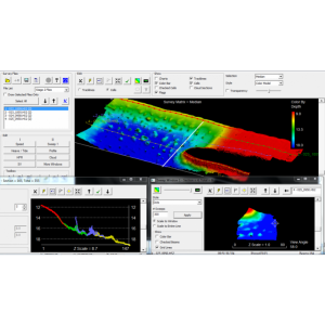
Trackline, sounding, ancillary data, real time mosaic
Max number of online displayed ROVs
8
Max number of online displayed surface vessels
8
Computed orientation solution
Y
3D real time display
Y
Supported 3D display data
Y
Real time tidal correction methods
YES
RTK GPS height correction
Y
Real time video integration
N
Real-time Pipe detection
N
Real time IHO / IMCA TPU support
Y
SSS waterfall display
Y
SSS target annotations
Y
Backscatter display
Y
Online filtering options
MIN, MAX depth, HDOP, SVs
Multibeam bathymetry coverage
not available in HYPACK Survey module
Multibeam water column display
N
Remote control
N
Real-time DTM vizualization
Y
Online eventing
Y
Real-time DTM comparison
N
-
Hardware requirements
-
RAM
8
HD (GB)
250
Processor (CPU)
32-bit, 64-bit
Languages Supported
English, Spanish, French, Russian, and 15 more
Documents
Brochure
hypack-brochure-5.pdf
2.03 MB


