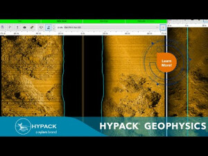


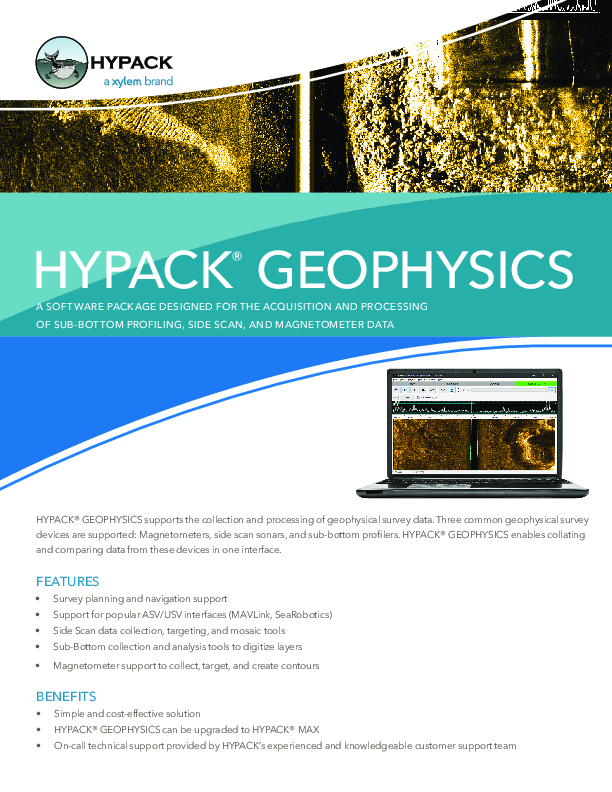
HYPACK® GEOPHYSICS
HYPACK® GEOPHYSICS Supports the Collection and Processing of Geophysical Survey Data
Software package designed for the acquisition and processing of sub-bottom profiling, side scan, and magnetometer data.

HYPACK, A Xylem Brand
Middletown, US
Description
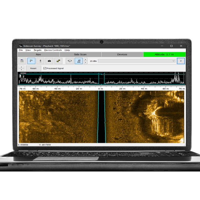
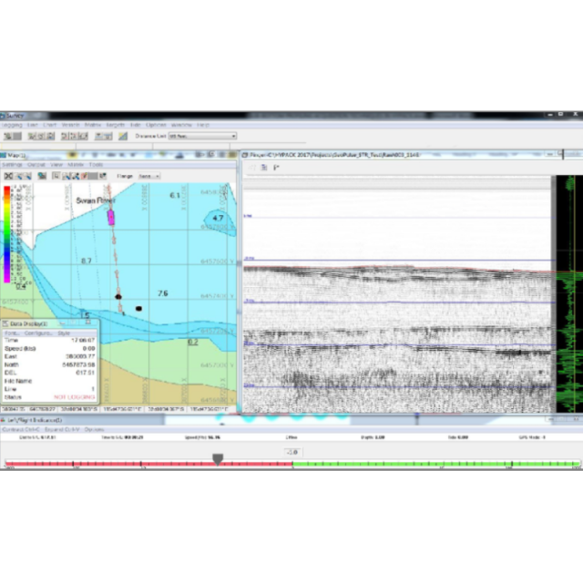
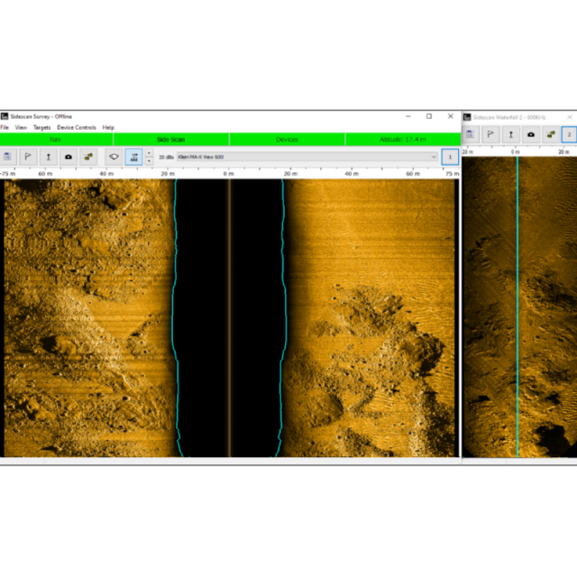
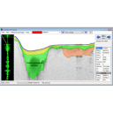
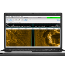
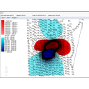
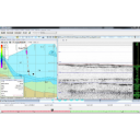
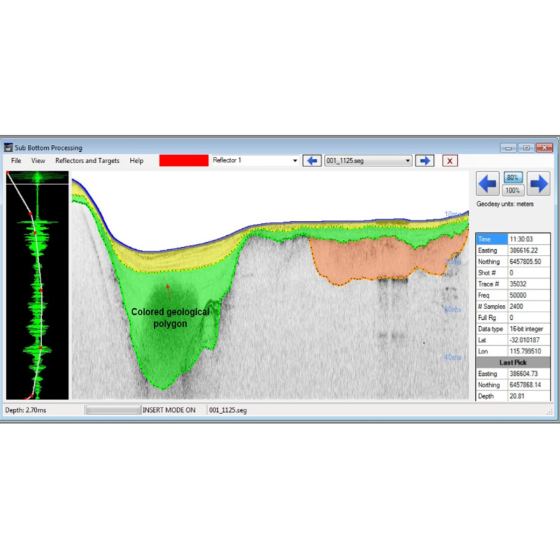
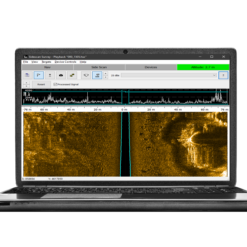
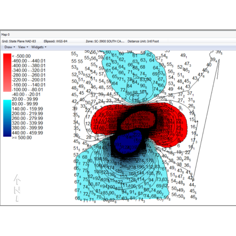
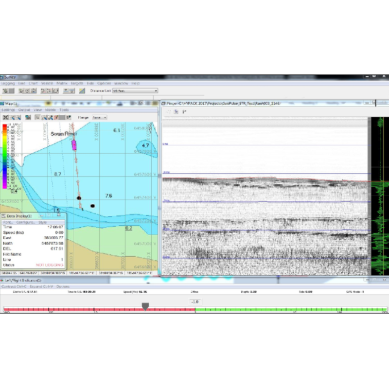
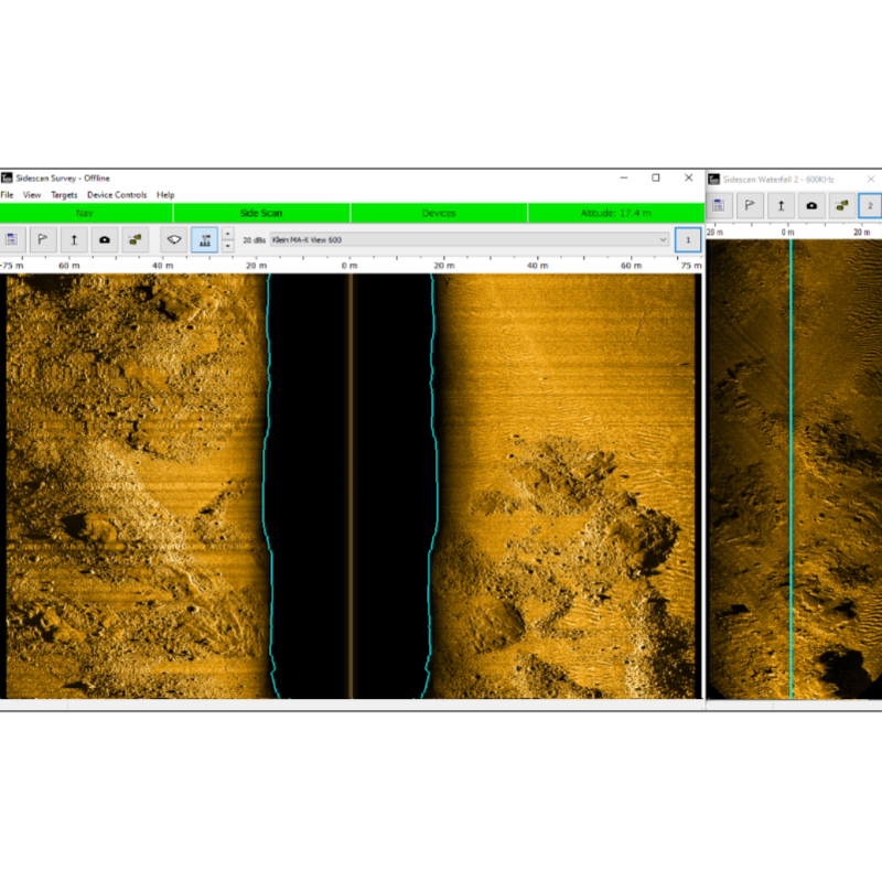
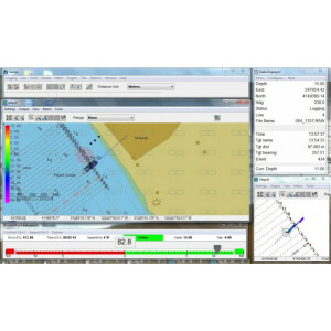
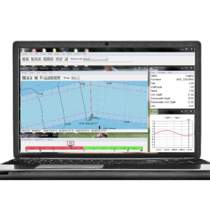
Three common geophysical survey devices are supported: Magnetometers, Sidescan sonars, and sub-bottom profilers. HYPACK® GEOPHYSICS enables collating and comparing data from these devices in one interface.
Do you have questions about this product?
- Questions about price, availability, and/or retailers
- Questions about technical specifications and usage
- Questions about suitability for your project or application
Specifications
-
Hardware/software requirements
-
RAM [MB]
8
HD{GB}
20
Field of Use
Marine geophysical surveys, engineering & geotechnical site surveys.
Languages Supported
English, Spanish, French, Italian, Chinese, Japanese, Dutch, German, Portuguese, Korean, Danish, Arabic, Greek, Russian, Polish, Ukrainian.
Use of GPU
N
Processor
["32-bit","64-bit"]
Stereo Display
N
-
General
-
Year of last update
2022
Year of initial introduction
2022
Supported Systems (SB, MB, SSS, Lidar etc.)
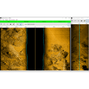
Sub-bottom, SSS, Magnetometers.
Area of Application
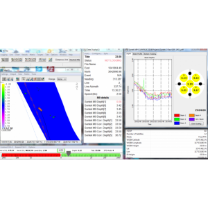
HYPACK® Sub-bottom is our sub-bottom profiling (SBP) software package designed for marine geophysical, engineering & geotechnical site surveys, dredging, mining applications. It’s a simple and easy-to-use solution for all your Sub-bottom profiling survey requirements.
Operator license needed
Dongles are USB devices required by HYPACK® SUB-BOTTOM to activate the program modules associated with the license purchased.
Product Brochure
yes
Product manual
yes
Product Video (YouTube/Vimeo URL)
http://www.ustream.tv/recorded/99328669
Product Video 2 (YouTube/Vimeo URL)
https://www.youtube.com/watch?v=GIIkNSCcQ5Y
-
Processing
-
Sound velocity correction
Multiple profile correction support
Sound velocity correction type
Distance
Tidal reduction
Tide, RTK-tide
Support tidal reduction network
N
Gridding/Interpolation techniques
Yes
Lay-back correction
Y
Siant range correction
N
Mosaic creation
Y
SSS Targeting
Yes
Video integration
N
Assessment of bathymetry IHO Cat S-44
N
Multibeam water column imaging support
N
Manual editing capability
Y
Mulitbeam Calibration mehods
-
Geodetic Functionality
-
Supported coordinate systems
All
Geographical Coordinates {Lat, Long}
Y
Ground Coordinates {E,N}
Y
Seven Parameter shift supported
Y
Supported vertical reference frames
Any using the TIDE function
Separation model for vertical datum shift support
Y
Local datum support
Y
Ellipsoidal reference support (GRS80)
Y
-
Product Generation
-
Automatic top of pipe calculation
N
Slope analysis
N
Dynamic event numbering
Y
Automatic cross profile creation
N
Volume calculation
N
Contouring
Y
Sounding Selection methods
Y
Export/Exchange options
HYPACK All format XYZ, ASCII, DXF, TIFF
Combining bathymetry / terrestrial point clouds
N
-
Visualisation and Editing
-
2D Editing
Y
2D Visualization
Y
Fly-throughs support
N
3D fly-through movies {*.mov etc}
N
Area based 3D editing
N
Area based 3D View
No
3D Integrated models
Fence diagram with interpretation
4D support
N
-
Files and Registering
-
Input Formates {XTF, XYZ, GSF etc}
SEG-Y JSF, HSX, SDF, XTF, RAW, CM2
Background format support {Google, Bing, OGC, CAD etc.}
BING, S57, S63, ARCS, BSB, DGN, DXF, DWG, ECW, GML, MIF, JPEG2000, MrSID, PDF, PNG, SHP, TIF & VPF
Supported Hydrographic Systems
We cover over 30 Side Scan, Sub-bottom and Magnetometer Systems. Please see our brochure for details.
Documents
Brochure
hypack-geophysics-brochure.pdf
1.47 MB
Videos


