
HYPACK ECHO
HYPACK® ECHO Is Our Software Package for Bathymetric and Hydrographic Surveying, Which Use Single Beam Echosounder (SBES) Technologies
Solution for Single Beam Bathymetric and Hydrographic Surveying

HYPACK, A Xylem Brand
Middletown, US
Description
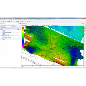
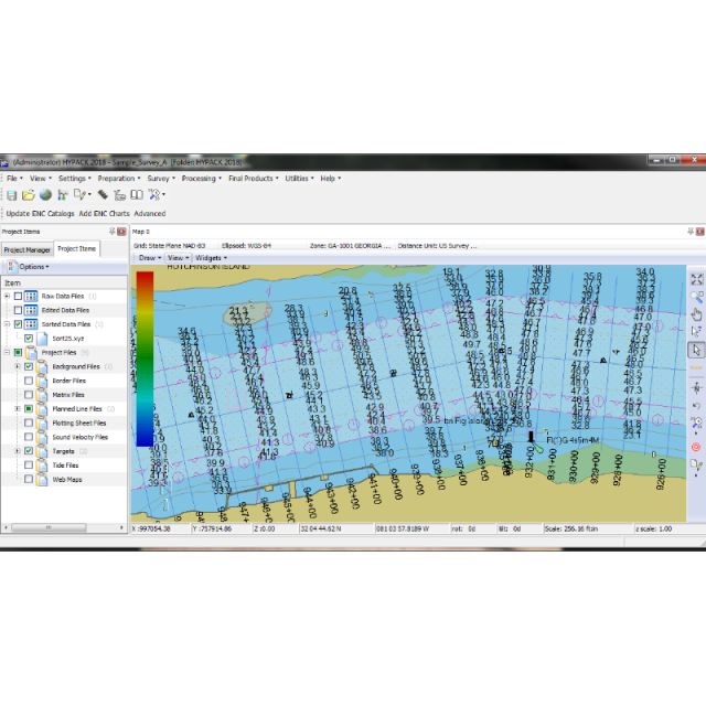
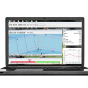
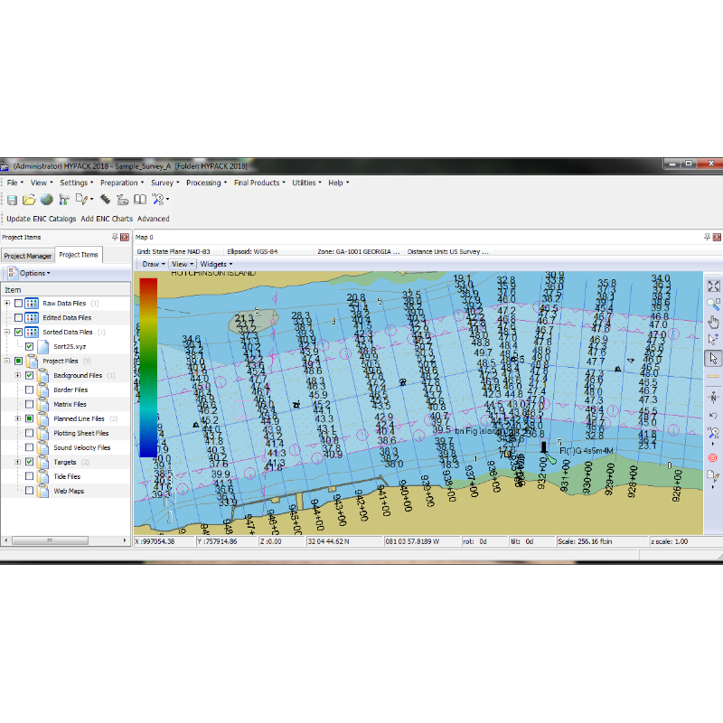
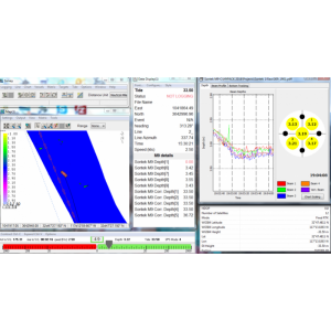
HYPACK® ECHO is a good choice for any industry that requires an SBES survey and is especially suitable for support mining operators or military surveyors in need of professional-grade software with a simplified workflow. HYPACK® ECHO is built on the same core as HYPACK®, which ensures ECHO can be maintained and continuously improved for the future.
Do you have questions about this product?
- Questions about price, availability, and/or retailers
- Questions about technical specifications and usage
- Questions about suitability for your project or application
Specifications
-
General
-
Year of initial development
2022
Year of latest version
2022
Operating System
Windows 10, Windows 11
Area of Application
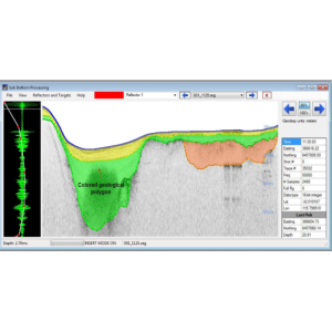
Single Beam Survey
-
Geodetic Functionality
-
Supported coordinate systems
All
Supported datum transformations
All
Geographical coordinates (Lat, Long)
Y
Ground coordinates (E,N)
Y
Seven Parameter shift supported
Y
Time-dependent Transformation Parameters (14param)
N
Supported vertical reference frames
All
Ellipsoidal reference support (GRS80)
Y
Separation model for vertical datum shift support
Y
Local datum support
Y
Supported map projections
All
-
Data / System Support
-
Recorded data storage formats
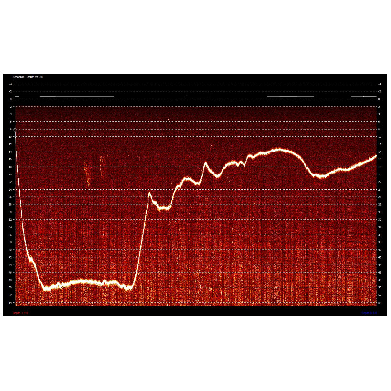
HYPACK RAW
Supported Hydrographic Systems
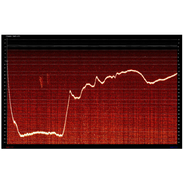
Over 50 Single Beam sonars with support for all NEMA 0183 sensors.
Supported surface positioning systems
GPS, INS, Total positioning stations
Supported singlebeam systems
Over 50
Supported gyrocompass systems
Yes
Supported motion sensor systems
Yes
Supported INS
Yes
Metadata management
N
Time synchronization methods
GNSS from ZDA message
Supported total station systems
Yes
-
Online capabilities
-
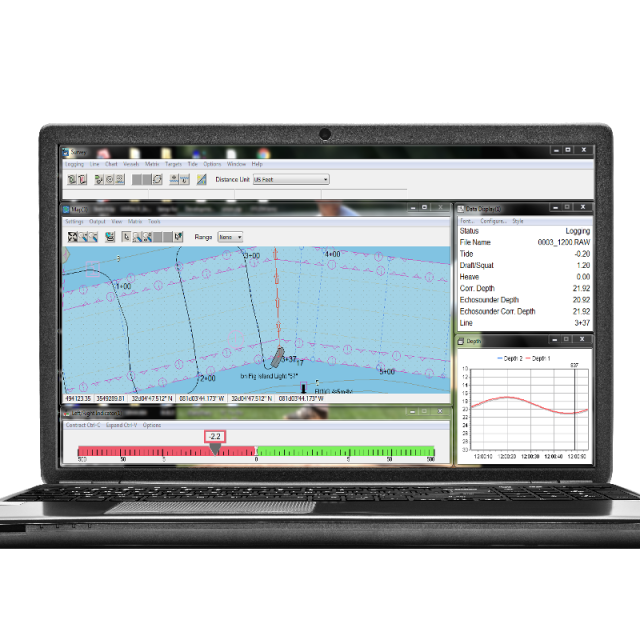
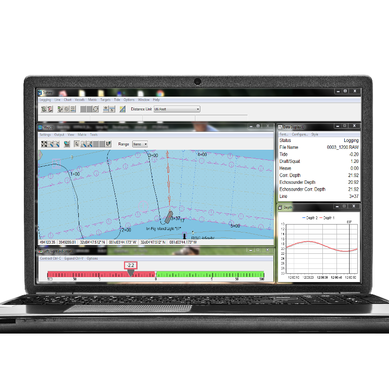
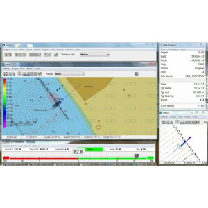
Helmsman display
Y
Max. number cloned displays
6
Supported background formats
Esri Raster TIF, S57, S63, ARCS, BSB, DGN, DXF, DWG, ECW, GML, MIF, JPEG2000, MrSID, PDF, PNG, SHP, TIF & VPF
Survey data types real-time navigation display
Map and left/right indication
Max number of online displayed surface vessels
1
Computed orientation solution
Y
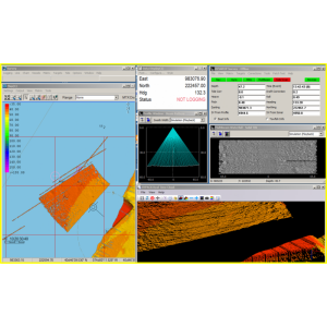
3D real time display
Y
RTK GPS height correction
Y
Real time video integration
N
Real-time Pipe detection
N
Real time IHO / IMCA TPU support
N
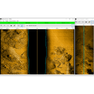
SSS waterfall display
N
SSS target annotations
N
Backscatter display
N
GIS integration
Esri and QGIS
Remote control
N
Real-time DTM vizualization
Y
Online eventing
Y
Real-time DTM comparison
N
Supported 3D display data
Y
Real time tidal correction methods
RTK, GPS, Digital Tide Gage, Manual Entry
-
Hardware requirements
-
RAM
8
HD (GB)
20
Processor (CPU)
32-bit, 64-bit
Languages Supported
English, Spanish, French, Italian, Chinese, Japanese, Dutch, German, Portuguese, Korean, Danish, Arabic, Greek, Russian, Polish, Ukrainian.
Documents
Brochure
hypack-echo-brochure.pdf
2.1 MB


