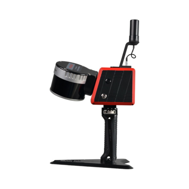
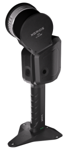
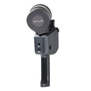
K120
The fusion of SLAM positioning and Laser Scanning, fit for various indoor/ outdoor high precision mapping projects.
The K120 is able to collect 320,000 points per second, with a scanning range of 120 meters, a view field of 360°x 285°, and achieve a relative point accuracy of 1cm (in the best condition).
Kolida Instrument Company
Guangzhou, CN
Description
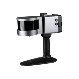
Positioning by RTK, Easy and Accurate!
K120 is designed with built-in GNSS RTK module and network module. When you access to a CORS network and performing measurement outdoor, you can skip control-point recording and coordinate system conversion, and achieve a absolute accuracy down to 5cm.
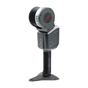
More Working Modes Are Available
K120 is able to be upgraded to RTK backpack mapping system, which is more suitable for outdoor applications. Moreover, it can be mounted to USV, UAV, CAR, even Robot Dog.
Post-Processing Software
KOLIDA SLAM OFFICE integrates device application and point cloud processing. Eight basic functions: one-click point cloud denoising, point cloud splicing, shadow rendering, coordinate transformation, automatic horizontal plane fitting, automatic point cloud data report generation, ortho-photography and point cloud encapsulation.
It is also compatible with third-party device point cloud processing.
Application 1: Stock Pile Measurement
Slam LiDAR Scanning is an ideal solution for volume inventory of coal pile, ore pile, materials and granary.
K120 can perform fast and accurate mobile scanning operations in shed and outdoor environments, without GPS. The unique ultra-low reflectivity range extension function is particularly effective for coal pile and mineral materials. This has incomparable advantages over other measurement methods.
Application 2: Building Info. Collection
K120 can conduct high-density space data collection, is very suitable for internal 3D modeling and drawing for modern real estate, urban houses, rural cadastres, building facades, ancient buildings, etc.
Application 3: Underground Facilities
SLAM positioning technology does not require GPS signal to perform 3D data acquisition indoors, and obtaining high-quality point cloud data is regardless of bright or dark environments. So it is wonderful solution for measuring underground parking lots, civil air defense facilities, shopping malls and airports, large-scale factories and mines.
Application 4: Agriculture, Forestry, Geology
Agriculture, forestry, and geology's intricate on-site environment and high-density coverage have always been difficult areas for 3D data acquisition. The arrival of SLAM technology has solved the problems in this field.
K120 is with a 360×285-degree scanning coverage. The 3D information of the horizontal and vertical surfaces of the trunk and canopy can be collected to a large extent. Agricultural growth, forestry green quantity, and geological survey are no longer difficult tasks.


