
eMotion 3
Drone flight & data management.
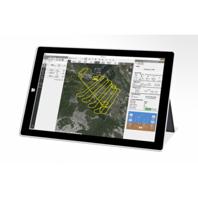
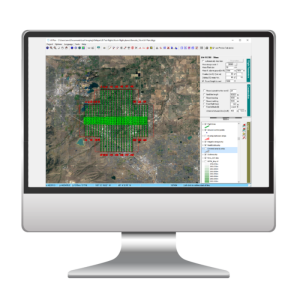
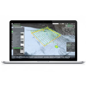
With eMotion, flights are built using mission blocks. Just choose your block (aerial mapping, corridor etc.), highlight the region you want to map, define key settings, and eMotion auto-generates your drone’s flight plan. Multi-flight missions are supported and you can activate/import elevation data for even safer, terrain-accurate flights.
AgEagle Aerial Systems Inc.
Cheseaux-Lausanne, CH
Description
eMotion 3 makes professional flight and data management a breeze - minimizing the time you need to spend planning missions, managing battery changes and preparing the data you collect. So you can focus on results, not on operations.
eMotion’s Simulator mode helps you to optimise your flight plan and explore the functions of your senseFly drone. Just enter the wind strength and direction, then press Play to ‘launch’ your drone. Now you can view all aspects of your flight as the drone flies its mission.
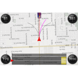
Upload your flight plan wirelessly to your drone. After a simple hand launch, eBee fixed-wing drones then fly, capture images, and land themselves. For albris, choose between an automatic mapping mission or eMotion’s Interactive ScreenFly mode for live inspections.
eMotion’s built-in Flight Data Manager automatically handles the georeferencing & preparation of images required for post-processing in software such as Pix4Dmapper (vastly reducing third-party software compatibility issues).
Specifications
-
General
-
Area of Application
Inspection, Modelling
Desktop platform support
Windows
Compatible drones
Every senseFly drone
-
Flight Planning Characteristics
-
Mission flying types (grid, around point of interest, custom route, corrider etc.)
Horizontal Mapping, Corridor, Cylinder, Aroind Point of Interest, Panoramic, Custom Route
Flight modes
Automatic
Auto-return and resume from left off
Y
Mission progress monitoring
Y
Real-time flight status
Y
Multi-flight mission support
Y
3D flight planning
Y
Live weather updates
Y
Data import types
Import Elevation Data, KML, Shapefile
Background map options (WMS, importable)
DSM
-
Additional Features
-
Distinguishable features
A drone’s flight management (or ground station) software defines your experience—if this is complicated or confusing, professional drone operation can quickly become a chore. eMotion 3 is different: it’s advanced, scalable software anyone can use.
-
Geo-referencing
-
RTK/PPK processing and validation
Y
Geo-referencing of captured data
Y
-
Data Capturing
-
Photogrammetry planner
Y
-
Data Output
-
Export data to cloud applications tool
Pix4D, Airnavigation, Skyward(future versions)


