
Drone Harmony Data Capture Platform
Software Platform for Enterprise Grade Data Acquisition
A complete software platform to automatically plan and operate your drone data acquisition workflows in 3D. Access everything from enterprise-wide views to individual flight plans, from the web browser or the mobile device. Take advantage of the most advanced terrain aware flight planning on the market for better drone-based surveying & mapping and linear infrastructure inspection.
Drone Harmony
Luzern, CH
Description
Base Your Decisions on Better Data
Feed you workflow with reliable and consistent drone data from hundreds of assets and inspections. Leverage the most advanced data capture automation software on the market to simplify planning & execution of complex drone flights.
A Tool for Each Stakeholder
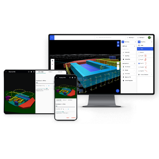
Plan your drone capture workflows from the web browser, or the mobile device. Equip each stakeholder in your organization, from the inspection engineer to the field operator, with a tool tailored for their exact needs. Coordinate work seamlessly using automated cloud synchronization tools.
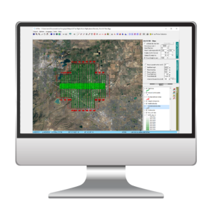
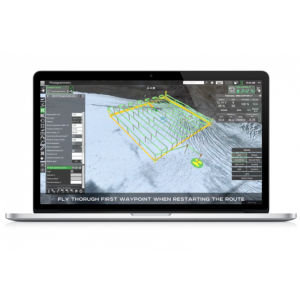
Visualize in 3D
Plan each stage of the workflow in an intuitive 3D interface. Easily model or import complex 3D geo-referenced structures to gain immediate visual insight into the inspection asset, flight plan and environment. Leverage data integrations to add context to your inspection site and improve the quality of the resulting data product.
Specifications
-
General
-
Mobile platform support
Android
Compatible drones
DJI
Desktop platform support
Windows, Ubuntu, macOS
-
Flight Planning Characteristics
-
Flight modes
Automatic, Semi-Automatic, Manual
Auto-return and resume from left off
Y
Multi-flight mission support
Y
3D flight planning
Y
Map-catching and offline planning
Y
Live weather updates
N
Show camera footprint on map
Y
No-fly zone integration
Y
Mission progress monitoring
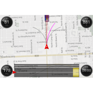
Full monitoring in several interfaces (2D map, FPV and 3D)
Real-time flight status
Full Telemetry
Data import types
geotiff terrain models, KML/KMZ for shape outlines
-
Additional Features
-
User interface language
Mobile app translations into several languages including German, French, Italian, Spanish and Portuguese
Distinguishable features
3D Flight planning, complex terrain aware flights, 3D terrain view, complex Facade inspections, Cell tower inspections
Offline sharebale flight planning
From mobile application through state file exports
Customer support
Email support, community, video and text supporting material
-
Requirements
-
Hardware
Web: any browser, Mobile: Android 5+, Drone: DJI
-
Geo-referencing
-
Geo-referencing of captured data
Y
Image geotagging
Y
RTK/PPK processing and validation
Most DJI drones
Base station integration
Y
-
Data Capturing
-
Post-flight data quality check
data preview in-app during and after flight
Vertical and oblique photoshooting
Y
Live video streaming
FPV
Photogrammetry planner
Y
Payload manager (for different sensor configurations)
Custom camera support for DJI M600
Manual photo control
Y
-
Data Output
-
Output products
Image and Video Data
Export data to cloud applications tool
Drone Harmony Cloud for storage of flight missions and terrain data
Replay flights
Y


