
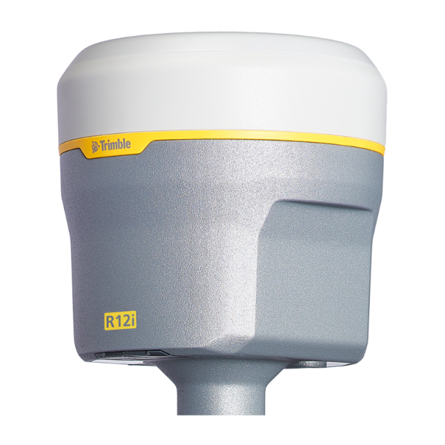


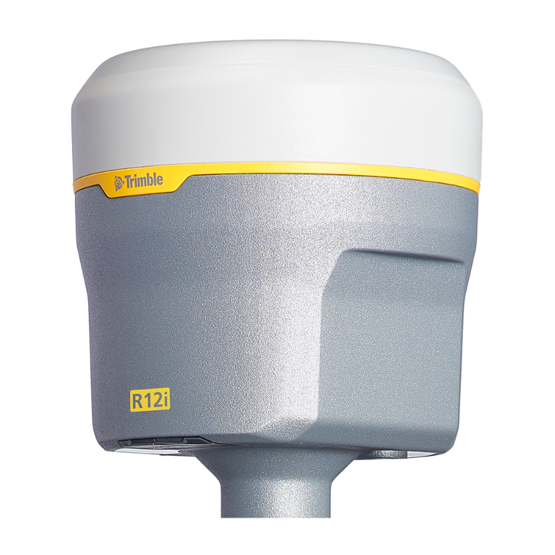


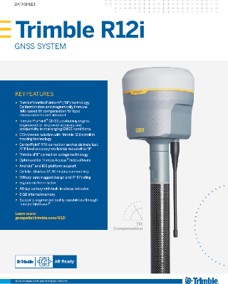
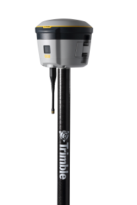
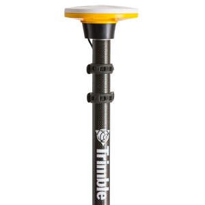
Trimble R12i
The Trimble R12i Is a High-Performance Solution for Professional Land Surveyors
It incorporates Inertial Measurement Unit (IMU)-based tilt compensation using Trimble TIP technology which enables points to be measured or staked out quickly and easily without levelling the survey pole. Powered by the ground-breaking Trimble ProPoint GNSS engine, surveyors can now collect data more accurately in challenging GNSS environments than was previously possible.

Trimble, Inc.
Westminster, US
Description
The Trimble® R12i GNSS System delivers pinpoint accuracy, speed, and flexibility to boost productivity. Survey faster than ever before with Inertial Measurement Unit (IMU)-based tilt compensation which helps surveyors to quickly and accurately layout and measure points without precisely levelling the survey rod. The system is calibration-free and immune to magnetic interference. It also features real-time automatic IMU integrity monitoring to detect and alert the user of sensor biases introduced by time, temperature or physical shocks.
The R12i's powerful Trimble ProPoint™ GNSS positioning engine computes positions based on any combination of GNSS constellations and signals. So, if you’re surveying among trees, near buildings, or in a mixed tree-and-urban environment the Trimble R12i can handle the job, even with tilt compensation enabled.
Do you have questions about this product?
- Questions about price, availability, and/or retailers
- Questions about technical specifications and usage
- Questions about suitability for your project or application
Specifications
-
More information
-
Distinguishable features
The Trimble R12i System features Trimble TIP Inertial Measurement Unit (IMU)-based tilt compensation technology, which enables points to be measured or staked out while the survey rod is tilted. It features Trimble ProPoint GNSS technology which improves performance in challenging GNSS conditions, with groundbreaking signal management that leverages the latest developments in GNSS signal infrastructure and Trimble receiver hardware. The R12i also comes equipped with Trimble 360 tracking technology, Trimble xFill® technology, and support for Trimble CenterPoint® RTX corrections.
-
Power
-
Operating power: min. [V]
11
Operating power: max. [V]
24
Typical consumption [W]
4.2
Internal power supply
Y
External power supply
Y
Operating time with internal power supply [hr]
6.5
Certifications
FCC, CE, IC, RCM, KC, MIC, PTCRB, WFA, BT SIG
Rechargeable with (auto)battery
via external charger
Direct car connection cable available
Y
-
Performance
-
No. channels
672
Max. simultaneous tracked channels
672
Tracked satellite signals
GPS (L1C, L1C/A, L2C, L2E, L5), GLONASS (L1C/A, L1P, L2C/A, L2P, L3), BeiDou (B1, B1C, B2, B2A, B2B, B3), Galileo (E1, E5A, E5B, E5 AltBOC, E6), QZSS (L1C/A, L1S, L1C, L2C, L5, L6), NavIC (L5), SBAS (L1C/A, L5)
SBAS differential signals
WAAS, EGNOS, MSAS, GAGAN
Type of measurements
Full wavelength carrier phase; C/A; P; C
Reacqisition time [s]
1
RTK Network Compatibility
Y
MRS functionality
Y
-
General
-
Type
Land
Year of initial introduction
2020
Height [m]
0.136
Depth [m]
0
Width [m]
0.119
Total Weight [kg]
1.12
Housing Material
Magnesium
-
Horizontal uncertainty
-
code: DGNSS/RTC (constant part) [m]
0.25
code: DGNSS/RTC (variable part) [ppm]
1
phase: RTK rapid static (constant part) [m]
0.008
phase: RTK rapid static (variable part) [ppm]
1
phase: RTK kinematic (constant part) [m]
0.008
phase: RTK kinematic (variable part) [ppm]
1
phase: static post processing (constant part) [m]
0.003
phase: static post processing (variable part) [ppm]
0.5
phase: kinematic post processing (constant part) [m]
0.008
phase: kinematic post processing (variable part) [ppm]
1
Initialization time on the fly [s]
2
Range on the fly [km]
30
RTK network solution methods
VRS
Horizontal uncertainty [m]
0.008 m + 0.5 ppm
-
Communication: Protocols
-
RTCM standards for differential data
2.1; 2.3; 3.0; 3.1; 3.2
CMR standards for differential data
CMR+; CMRx
NMEA output format
24 NMEA messages
other output formats
1PPS
L-Band Compatible
Yes
Configuration method
Web interface, Handheld Controller, PC software
-
Recording
-
Memory medium
Internal
Data capacity [MB]
6000
Type of data (on board recording)
Trimble compact format
Data input
multiple data controllers are available
-
Communication: general
-
Communication ports
Serial, USB, TCP/IP, IBSS/NTRIP, Bluetooth
Simultaneous links
Y
PPS Out
Y
Bluetooth
Y
-
Environment
-
Operating temperature: min. [°C]
-40
Operating temperature: max. [°C]
65
Humidity resistance
100%, condensing
Water sand and dust proof
IP67
Shock and vibration proof
MIL-STD-810F, FIG.514.5C-1
ROHS compliance
Y
WEEE compliance
Y
-
Communication: links
-
Radio modems
Internal
GSM; UMTS phone modems
Internal
CDMA phone modems
External
Landline modems
External
Documents
Brochure
Datasheet - Trimble R12i GNSS System - English (A4) - Screen.pdf
Other documents
-
Trimble R12i GNSS Sales Sheet1.18 MB


