


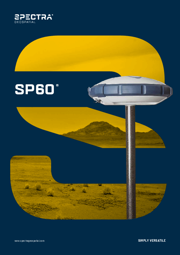
SP60 GNSS Receiver
Simply Versatile
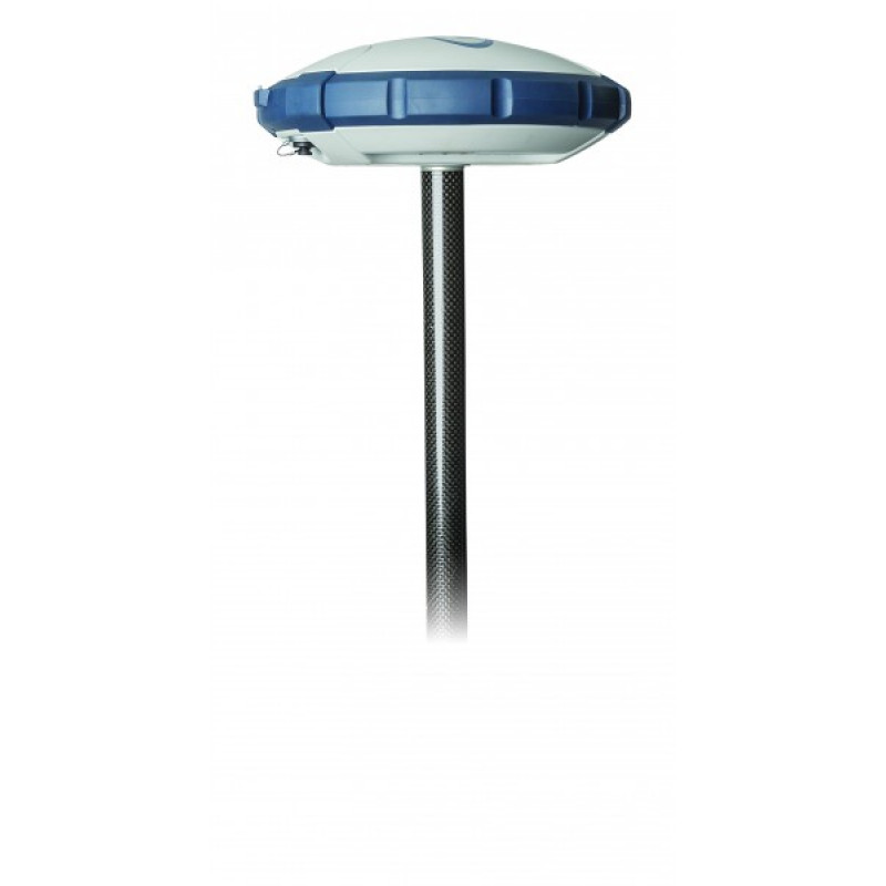
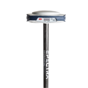
The Spectra Geospatial SP60 is a GNSS receiver offering a high level of flexibility to cover any survey demand from simple post-processing, through UHF or Long Range Bluetooth base and rover systems to sophisticated RTK and RTX rover solutions. Combining the unique all-signals-tracking and processing Z-Blade GNSS-centric technology and L-band capability for satellite-delivered RTX services, the SP60 GNSS receiver provides the most reliable measurements and the highest possible accuracy.

Spectra Geospatial
Carquefou (Nantes),, FR
Description
The Spectra GeospatialSP60 is a GNSS receiver offering a high level of flexibility to cover any survey demand from simple post-processing, through UHF or Long Range Bluetooth base and rover systems to sophisticated RTK and RTX rover solutions. Combining the unique all-signals-tracking and processing Z-Blade GNSS-centric technology and L-band capability for satellite-delivered RTX services, the SP60 GNSS receiver provides the most reliable measurements and the highest possible accuracy under any conditions and in any place in the world.
Do you have questions about this product?
- Questions about price, availability, and/or retailers
- Questions about technical specifications and usage
- Questions about suitability for your project or application
Specifications
-
More information
-
Distinguishable features
- Extended scalability- Z-Blade GNSS-centric technology- 240-channel 6G ASIC- Anti-theft technology- Long Range Bluetooth- Trimble RTX correction services
-
Power
-
Operating power: min. [V]
9
Operating power: max. [V]
28
Internal power supply
Li Ion Battery, 7.4V, 2600mAh
External power supply
DC power 9-28V
Operating time with internal power supply [hr]
10
Certifications
CE, MIL-STD 810
Rechargeable with (auto)battery
Yes
Direct car connection cable available
No
-
Performance
-
Tracked satellite signals
- GPS L1C/A, L1P(Y), L2P(Y), L2C- GLONASS L1C/A, L2C/A, L3- BeiDou B1 (phase 2), B2- Galileo E1, E5b- QZSS L1C/A, L2C, L1SAIF- SBAS L1C/A- L-band
SBAS differential signals
WAAS, EGNOS, GAGAN, MSAS
Type of measurements
Full carrier Phase
Reacqisition time [s]
2
RTK Network Compatibility
Y
-
General
-
Year of initial introduction
2015
Height [m]
0.07
Depth [m]
0.21
Width [m]
0.21
Total Weight [kg]
0.93
Housing Material
Polycarbonate
Type
Land
-
Horizontal uncertainty
-
code: DGNSS/RTC (constant part) [m]
0.25
code: DGNSS/RTC (variable part) [ppm]
1
phase: RTK rapid static (constant part) [m]
0.08
phase: RTK rapid static (variable part) [ppm]
1
phase: RTK kinematic (constant part) [m]
0.08
phase: RTK kinematic (variable part) [ppm]
1
phase: static post processing (constant part) [m]
0.03
phase: static post processing (variable part) [ppm]
0.5
Initialization time on the fly [s]
2
Range on the fly [km]
20
RTK network solution methods
VRS, FKP
-
Communication: Protocols
-
RTCM standards for differential data
RTCM 2.1, 2.3, 3.0, 3.1 and 3.2
CMR standards for differential data
CMR, CMR+, CMRx, sCMRx
Other formats for differential data
ATOM
NMEA output format
NMEA 0183
L-Band Compatible
Yes
-
Recording
-
Memory medium
Internal Nand Flash
Data capacity [MB]
256
-
Environment
-
Operating temperature: min. [°C]
-40
Operating temperature: max. [°C]
65
Humidity resistance
100%
Water sand and dust proof
IP67
Shock and vibration proof
MIL-STD 810
ROHS compliance
Y
WEEE compliance
Y
-
Communication: links
-
Radio modems
UHF, Bluetooth Long Range
GSM; UMTS phone modems
No
CDMA phone modems
No
Documents
Brochure
sg-sp60-br-v3-web.pdf
521.41 KB
Other documents
-
SP60 Brochure521.41 KB
-
Trimble technology produces cost saving and high accuracy results using Spectra Geospatial SP60 GNSS in combination with Trimble CenterPoint RTX correction service1.77 MB
-
Roman ruins modeling aided with SP60839.51 KB
-
Mauritanian power transmission surveyed with SP60797.49 KB


