
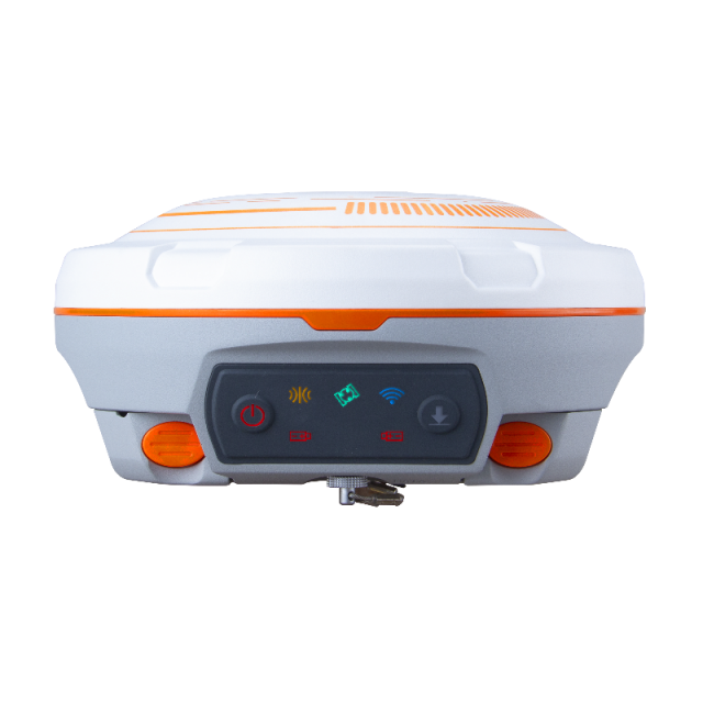
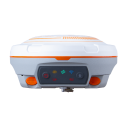

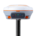
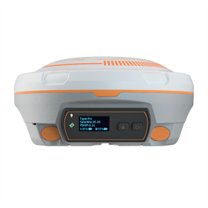
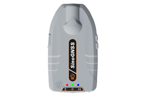
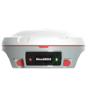
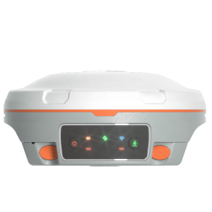
N3 IMU
Reliable IMU and Enhanced UHF bring you a brand new high-efficiency experience!
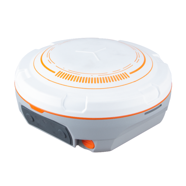
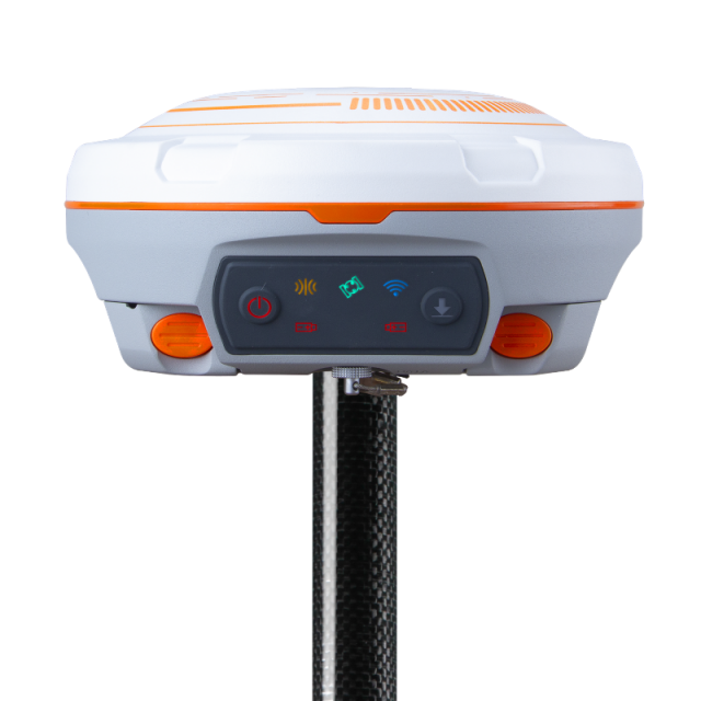
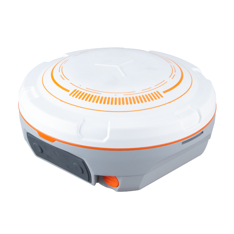
The N3 IMU GNSS receiver makes any survey task more efficient. The N3 features 1198 channels of tracking all running and planned constellations, enhanced UHF for up to a working range of 15km, an improved high precision IMU and a working time for over 24 hours.

ComNav Technology
Shanghai, CN
Description
Featuring 1198 channels of tracking all running and planned constellations, enhanced UHF for up to 15km working range, improved high precision IMU, low power consumption and over 24 hours working time, the N3 receiver making it work-efficient and energy-saving for your survey tasks.
Features
- Support GPS, BDS-2, BDS-3, GLONASS, Galileo, QZSS and SBAS tracking.
- 25 hours long-lasting batteries.
- Up to 15km work range with 2W power consumption with enhanced UHF
- IP67 water and dust proof level for harsh environments.
- Improved IMU of simpler initialization and high accuracy.
- Industry-leading 1.7W low power consumption.
- Powerful web UI to easily download static data & upgrade firmware.
- Support WiFi/4G/Bluetooth/UHF transmission.
Do you have questions about this product?
- Questions about price, availability, and/or retailers
- Questions about technical specifications and usage
- Questions about suitability for your project or application
Specifications
-
More information
-
Distinguishable features
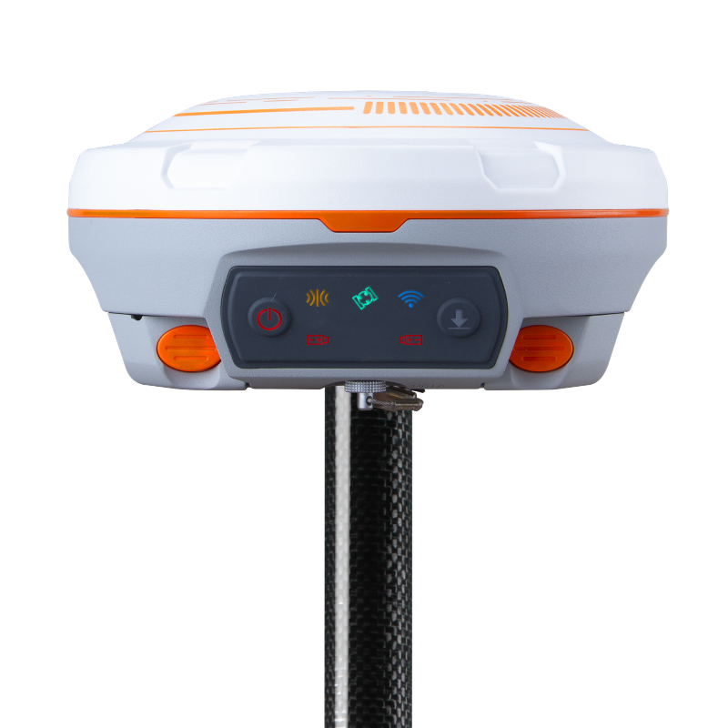
Built-in IMU supports up to 60° tilt compensation
-
Power
-
Operating power: min. [V]
6
Operating power: max. [V]
28
Typical consumption [W]
1.7
Internal power supply
7.4 V
External power supply
6 - 28 VDC
Operating time with internal power supply [hr]
25
Certifications
CE
Connectors
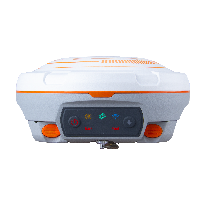
1 7-pin Lemo port for USB/serial cable, 1 TNC connector for UHF antenna
Rechargeable with (auto)battery
Y
-
Performance
-
No. channels
1198
Max. simultaneous tracked channels
1198
Tracked satellite signals
GPS L1/L2/L5, BeiDou B1/B2/B3, BeiDou Global B1C/B2a, GLONASS L1/L2, Galileo E1/E5a/E5b, QZSS L1/L2/L5, IRNSS
SBAS differential signals
WAAS, EGNOS, MASAS,GAGAN, SDCM
Type of measurements
RTK, PPK, Static
Reacqisition time [s]
1.5
RTK Network Compatibility
Y
-
General
-
Type
Land, Marine
Year of initial introduction
2021
Height [m]
0.073
Depth [m]
0.155
Width [m]
0.155
Total Weight [kg]
1.2
Housing Material
Aluminum-magnesium alloy
-
Horizontal uncertainty
-
code: DGNSS/RTC (constant part) [m]
0.4m 3D
phase: RTK rapid static (constant part) [m]
0.0025
phase: RTK rapid static (variable part) [ppm]
0.5
phase: RTK kinematic (constant part) [m]
0.008
phase: RTK kinematic (variable part) [ppm]
1
phase: static post processing (constant part) [m]
0.003
phase: static post processing (variable part) [ppm]
0.1
phase: kinematic post processing (constant part) [m]
0.008
phase: kinematic post processing (variable part) [ppm]
1
RTK network solution methods
VRS
Initialization time on the fly [s]
10
-
Communication: Protocols
-
RTCM standards for differential data
RTCM 2.X, 3.X
CMR standards for differential data
CMR, CMR+
NMEA output format
NMEA 0183
other output formats
ComNavBinary(CNB)
Configuration method
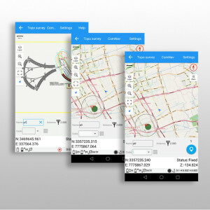
PC, survey software, web interface
-
Recording
-
Memory medium
Internal
Data capacity [MB]
8192
Type of data (on board recording)
ComNavBinary
-
Communication: general
-
Communication ports
1 serial port (7 pin Lemo), 1 TNC port
Simultaneous links
Y
Bluetooth
Y
PPS Out
N
-
Environment
-
Operating temperature: min. [°C]
-40
Operating temperature: max. [°C]
65
Humidity resistance
100% no-condensing
Water sand and dust proof
IP67
Shock and vibration proof
2m drop
-
Communication: links
-
Radio modems
15km working range with 2W power consumption, Tx/Rx with full frequency range from 410-470 MHz
GSM; UMTS phone modems
Y
Documents
Brochure
sinognss-n3-imu-gnss-receiver.pdf
2.19 MB


