
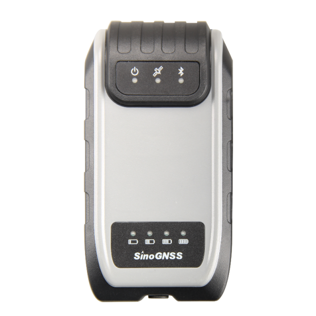
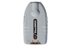
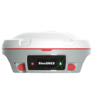
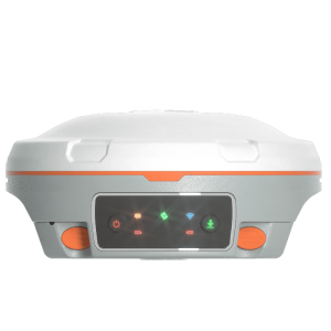
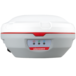
G200 GNSS Receiver
A cost-effective GNSS receiver that provides high-accuracy positioning to any connected mobile devices for RTK field surveying
The G200 is able to delivery robust survey workflows with SinoGNSS Android-based Survey Master Software, so that you collect quality high-accuracy positions no matter what mobile device you use. No heavy, expensive data collectors required and no compromise with quality but at an affordable price for every surveyor.

ComNav Technology
Shanghai, CN
Description
The G200 is a cost-effective GNSS receiver that provides centimeter accuracy positioning to any connected mobile devices for RTK fleld surveying. The G200 is able to delivery robust survey work flow with SinoGNSS Android-based Survey Master Software, so that you collect quality high-accuracy positions no matter what mobile device you use. No heavy, expensive data collectors required and no compromise with quality but at an affordable price for every surveyor.
- GPS L1/L2, BeiDou B1/B2, GLONASS L1/L2, Galileo E1/E5b, QZSS
- High-accuracy Positioning
- Ideal for RTK Solution
- Compact, Rugged Design
- Multiple Data Collection Device Choices via Bluetooth Connection
Do you have questions about this product?
- Questions about price, availability, and/or retailers
- Questions about technical specifications and usage
- Questions about suitability for your project or application
Specifications
-
Power
-
Operating power: min. [V]
5
Operating power: max. [V]
27
Typical consumption [W]
1.6
Internal power supply
3400mAh, 7.2V
External power supply
5-27 VDC
Operating time with internal power supply [hr]
9
Certifications
CE
Rechargeable with (auto)battery
Y
-
Performance
-
No. channels
352
Max. simultaneous tracked channels
352
Tracked satellite signals
GPS L1/L2, BeiDou B1/B2, GLONASS L1/L2, Galileo E1/E5b
SBAS differential signals
WAAS, EGNOS, MSAS, GAGAN
Type of measurements
RTK, PPK, Static
Reacqisition time [s]
1.5
RTK Network Compatibility
Y
-
General
-
Type
Land
Year of initial introduction
2018
Height [m]
0.0504
Depth [m]
0.137
Width [m]
0.072
Total Weight [kg]
< 0.35
-
Horizontal uncertainty
-
code: DGNSS/RTC (constant part) [m]
0.4
phase: RTK kinematic (constant part) [m]
0.008
phase: RTK kinematic (variable part) [ppm]
1
phase: static post processing (constant part) [m]
0.003
phase: static post processing (variable part) [ppm]
0.1
phase: kinematic post processing (constant part) [m]
0.008
phase: kinematic post processing (variable part) [ppm]
1
Initialization time on the fly [s]
10
RTK network solution methods
VRS
-
Communication: Protocols
-
RTCM standards for differential data
RTCM 2.X, 3.X
CMR standards for differential data
CMR, CMR+
NMEA output format
NMEA 0183
other output formats
ComNavBinary(CNB)
Configuration method
PC, survey software
-
Communication: general
-
Communication ports
1 serial port (9 pin Fischer), 1 Fischer connector
Simultaneous links
Y
PPS Out
N
Bluetooth
Y
-
Environment
-
Operating temperature: min. [°C]
-20
Operating temperature: max. [°C]
60
Water sand and dust proof
IP65
Shock and vibration proof
1.5m drop

