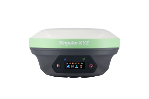
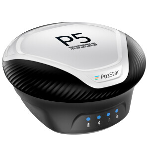
eSurvey NET20 PLUS CORS Solution
High-Quality CORS Solution
NET20 PLUS is specially designed for high-precision CORS reference stations. The rich data interface demands various of applications such as monitoring and machine control. User can use any phone or tablet to configurate device easily from the powerful Web UI.
eSurvey GNSS
Shanghai, CN
Description
Multi-constellation and Multi-frequency
With 800 channels of GNSS tracking, NET20 PLUS covers all GNSS signals including GPS, BDS, GLONASS, GALILEO and IRNSS, QZSS to provide stable and reliable data sources.
Rich Data Interface
Net20 PLUS supports multiple data interfaces such as serial ports, 1PPS, and event to demand various of applications. Its powerful Linux system ensures a smooth operation without any worries.
Rich Wireless Communication
Net20 PLUS supports WIFI, Bluetooth, Ethernet, SIM cards. Users can send or receive data through any method.
Large Battery
The 13600 mAh battery lasts up to 12 hours to respond to emergencies. It also ensures the data is stored safely.
Large Memory Storage
The internal 32 GB storage and TF card expansion ensure users to store the data for a long time. It also supports FTP push to make it more convenient for data management.
L-Band Atlas
Atlas is a service to provide global precision correction service over L-band satellites. With ATLAS subscription, Net20 PLUS is able to achieve centimetre accuracy without any correction data.
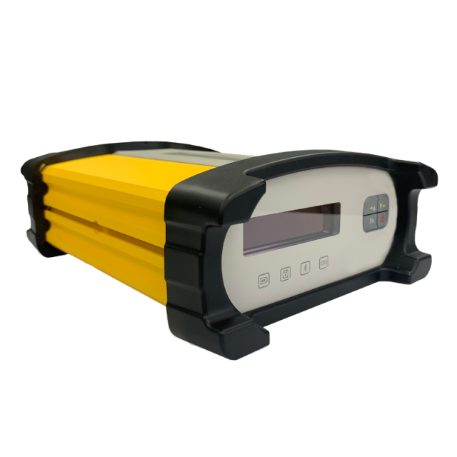
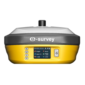
Web UI
It is able to view position status, configure devices, download data and update firmware from the Web user interface with any phone, tablet or PC.
Smart Alert
It will alert the user through email or SMS once the charger is disconnected, the battery level is too low, the temperature is too high or the memory storage is almost full.
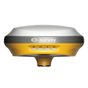
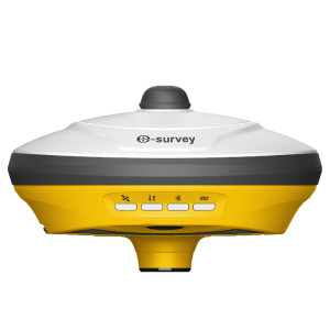
Rugged Design
Net20 PLUS main body is using aluminium alloy materials to provide strong shock and vibration-resistant characteristics. IP67 certification ensures operation in various of tough environments.
Specifications
-
Power
-
Internal power supply
13600mAh
External power supply
2-pin lemo, 9~28 VDC
Operating time with internal power supply [hr]
12
Certifications
CE, FCC
Rechargeable with (auto)battery
YES
Connectors
2-Pin Lemo
-
Performance
-
No. channels
800
Tracked satellite signals
GPS, Glonass, Beidou, Galileo, QZSS, SBAS, L-band, IRNSS
SBAS differential signals
Support
Reacqisition time [s]
1
RTK Network Compatibility
Full compatible
MRS functionality
Support
-
General
-
Type
Land
Year of initial introduction
2019
Height [m]
0.079
Depth [m]
0.222
Width [m]
0.164
Total Weight [kg]
2
-
Horizontal uncertainty
-
code: DGNSS/RTC (constant part) [m]
0.3
phase: RTK rapid static (constant part) [m]
0.0025
phase: RTK rapid static (variable part) [ppm]
0.1
phase: RTK kinematic (constant part) [m]
0.008
phase: RTK kinematic (variable part) [ppm]
1
phase: static post processing (constant part) [m]
0.002
phase: static post processing (variable part) [ppm]
0.1
-
Communication: Protocols
-
RTCM standards for differential data
RTCM2, RTCM3, RTCM32
CMR standards for differential data
CMR, CMR+
Other formats for differential data
ROX
NMEA output format
NMEA0183
other output formats
Binary
L-Band Compatible
Atlas H10/30/Basic
Configuration method
WebUI, Serial port
-
Recording
-
Memory medium
Internal Storage
Data capacity [MB]
32768
Type of data (on board recording)
Dat binary, Rinex
-
Communication: general
-
Communication ports
RS232, SIM card, TF card, PPS, Event
Simultaneous links
Y
PPS Out
Y
Bluetooth
Y
-
Environment
-
Operating temperature: min. [°C]
-40
Operating temperature: max. [°C]
65
Humidity resistance
100%
Water sand and dust proof
IP67
Shock and vibration proof
Survive a 1.2 m drop on concrete floor
-
Communication: links
-
GSM; UMTS phone modems
2G/3G/4G


