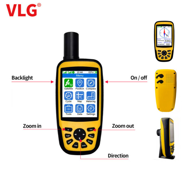
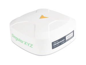
Handheld RTK GNSS Receiver for Positioning, Topographic survey, Land survey
2.5cm +1ppm positioning accuracy with compact size body
Agriculture 4 major functions > Find out water pile > Sharing AB point > Topographic survey > Land survey
VLG
Shenzhen, CN
Description
More details, Pls contact: [email protected]
Agriculture 4 major functions
>find out water pile
Identify the water piles and collect the location of each pile before harvesting or plowing, then find the correct location to install the pile before planting
>sharing AB point
Share the AB point, and share the collected AB point data with the tractor navigator to avoid the tractor running on the ground for nothing.
>Land survey
Plot measurement, enclosing area, dot area, perimeter, curve length, straight line length
>Topographic survey
Topographic survey, minimum height, maximum height, average height, the amount of earthwork to make the plane, etc
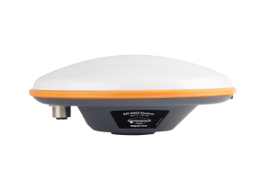
Specification
| Item | Handheld RTK survey meter | -Positioning, Navigation | |
| Display screen | 3.2 inches | Custom coordinate system | support |
| GNSS | Single frequency/dual frequency | Zonal selection | support |
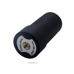
| Built-in antenna | Flat plate antenna | Data interface | Type-C |
| External antenna interface | SMA | Center bar interface | Yes |
| Positioning accuracy | 2.5 cm + 1 PPM | Scan for position | Yes |
| 4G | 4G All-Netcom CAT1 | Dimension | 14.4*7.3*3.5cm |
| Dual-mode bluetooth | Yes | Weight | 270g |
| Built-in storage | 16-125GB (Optional) | Protection class | IP67 |
| Endurance time | > 20 hours | Look for Water pile location | Yes |
| Track file | Each 10000 points | Shared AB point | Yes |
| Waypoint file | Each 1000 points | Topographic survey | Yes |
| Route file | Each 250 points | Area survey | Yes |
| Coordinate system | support | Wechat backup | Yes |
More details, Pls contact: [email protected]
Specifications
-
Performance
-
Tracked satellite signals
GPS、BDS、GLONASS、 GALILEO (QZSS optional)
Type of measurements
m
-
General
-
Material
Plastic
Height [m]
0.144
Depth [m]
0.073
Width [m]
0.035
Mounting possibilities
Centering Rod, Handheld
-
Terrain compensation / INS
-
Terrain compensation module
-
Horizontal uncertainty
-
DGNSS speed accuracy [km/h]
0.36
RTK horizontal accuracy (constant part) [m]
0.025
RTK horizontal accuracy (variable part) [ppm]
1
RTK speed accuracy [km/h]
0.36
DGNSS/RTC horizontal accuracy (constant part) [ppm]
1
Omnistar horizontal accuracy (variable part) [ppm]
1
-
Communication and data
-
Bluetooth
Y
Cellular modem
Y
Cellular description
4G All-Netcom CAT1
-
Environment
-
Water sand and dust proof
IP67
-
Connectivity
-
Other connectors or connector specifications
microUSB

