
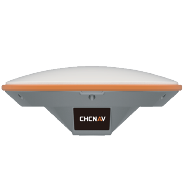


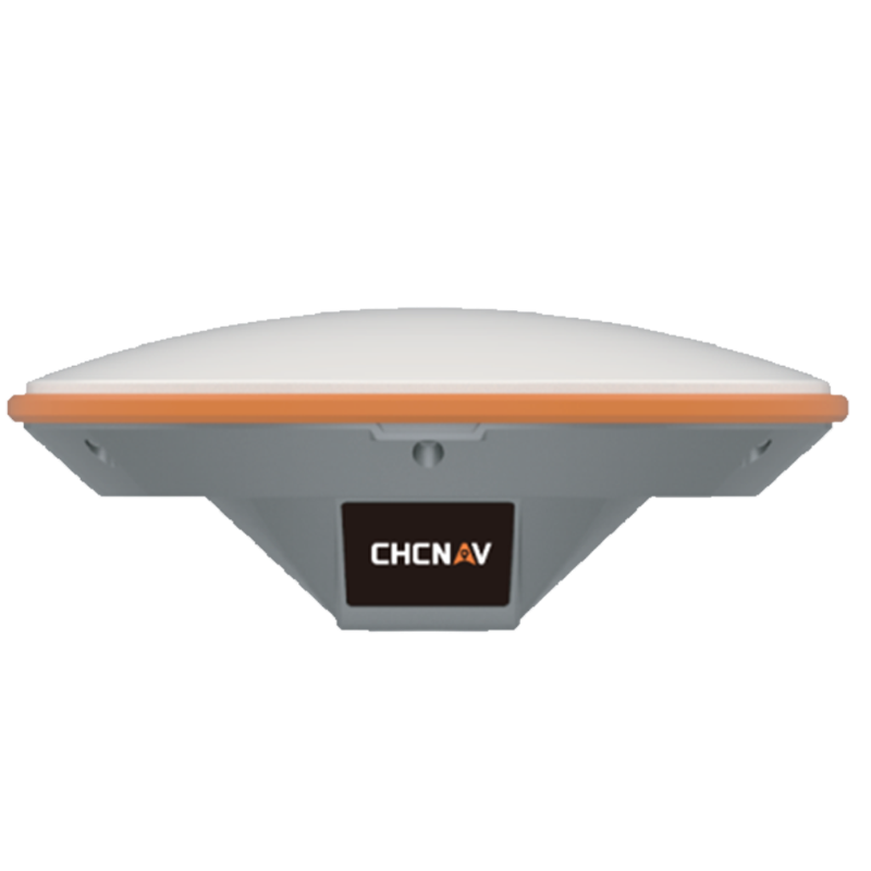

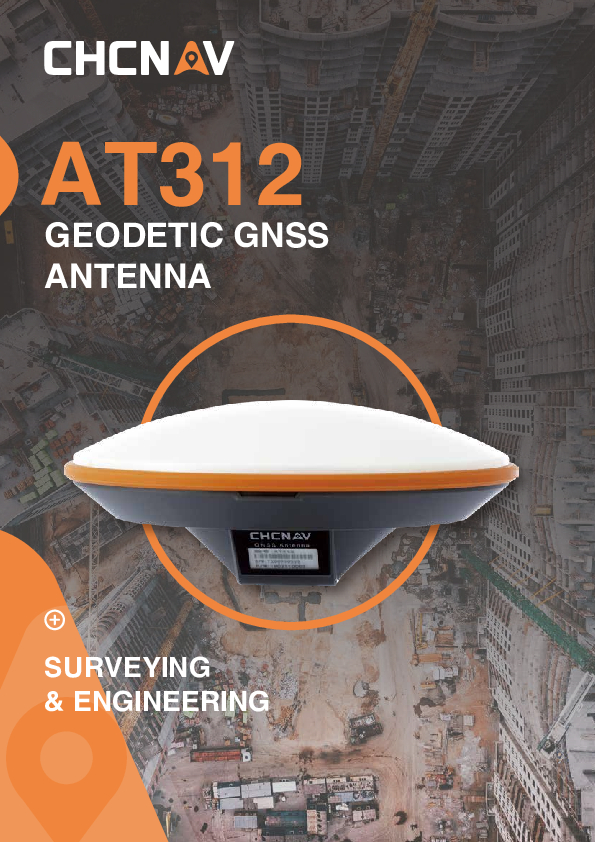
AT312
Versatile Geodetic GNSS Antenna Designed for Land Surveying, Construction and Engineering Applications
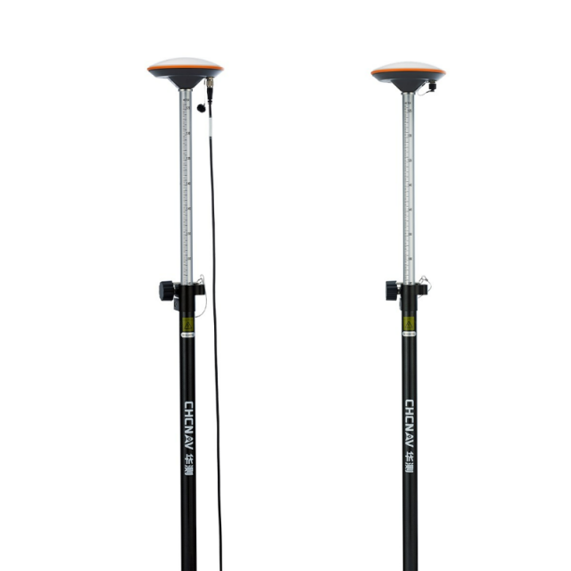
The AT312 is a versatile geodetic GNSS antenna designed to match the requirements of any land surveying, construction and engineering applications. With advanced filtering and robust signal tracking capabilities, the AT312 provides survey-grade GNSS signal to enhance your position accuracy performances.

CHC Navigation | CHCNAV
Shanghai, CN
Description
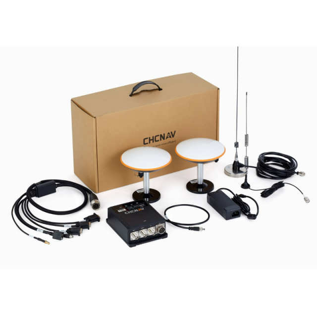
The CHC GNSS antennas provide a high-accuracy and cost-effective solution to demanding positioning applications such as geodetic reference stations, marine surveys, machine control, GIS, and mapping when performance and reliability are required. It offers:
- Multi-constellation GNSS tracking
- Advanced phase centre accuracy
- Advanced multipath rejection
The AT312 supports all current and upcoming GNSS signals, including GPS, GLONASS, BeiDou, Galileo, QZSS, IRNSS, SBAS, and L-Band. The AT312 advanced LNA and optimised ground plane technology significantly reduce multipaths’ impact on measurement accuracy. The IP67 industrial design of the AT312 makes it safe to use in harsh conditions within a wide operating temperature range. The AT312 features 40-dB signal gain and a low elevation GNSS signal tracking capability even in challenging surroundings.
Do you have questions about this product?
- Questions about price, availability, and/or retailers
- Questions about technical specifications and usage
- Questions about suitability for your project or application
Specifications
-
Power
-
Min. operating power [V]
3.3
Max. operating power [V]
12
Connection/cable for power
TNCFemale
-
Operational
-
Design keywords
Geodetic Antenna, Rugged, High vibration resistant
Mounting
5/8" - 11 FemaleThread
-
Amplifier
-
Amplifier
Noise figure [max dB]
2
-
Tracked signals
-
Tracked satellite signals
GPS, GLONASS, Galileo, BeiDou, SBAS
Type of GPS measurements
L1, L2, L5
Type of GLONASS measurements
L1, L2, L3
Type of Galileo measurements
E1, E2, E5, E6
Type of Beidou measurements
B1, B2, B3
Type of SBAS measurements
QZSS
L-Band
Y
-
Connectivity
-
TNC female
Y
-
Environment
-
Operating temperature: min. [°C]
-40
Operating temperature: max. [°C]
85
Humidity resistance
Humidity 95% non-condensing
Water sand and dust proof
IP67waterproof and dustproof
Shock and vibration proof
NGS Calibration proof and survives a 2 m (6.56ft) drop onto concrete
-
General
-
Type
Land
Height [m]
0.063
Total Weight [kg]
0.450
Certifications
IP67waterproof and dustproof and MIL-STD-810 G, 514.7
Housing and finish material
Survive a 2 m (6.56ft) drop onto concrete
Depth [m]
0.154
-
More information
-
Distinguishable features
Multi-constellation tracking, advanced multipath mitigation and superior performance
Documents
Brochure
at312-ds-en.pdf
811.34 KB


