Topocad
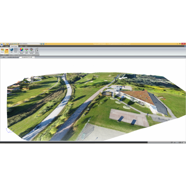
Topocad is a CAD system for measurement engineering calculations, map editing and a variety of specialized functions. Topocad uses a format that is compatible with both coordinate data, CAD-and GIS data. It has an integration between different types of data, such as vectors, raster, terrain models and point clouds.
Adtollo
Stockholm, SE
Description
Topocad is a CAD system for measurement engineering calculations, map editing and a variety of specialized functions. Topocad is involved in community building with a wide range of different activities. A few advantages when using Topocad:
- Topocad is a comprehensive 3D CAD system with modules for different types of work
- Topocad is a Swedish system built for conditions where development takes place in close contact with users
- Topocad handles a large amount of data format import/export and database connectivity
- Topocad uses a format that is compatible with both coordinate data, CAD-and GIS data
- Topocad has integration between different types of data, such as vectors, raster, terrain models and point clouds
Specifications
-
Hardware/software requirements
-
RAM [GB]
4
HD [GB]
1
Use of GPU
N
Processor
["64-bit"]
Stereo Display
N
Stand-alone
Yes
-
Other
-
Support
Yes, online/phone
Typical applications
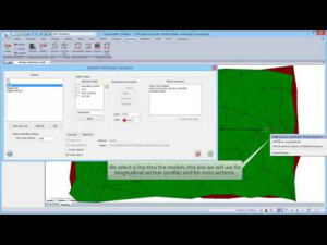
Volume calculation, Cross sectioning, Contouring
Distinguishing features
Calculation for contouring, profiling, cross sectioning, volume calculations.
Training
Y
-
Files and Registering
-
Input formats
LAS, ESRI Ascii Grid, Coordinate files, Gener
Output formats
TPC, TOP, DTM
Max. file size (#3D points)
10
Geo-referencing
Y
Automatic Target Detection
N
Stitching multiple scans
N
-
Pre-processing and Automatic Filtering
-
Image matching facilities
Y
Frequency domain decoding for data reduction
No
Removal of individual outliers
Y
Removal of vegetation
Y
Removal of buildings
Y
Bare ground DEM generation
Y
-
Manual Measurements
-
3D Coordinates extraction
Y
Length and Height
Y
Angle
Y
Distance
Y
Area
Y
Volume
Y
-
General
-
Year of last update
2019
Year of initial introduction
1995
Modules
Base modulePoint cloudDesign modulesDatabase adapters
Supported Systems
Imports following files: - LAS- ESRI Ascii Grid- Coordinate files- Generic import
Source of Point Clouds
Airborne Lidar, Indoor TLS, Outdoor TLS, Photogrammetric, Radar
-
Analysis
-
Line of sight
N
Aspect and slope
Y
Individual tree heights
N
Simulation facilities
No
Time series analysis
N
-
Automatically Generated Products
-
Regular Grid DEMs
Y
Cross sections
Y
TIN
Y
Contour Lines
Y
Break lines
N
Boundary detection of solids
N
Building footprints
N
Building roofs
N
3D City modelling
No
-
Solid Modelling
-
Lines
N
Planes
N
Cubes
N
Spheres
N
Cylinders
N
NURBS
N
Industrial features
No
Earth surface features
No
-
Visualisation and Editing
-
Zoom, pan and rotate
Y
Fly-throughs
Y
Adding Points
N
Removing Points
Y
Point Reduction
Y


