Description
Specifications
-
Data management
-
Security options for access
N
Search on file content
Y
Version management
Y
Spatial reference system
From data source, Manual georeferencing
-
Geometry types
-
Lines
Line segment, Polyline, Multiline, B-spline
Points
Point, Symbol, Others
Surfaces
Polygon, Circle, Multipolygon, Others
Raster
Reference
-
Other
-
License or freeware
License
Training
Y
Main users
Geoscientists, hydrologists, engineers, geologists, archeologists, oceanographers, biologists, foresters, geophysicists, medical researchers, climatologists
Main applications
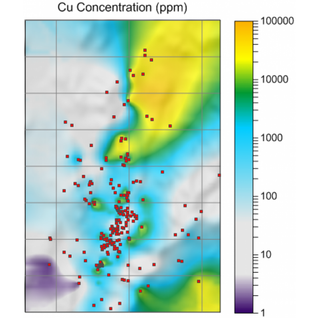
Surfer is used extensively for terrain modeling, landscape visualization, surface analysis, gridding, volumetrics, 2D map generation, and much more
Extensions
none
Related products
Voxler, Strater, Grapher, MapViewer, Global Mapper, ArcGIS, ArcMap, QGIS, Oasis Montaj
Distinguishable features
Easy-to-use interface, affordable, publication-quality maps
-
2D Editing
-
Select
Select by administrative attributes, Spatial selection, Multiple select, Others
Remove
Graphic transformations
Scale, Copy, Move, Rotate, Mirror, Align, Stretch, Drag and drop
Coordinate transformations
yes, on the fly
Mosaicing
yes
Generalization
yes
-
2D Construction
-
Positioning by coördinates
Y
Positioning by snapping
Y
Positioning in relation to other element
-
Storage
-
Type of data storage
File
Native storage format
SRF
Input formats
Dwg, Shape, KML, GeoTiff, ECW, SID, Jpg, Others
Export formats
Dxf, Shape, KML, GeoTiff, ECW, Jpg, Others
GML version
n/a
Compression
Y
-
Visualisation
-
Types
Color, Pattern, Hatch
Change view
Temporal
no
Thematic mapping
Proportional symbol map, Contour map
-
Interoperability
-
Web standards
WMS
Spatial database management systems
None
Messaging protocols
None
Publish standards
KML
Extensions
Macro
Available API’s
none
Metadata
Creation
-
General
-
Year of introduction
1985
Year of last update
2016
Supported hardware
printer
Supported operation system
Windows
Main GIS category
Desktop GIS
-
Data analysis
-
Merge
Map layers
Clip
Y
Buffer
Point buffer, Line buffer, Polygon buffer, Multiple buffers
Overlay operations
Intersection, Union, Symmetrical difference, Difference, Spatial join
