
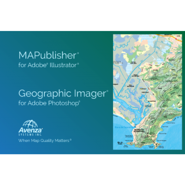
MAPublisher and Geographic Imager for Adobe CC
Map Design Tools For Professionals
MAPublisher and Geographic Imager are powerful suite of mapping tools for Adobe Illustrator and Adobe Photoshop. MAPublisher bridges the gap between geographic information systems (GIS) and high-end graphic design software in order to facilitate the map creation process.While, Geographic Imager enables spatial imagery to be opened, edited, transformed and saved while retaining all the spatial properties of the image.
Avenza Systems
Toronto, CA
Description
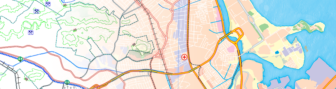
Create Maps With Geospatial Data in Adobe Illustrator
MAPublisher® cartography software seamlessly integrates more than fifty GIS mapping tools into Adobe Illustrator to help you create beautiful maps.
Import industry-standard GIS data formats and make crisp, clean maps with all attributes and georeferencing intact using the Adobe Illustrator design environment.
Seamless Integration
MAPublisher panels and tools seamlessly integrate into the Adobe Illustrator interface and can be resized, moved, and docked. Quickly launch MAPublisher tools to manage map layers, view map attributes, create and edit theme stylesheets, create selection filters, plot points and much more.
Geospatial Interoperability
It’s all about increased productivity for cartographers and GIS professionals. Easily and quickly import various data formats, create high-quality map products, and export data to different file formats or publish to print and digital formats, including web maps and maps for mobile devices.
Cartographic Workflow
MAPublisher and Adobe Illustrator together form the complete cartographic workflow—from raw data to publishing a high-quality map; and everything in between. Combine powerful graphic design tools and the geospatial precision of MAPublisher tools to build visually-rich maps.
Highly Compatible
MAPublisher is available on Mac and Windows and is compatible with the latest Adobe Illustrator release, ensuring the latest graphic design tools are at your disposal. Licenses available as both fixed single and floating. Floating licenses are cost effective for any commercial, academic, or non-profit organization.
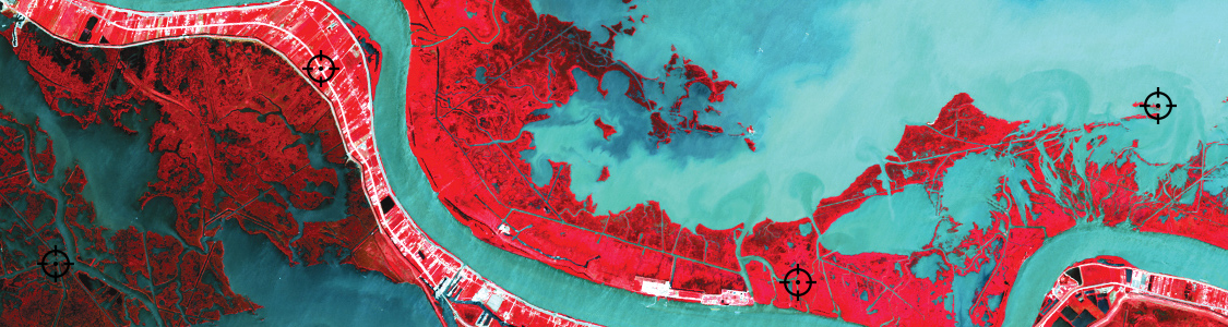
Working With Geospatial Imagery Doesn’t Have to be Complicated
Geographic Imager® mapping software enhances Adobe Photoshop to make working with spatial imagery quick and efficient. It adds tools to import, edit, manipulate and export geospatial images such as aerial and satellite imagery.
Enjoy the use of native Adobe Photoshop functions such as transparencies, filters, pixel editing, and image adjustments like brightness, contrast, and curve controls while maintaining spatial referencing.
Seamless Integration
The Geographic Imager panel provides access to all the tools and functions quickly and easily. All spatial information related to the image including the coordinate system, world location of the corners, pixel size, and more. Convenient tabs provide access to vital image information and the ability to copy values to the clipboard.
Editing Workflow
Geographic Imager and Adobe Photoshop together form the complete spatial image editing solution. Combine powerful graphic design tools and the geospatial precision of Geographic Imager tools to manipulate high-resolution images.
Geospatial Interoperability
It’s all about increased productivity for cartographers and GIS professionals. Easily and quickly import various data formats, create high-quality map products, and export data to different file formats or publish to print and digital formats, including web maps and maps for mobile devices.
Highly Compatible
Geographic Imager is available on Mac and Windows and is compatible with the latest Adobe Photoshop 2020 release, ensuring the latest graphic design tools are at your disposal. Licenses available as both fixed single and floating. Floating licenses are cost-effective for any commercial, academic, or non-profit organization.
Specifications
-
Data management
-
Security options for access
N
Search on file content
N
Version management
N
Spatial reference system
From data source, Selectable, Manual georeferencing, Others
-
Geometry types
-
Lines
Line segment, Polyline, Multiline, Arc, B-spline, Others
Points
Point, Symbol, Text, Others
Surfaces
Polygon, Circle, Multipolygon, Others
Raster
Reference
-
Other
-
License or freeware
License
Training
Y
Main users
Cartographers, GIS professionals, map makers, government, and academic organizations
Main applications
Forestry and Agriculture, Infrastructure, Academic, Publishing, Public Safety, Law Enforcement, Utilities, Travel and Tourism, Oil and Gas, Military and Intelligence
Extensions
MAPublisher LabelPro - advanced collision-free labeling engine. MAPublisher FME Auto - connects the processing power of FME Desktop to the design environment of MAPublisher Adobe Illustrator.
Related products
MAPublisher for Adobe Illustrator, Geographic Imager for Adobe Photoshop, Avenza Maps app for mobile devices
Distinguishable features
Bridges GIS and graphic design
-
2D Editing
-
Select
By drawing attributes, Select by administrative attributes, Within buffer, Spatial selection, Multiple select, Others
Remove
Graphic transformations
Scale, Copy, Move, Rotate, Mirror, Align, Stretch, Drag and drop, Dilate, Erode, Others
Coordinate transformations
Thousands of coordinate system transformations possible
Mosaicing
Yes, with Geographic Imager Mosaic tool in Adobe Photoshop
Generalization
Yes, available using the MAPublisher Simply Art tool in Adobe Illustrator
-
2D Construction
-
Positioning by coördinates
Y
Positioning in relation to other element
Extend, Perpendicular, Particular angle, Concentric, Tangent, Symmetric, Others
Positioning by snapping
Y
-
Storage
-
Type of data storage
File, Database, Internet
Native storage format
AI
Input formats
Dwg, Dxf, Dgn, Shape, GML, KML, GeoTiff, ECW, Jpg, Others
Export formats
Dwg, Dxf, Dgn, Shape, GML, GeoTiff, ECW, Jpg, Others, KML
GML version
3.1.1
Compression
Y
-
Visualisation
-
Types
Color, Pattern, Hatch, Gradient color
Change view
Temporal
N/A
Thematic mapping
Choropleth, Dot distribution map, Proportional symbol map
-
Interoperability
-
Web standards
WMS, WFS
Spatial database management systems
PostGIS
Messaging protocols
None
Publish standards
KML
Extensions
none
Available API’s
N/A
Metadata
Creation, Management, Others
-
General
-
Year of introduction
1995
Year of last update
2020
Supported hardware
All PC and Mac
Supported operation system
Windows, Mac OS X
Main GIS category
Desktop GIS
-
Data analysis
-
Merge
Map layers, Attribute table to geometry, Others
Clip
Y
Buffer
Point buffer, Line buffer, Polygon buffer, Multiple buffers, Dissolve buffers, Other
Overlay operations
Intersection, Union, Difference, Spatial join
Related products


