
Description
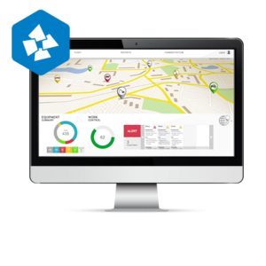
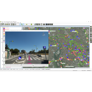
The application is used to manage the process of executing projects and missions carried out with the use of various UAV systems,
- from the phase of determining the place of carrying out the flight,
- through planning and supervision of the flight
- to the publication of the resulting data.
Users ordering service can determine the place of the mission with its basic parameters such as determining the type of aircraft (airframe, rotor), type of sensor, date and time of carrying out the mission and can supervise its planning and execution. The application also allows you to upload additional vector data characterizing the place of flights, e.g. the location of power pylons and lines over which the mission is being carried out. The application is based on Open Source technology and WWW, publishing data in the cloud.
The application allows storing, analyzing and publishing various result data; orthophotos, photos, videos, and reports. One of the most interesting options of the application is the possibility to send and share a VIDEO LIVE signal directly from the flight site, which allows for observation of the flight object from any location.
All you need is Internet access and an account in the DRONonLine application. When deciding on a service, the customer can choose an account profile that is appropriate to their needs from three different types; Basic, Standard and Professional differing in functionalities and available disk space for data publication.
Specifications
-
Data management
-
Security options for access
Y
Search on file content
N
Spatial reference system
-
Geometry types
-
Lines
Polyline, Multiline
Points
Point, Multipoint, Symbol, Text
Surfaces
Polygon
Raster
Reference
-
Other
-
License or freeware
License
Training
Y
-
2D Editing
-
Select
By drawing attributes, Spatial selection
Remove
By select
Graphic transformations
Coordinate transformations
Any required
-
2D Construction
-
Positioning by coördinates
Y
Positioning in relation to other element
-
Storage
-
Type of data storage
Public cloud
Native storage format
Tiff, SHP, Video
Input formats
Shape, KML, GeoTiff
Export formats
Shape, KML
-
Visualisation
-
Types
Color, Pattern
Change view
Zoomfactor, Target point, Twist angle
Thematic mapping
-
Interoperability
-
Web standards
WMS, WFS, WCS
Spatial database management systems
Messaging protocols
XML, REST
Extensions
Metadata
Management
-
General
-
Year of introduction
2018
Year of last update
2019
Supported hardware
Web based
Supported operation system
Other
Main GIS category
Internet GIS
-
Data analysis
-
Merge
Buffer
Overlay operations
