Leica DMC-4 Airborne Imaging Sensor
Delivering Unsurpassed Image Fidelity for Multiple Photogrammetric and Remote Sensing Applications
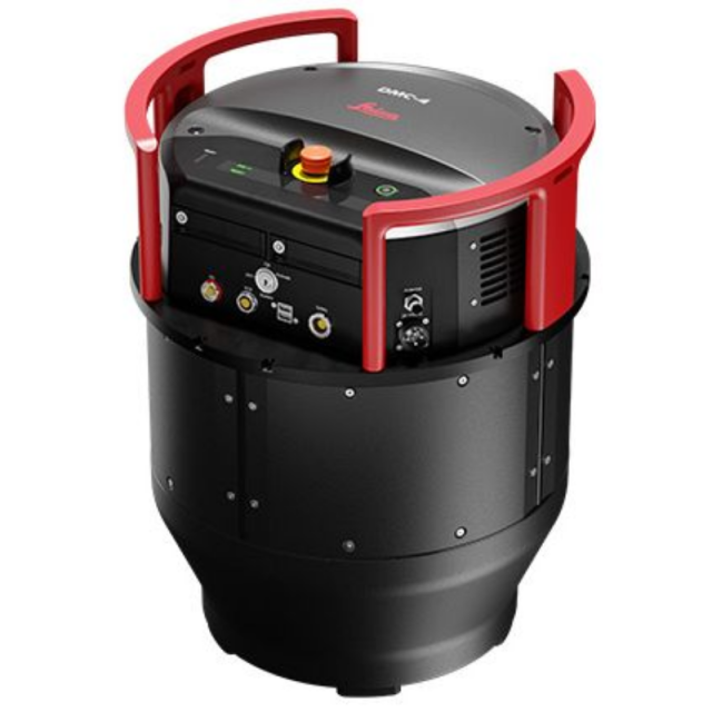
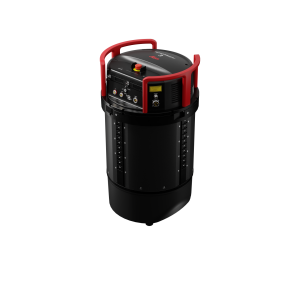
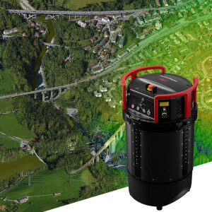
The Leica DMC-4 is a highly efficient airborne imaging sensor delivering superior image fidelity for versatile applications and complex mapping environments.

Leica Geosystems Airborne Solutions
Switzerland
Description
With over 31,500 pixels across swath, the system maximises acquisition efficiency and improves the imaging performance by 20% compared to previous systems. The sensor leverages Leica Geosystems’ CMOS based MFC150 camera module with mechanical forward-motion-compensation (FMC) to deliver the highest image detail. The DMC-4 was designed with application versatility in mind and supports multiple photogrammetry and remote sensing applications.
Integrated system
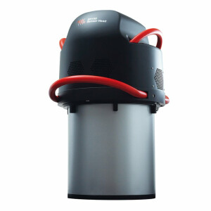
The system fully integrates with powerful Leica HxMap end-to-end processing workflow, supporting customers from mission planning and execution to product generation. Installed in the new Leica PAV200 compact sensor mount, the sensor provides highest sensor stabilisation and data collection efficiency.
Superior image quality
The DMC-4 features the modular MFC150 optical system and proven CMOS technology to deliver the highest accuracy at faster aircraft speeds. Stable, environment-tested lenses and unique forward-motion-compensation (FMC) deliver crisp, full radiometry in a wide range of operating conditions.
Application Versatility
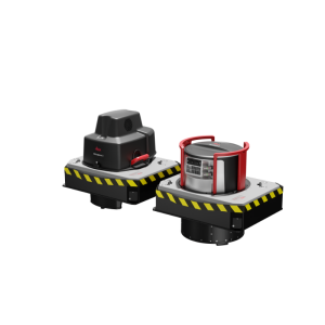
The sensor provides the frame geometry needed to support a wide range of applications such as photogrammetry, remote sensing, terrain extraction and vector mapping. Standard (S) and high (H) focal length configurations enable maximum flying height flexibility in restricted access airspaces.
Do you have questions about this product?
- Questions about price, availability, and/or retailers
- Questions about technical specifications and usage
- Questions about suitability for your project or application
Specifications
-
Application
-
Main applications
Nat’l/Reg’l Map, Orthophotograph, 3D Feature Extract, DSM, Remote Sensing
Distinguishable features
Mecahnical FMC, > 30.000 pixels swath
-
Uncertainty
-
Geometric calibration
Yes, grid based distortion correction
Radiometric calibration
Yes
-
Data storage
-
Type of storage
SSD
Storage capacity [GB]
15.36 TB
Storage Replaceable
Y
-
Sensor Characteristics
-
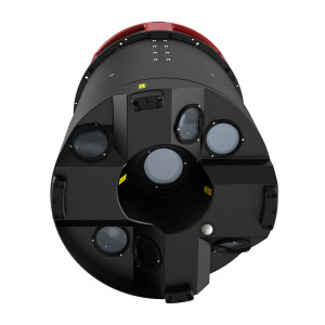
Number of lenses
5
Lenses: focal lengths [mm]
107 (DMC-4S), 143 (DMC-4H)
Type CMOS
BSI CMOS
Lenses: interchangeable
Interchangeable by factory technicans
Type CCD
BSI CMOS
Pixel size [µm]
3.76
Megapixels
150 nominal
Dynamic range [bits]
14
CCD RGB
BSI CMOS
Charged Coupled Device (CCD) IR
BSI CMOS
CCD simultaneous
N/A
CCD along track format [mm x mm]
50.5 effective
CCD along track format [pixel x pixel]
13440 (DMC-4S), 14760 (DMC-4H)
CCD across track format [mm x mm]
118.5 effective
CCD across track format [pixel x pixel]
31520
Max. integration time [s]
N/A
Max. shutter speed [s]
1/1000
Data collection rate [megapixel/s]
530 (DMC-4S), 542 (DMC-4H)
Max. across-track FOV [deg]
58 (DMC-4S), 45 (DMC-4H)
-
Operation Characteristics
-
Platform
Fixed-wing
Fixed-wing
Y
Max. acquisition duration [h]
> 8
Forward motion compensation
Y
In flight pre-view
Y
Temperature controlled pod
Y
-
Software
-
On board image storage format(s)
Proprietary
Type of mission planning software
Leica MissionPro
Type of postprocessing software
Leica HxMap
-
General
-
Year of introduction
2022
Last update
2022
-
Feature Extraction and Mapping
-
Mapping facilities
Y
Semi-automatic building extraction
Y
3D superimposition
Y
Integration with 2D vector maps
Y
Integration with point clouds
Y
Automatic texturing
Y
-
Images and data
-
Export data formats
TIFF, JPG, LAS (1.2/1.4), CityGML, OBJ, TDC
Scanned analogue Aerial Photos
N
Digital Aerial Nadir Frames
Y
Oblique Images
N
Linear array sensors
N
Optical Satellite Images
N
UAS Images
N
Radar Images
N
-
Orientation and triangulation
-
Automatic interior
Y
Relative
Y
Automatic aerotriangulation
Y
Automated blunder detection
Y
Self calibration
Y
images simultaneously processed
Y
-
Image manipulation & processing
-
Automatic contrast manipulations
Y
Spatial convolution
Y
Resampling
Y
Radiometric corrections
Y
Radiometric adjustment for mosaicing
Y
-
Hardware
-
Camera unit Weight [kg]
37.1
Camera unit Length [m]
0.56
Camera unit Width [m]
0.435
Camera unit Depth [m]
0.435
Power requirements
28 VDC, 450 W max average
Type of GNSS/ INS positioning system
Novatel SPAN OEM7, Class 5 IMU, 500 Hz
-
Application areas
-
Select an application area:
Land Surveying and Cadastre
-
Product characteristics
-
Choose characteristics:
Nadir, Colour Imagery, High-altitude, Gyro-stabilization
Documents
Brochure
leica dmc-4 ds 973558 0822 en_lr.ashx?la=en&hash=C9124E0B680DF5E48F52FFBC2EBCD9D4
Videos


