


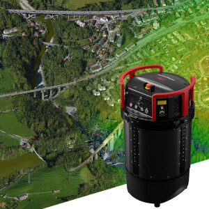
Leica CityMapper-2
The world’s only hybrid oblique imaging and LiDAR airborne sensor for fast and efficient digitisation of cities. High-Performance Hybrid Urban Mapping Sensor
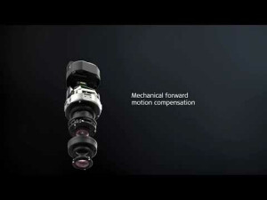
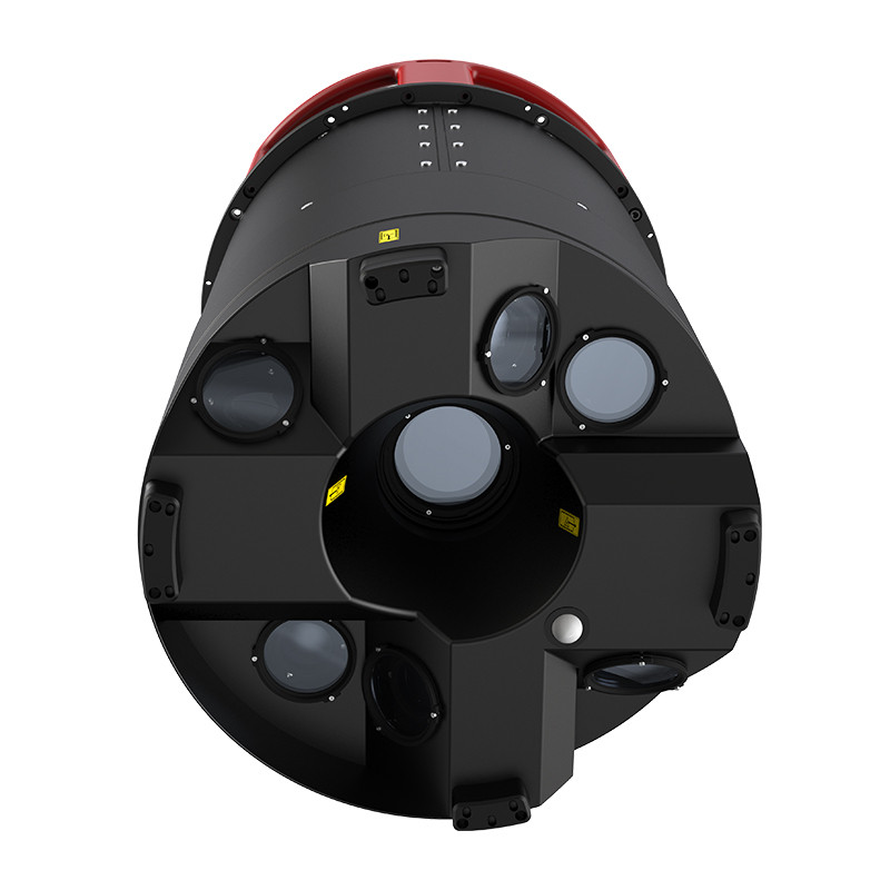
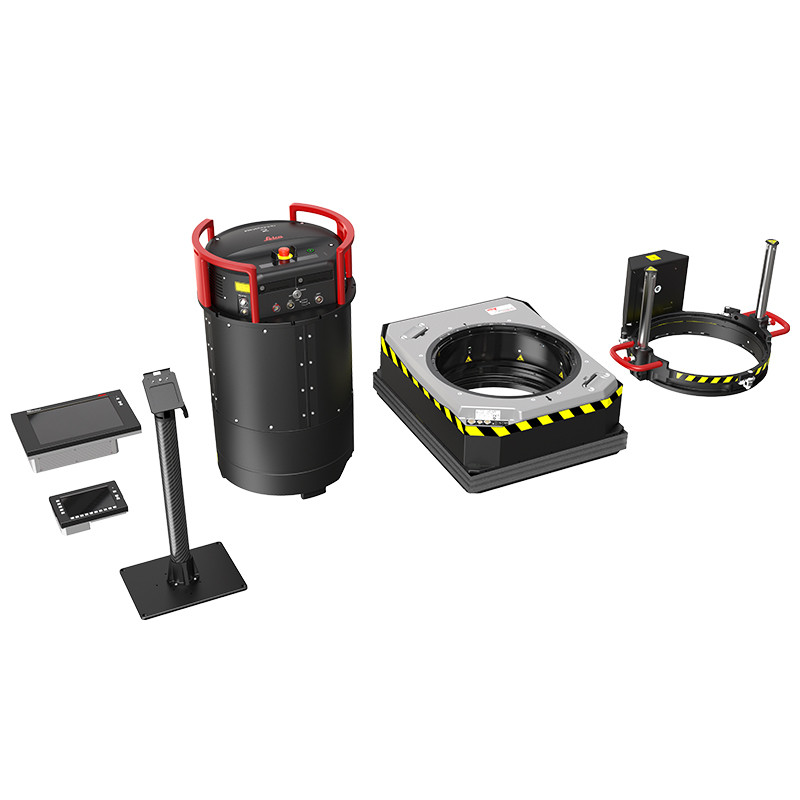
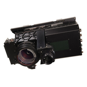
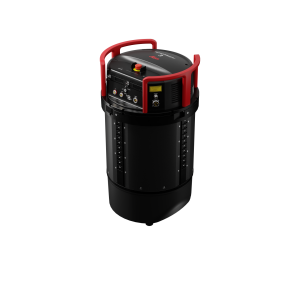
The Leica CityMapper-2 provides high quality oblique imaging and LiDAR from one flight, saving time and costs. It captures two nadir (RGB/NIR) and four oblique 150 MP images. Together with a new generation 2 MHz pulse rate LiDAR it breaks all barriers of urban mapping. The newly developed optical system is equipped with Leica Geosystem’s unique mechanical forward-motion-compensation (FMC), which allows to capture high-quality imagery even in difficult lighting conditions.

Leica Geosystems Airborne Solutions
Switzerland
Description
The need for accurate aerial data in metropolitan areas goes beyond traditional data products because the fast-changing urban environments require more frequent and hence more efficient updates of geospatial base layers.
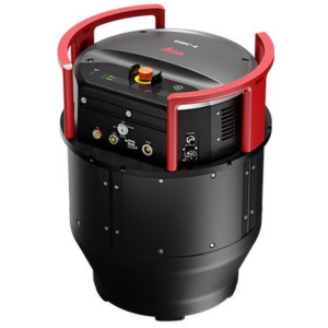
The Leica CityMapper-2 is specifically designed for airborne urban mapping and offers twice the data collection performance to addresses this urgent need for 3D data. The world’s only hybrid oblique imaging and LiDAR airborne sensors, captures two nadir (RGB/NIR) and four oblique 150 MP images every 0.8 seconds offering highest resolution to visualise every corner of the city. Together with a new generation 2 MHz pulse rate LiDAR, this sensor breaks all conventional barriers of urban mapping.
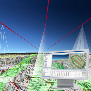
The Leica HxMap high-performance post-processing workflow moves into a new generation together with CityMapper-2. Edge computing creates fully calibrated high quality image data for rapid QC and emergency response applications.
Do you have questions about this product?
- Questions about price, availability, and/or retailers
- Questions about technical specifications and usage
- Questions about suitability for your project or application
Specifications
-
Application
-
Training facilities
Yes
Distinguishable features
Hybrid oblique system with high performance LiDAR, true Forward Motion Compensation
-
Data storage
-
Type of storage
SSD
Storage capacity [GB]
15360
Storage Replaceable
Y
-
Sensor Characteristics
-
Number of lenses
6
Lenses: focal lengths [mm]
CityMapper-2S: 112mm Nadir, 146mm Oblique, 70mm Nadir NIR / CityMapper-2H: 146mm Nadir, 189mm Oblique, 70mm Nadir NIR
Type CMOS
BSI
Pixel size [µm]
3.76
Megapixels
150
Dynamic range [bits]
14
CCD RGB
R (580-660nm), G (480-590nm), B (420-510nm)
Charged Coupled Device (CCD) IR
720-850nm
CCD along track format [mm x mm]
40
CCD along track format [pixel x pixel]
10640
CCD across track format [mm x mm]
53.3
CCD across track format [pixel x pixel]
14192
Max. integration time [s]
0.9
Max. shutter speed [s]
0.001
Data collection rate [megapixel/s]
1000
Max. across-track FOV [deg]
CityMapper-2S: 26.8 deg, CityMapper-2H: 20.7 deg
-
Operation Characteristics
-
Fixed-wing
Y
Min. flying height [m]
300
Typical flying height [m]
1490
Max flying height[m]
5500
Max. acquisition duration [h]
>8
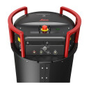
Forward motion compensation
Y
In flight pre-view
Y
Temperature controlled pod
Y
Platform
-
Software
-
On board image storage format(s)
Leica proprietary image and LiDAR data format, 4:1 thumbnails as TIFF
Type of mission planning software
Leica MissionPro
Type of postprocessing software
Leica HxMap
-
General
-
Year of introduction
2019
Last update
2019
-
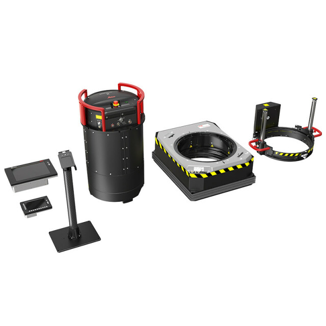
Hardware
-
Camera unit Weight [kg]
57.5
Camera unit Length [m]
0.7448
Camera unit Width [m]
0.435
Camera unit Depth [m]
0.435
Power requirements
950W / 28VDC (1200W peak for <60s
Type of GNSS/ INS positioning system
Novatel SPAN OEM7 / class5 IMU, 500Hz, no export license required US ECCN 7A994
-
Application areas
-
Select an application area:
-
Product characteristics
-
Choose characteristics:
Documents
Brochure
leica-citymapper-2-ds-900980-0520-en-lr.pdf
1.41 MB
Other documents
-
Leica RealCity Brochure1.11 MB
-
Leica HxMap Brochure1.12 MB
Videos


