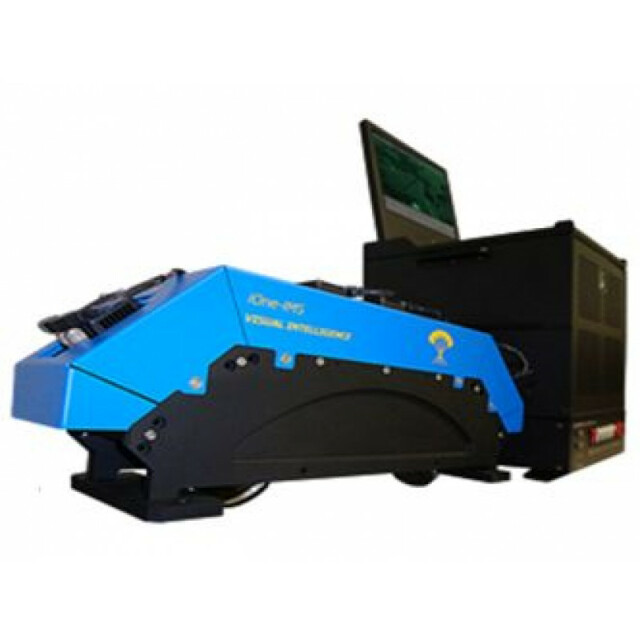
iOne IMS (Infrastructure Mapping System)
Visual Intelligence
Houston, US
Description
Specifications
-
Application
-
Main applications
Corridor infrastructure mapping, with or without Lidar for simultaneous data collection. Electric transmission, pipeline, highway, railway, construction monitoring. Fixed wing, rotorcraft, UAS/UAV’s,.
Distinguishable features
No physical shutters to break down. Fly multiple project types in one pass – Ortho, Stereo, NIR Stereo, Forward and Backward Oblique -.Using Sensor Reconfiguration Kit, may be reconfigured into other VI sensors.
-
Uncertainty
-
Precision [pixels]
0.5
Geometric calibration
Y
Radiometric calibration
Y
-
Data storage
-
Type of storage
SSD
Storage capacity [GB]
Up to 8 TB
Storage Replaceable
Y
-
Sensor Characteristics
-
Number of lenses
4
Lenses: focal lengths [mm]
2 x 24 (nadir color and NIR) & 2 x 100 (oblique)
Lenses: interchangeable
N
Type CCD
Kodak KAI-29050
Pixel size [µm]
5.5
Megapixels
86
Dynamic range [bits]
12
CCD RGB
Y
Charged Coupled Device (CCD) IR
Y
CCD along track format [mm x mm]
6576 x 4350
CCD across track format [pixel x pixel]
4350 x 5676
Max. integration time [s]
1.0
Max. shutter speed [s]
0.0005
Data collection rate [megapixel/s]
86
Max. across-track FOV [deg]
53
-
Operation Characteristics
-
Helicopter
Y
Fixed-wing
Y
Max flying height[m]
10000
Max. acquisition duration [h]
24
Forward motion compensation
Y
In flight pre-view
Y
Temperature controlled pod
N
-
Software
-
On board image storage format(s)
Raw
Type of mission planning software
Compatible with any, Topoflight available
Type of postprocessing software
Isis Earth
-
General
-
Year of introduction
2012
Last update
2014
-
Hardware
-
Camera unit Weight [kg]
7.25
Camera unit Length [m]
0.53
Camera unit Width [m]
0.152
Camera unit Depth [m]
0.21
Power requirements
28v DC (110v - 240v AC with ground power adaptor)
Type of GNSS/ INS positioning system
Compatible with any GPS/GNSS