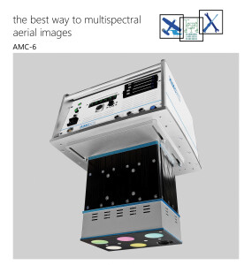
HELIDAS
HELICOPTER CORRIDOR MAPPING SYSTEM WITH SNYP’AIR OPTION
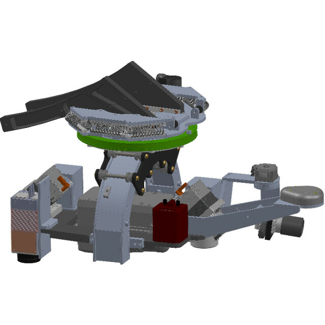
The HELIDAS efficiently captures sensor data from cameras, LiDAR systems, Infrared sensors, and other devices. Lead’Air’s equipment is fully integrated with the Applanix line of INS systems, from AP15 to AP60 depending on the required accuracies for your application. HELIDAS is a customizable Powerline system with many options such as Applanix AP60 INS, Riegl VUX1-LR LiDAR, and 3 PHASE ONE iXM-RS 150 Digital cameras as Nadir, fore, and aft RGB obliques.
Lead'Air, Inc.
Kissimmee, US
Description
Building on our successful MIDAS line of products, the HELIDAS efficiently captures sensor data from cameras, LiDAR systems, Infrared sensors, and other devices. Lead’Air’s equipment is fully integrated with the Applanix line of INS systems, from AP15 to AP60 depending on the required accuracies for your application. In addition, we have complete integration with Riegl’s Airborne LiDAR Systems.
HELIDAS is a customizable Powerline system with many options such as Applanix AP60 INS, Riegl VUX1-LR LiDAR, and 3 PHASE ONE iXM-RS 150 Digital cameras as Nadir, fore, and aft RGB obliques. There is a Nikon D850 and Black Magic video for real-time targeting of towers. In addition, there is a VARIOCAM Infrared sensor in a Nadir position.
Controlling the fully stabilized platform, the real-time targeting system can automatically follow a predetermined path or manually target the system using the joystick and real-time feedback from the Black Magic video assist display and capture system.
Specifications
-
Application
-
Main applications
Powerline, Pipeline, roadway, small block areas
Distinguishable features
Oblique/vertical camera system with various lens options and LiDAR Mount
Training facilities
Yes
-
Uncertainty
-
Precision [pixels]
0.2
Geometric calibration
Y
Radiometric calibration
Y
-
Data storage
-
Type of storage
SSD
Storage capacity [GB]
2000-5000
Storage Replaceable
Y
-
Sensor Characteristics
-
Number of lenses
3
Lenses: focal lengths [mm]
35,50,85,100
Lenses: interchangeable
Y
Type CCD
CMOS
Pixel size [µm]
3.76
Megapixels
108
Dynamic range [bits]
14
CCD RGB
CMOS
Charged Coupled Device (CCD) IR
CMOS
CCD simultaneous
Y
CCD along track format [mm x mm]
40
CCD along track format [pixel x pixel]
10652
CCD across track format [mm x mm]
53.4
CCD across track format [pixel x pixel]
14204
Max. integration time [s]
160
Max. shutter speed [s]
0.00025
Data collection rate [megapixel/s]
Depends on type and quantity of sensors
Max. across-track FOV [deg]
Depends on sensor/lenses
-
Operation Characteristics
-
Helicopter
Y
Fixed-wing
N
Min. flying height [m]
46
Typical flying height [m]
183
Max flying height[m]
304.8
Max. acquisition duration [h]
10
Warm-up time [s]
60
Forward motion compensation
Y
In flight pre-view
Y
Temperature controlled pod
N
-
Software
-
On board image storage format(s)
RAW(NEF) or JPG or IIQ RAW
Type of mission planning software
Integrated X-Track FMS 8 seats included
Type of postprocessing software
Appplanix POSPAC, Pictovera, others
-
General
-
Year of introduction
2015
Last update
2019
-
Hardware
-
Camera unit Weight [kg]
37
Camera unit Length [m]
0.56
Camera unit Width [m]
0.57
Camera unit Depth [m]
0.49
Power requirements
24-28 volts at 12-13 amps
Type of GNSS/ INS positioning system
Integrated Applanix POS-AV 410 or 510
