
Using UAV Photogrammetry to Survey a Wind Farm Access Road
Maintaining a large wind farm requires constant and reliable access. So when an access road is built, it needs to be carefully surveyed.
Have you ever stood beneath a wind turbine? They have huge pillars that reach incredibly high, the tallest in the world is over 240 meters (787 feet) at its highest point. More countries are building turbines to harness the advantages of wind power as they move away from unsustainable fossil fuels. In Norway, 98% of electricity comes from renewable sources. Wind energy is particularly popular, with wind power plant expansion happening both offshore and on land.
Biodrone is a Norway-based company that offers drone surveying and mapping services across Scandinavia. Typically, their work includes mapping infrastructure such as roads, agricultural spraying, and forest inventories. Renewable energy infrastructure is not new to Biodrone, who have inspected dams and wind turbines, including investigating how far away icicles on the turbines fall off and land, sometimes up to 200 meters (650 feet)!
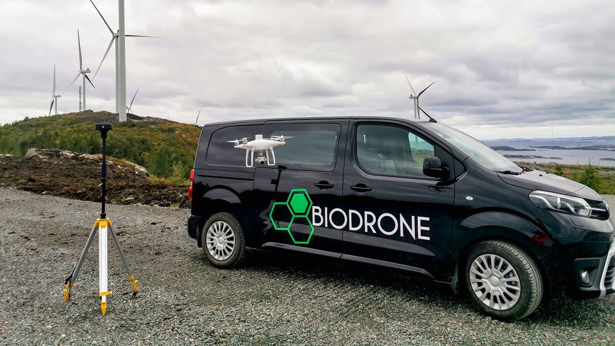
This project saw the Biodrone team working hard on-site
Details of this project
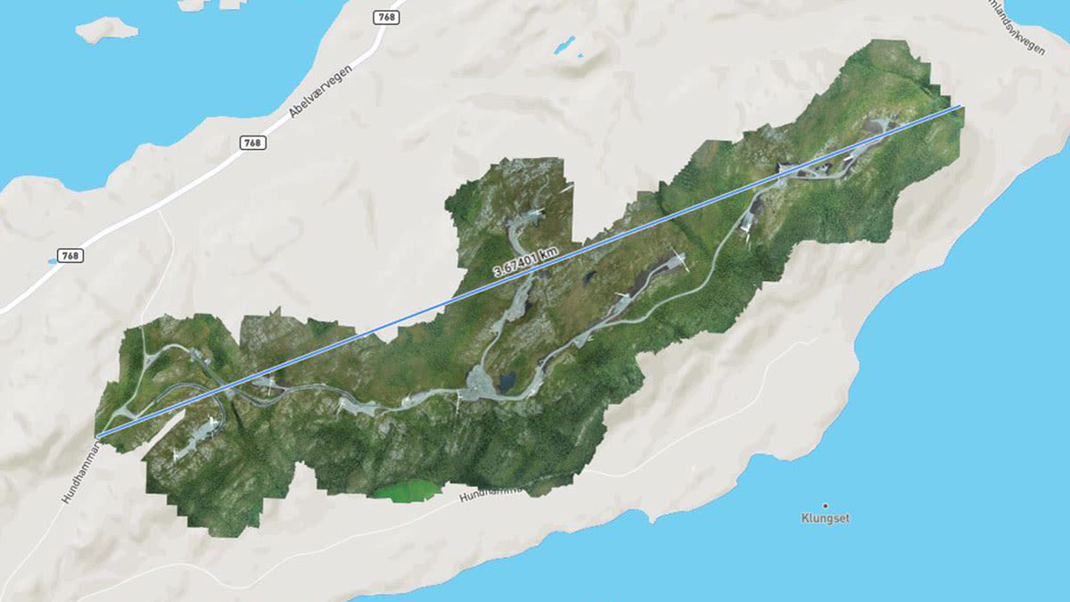
| Location | Hundhammerfjellet, Nærøysund, Norway |
| User | Biodrone |
| Area surveyed | 2.6 km2 (490 acres) |
| Total images captured | 1,245 |
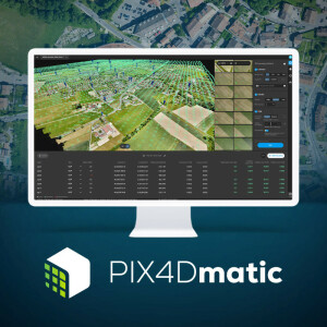
| Software | Pix4Dmatic |
| Hardware | DJI Phantom 4 RTK |
| Processing time | 2 hours |
| GSD | 3.87 cm/px |
How They Planned the Challenging Flight Path
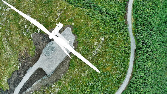
Surveying a wind farm and the land around it is a complicated process. The team knew that it would take a technical flight to safely survey the land and achieve its goal of highly accurate outputs. To start with, they got a special permit to fly at a height of 170 meters (570 feet) to survey the site while flying above the turbines. This altitude is not within the 120 meters (394 feet) height limit for drone flights in Norway but Biodrone have a special dispensation due to the nature of their work. They also issued a NOTAM, or notice to airmen, to warn any nearby pilots of their actions. Surprisingly, the site was not very windy that day, which is unusual for a wind park. This meant flying was easier with no unpredictable airflow pushing the drone off-course.
After flying above the wind turbines, Biodrone’s team flew between the pylons. This was time-consuming but necessary to gather the data needed for this project. The high-altitude flight of over 120 meters presented a challenge, as Biodrone needed a small ground-sampling distance (GSD) to satisfy the needs of their client. This is why flying between the pylons as well as over them was necessary, as it meant that Biodrone managed to capture an overall GSD of 3.87 cm per pixel (1.5 inches).
The structure of the park meant it was a corridor data collection mission
There is the obvious danger of the drone crashing into a wind turbine blade. Maintaining a visual line of sight (VLOS) with the drone helped the pilot navigate their UAV.
Surveying a large site of 2.6 km2 (642 acres) meant the team gathered a lot of data, with over 100 images per flight, and needed powerful software for the processing step. Specialized for large-scale mapping, Pix4Dmatic was the chosen solution since it is able to crunch very large projects in one go. The 1,245 images and the RTK/PPK data were imported and processed in just 2 hours. The resultant orthomosaic and point cloud were provided to a third-party consultant working for the owner of the wind park.
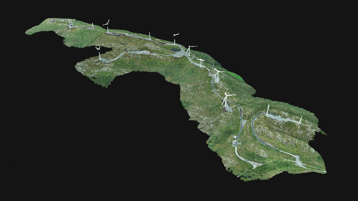
The final point cloud output in Pix4Dmatic
Shifting To Renewable Energy Sources
Drone surveying is not new to the energy sector, even as it evolves to suit the demand for renewable power. The move away from fossil fuels can leave behind huge infrastructures which need to be surveyed for redevelopment. Wind farm expansion is taking place worldwide, and drone surveys will likely be more common in the future, not least because drones can often save engineers a long and exhausting climb. Similar workflows are already in place with drones help in telecom tower inspections, showing how useful they are for accessing tall structures.
"Pix4Dmatic is a gamechanger for us when it comes to large datasets." - Atilla Haugen, Biodrone
As a result of using drones and Pix4Dmatic, Biodrone was able to survey the access road for the windfarm faster than before and achieve the required accuracy. With drone surveying for renewable energy projects becoming increasingly applicable and widespread, companies like Biodrone are demonstrating just how useful it is, as well as how much easier it makes their work.


