
Unmanned Surface Vehicle Makes 3D Bathymetric Surveying Easy
When conducting Multi beam bathymetric surveys with an unmanned surface vessel, marine survey professionals highlight three major points of concern: 1) How secure is their investment given the cost of Multi beam echo sounders? 2) Does the USV offer sufficient flexibility to handle a variety of bathymetric survey scenarios? 3) What about the final accuracy of the high-resolution 3D bathymetric survey?
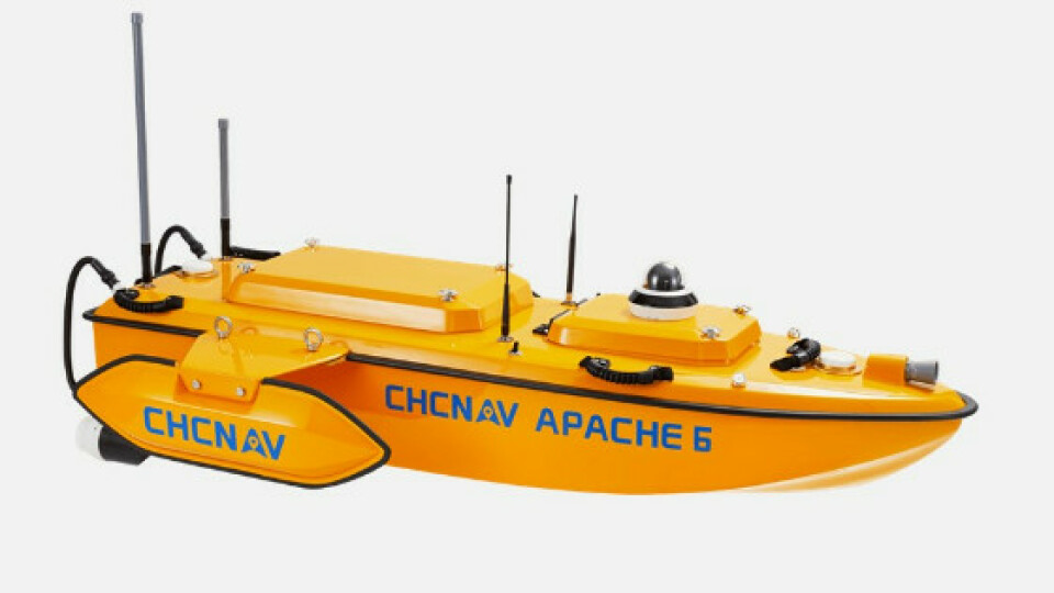
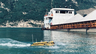
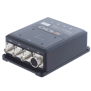
The Donghai Bridge, located in Shanghai, China, is a key component of the Shanghai International Shipping Center’s deepwater port infrastructure. An operational challenge is conducting underwater surveys of the bridge piers’ conditions for maintenance purposes. The bottom of the bridge piers is immersed in water and can be eroded by the action of sand and gravel. Hydrodynamic scour caused by rapid water flow can create scour holes and compromise the structure's integrity. The solution selected for the Donghai Bridge survey project comprises an unmanned survey vessel, the APACHE 6 of CHCNAV, carrying a NORBIT iWBMS STX Multibeam Echosounder.
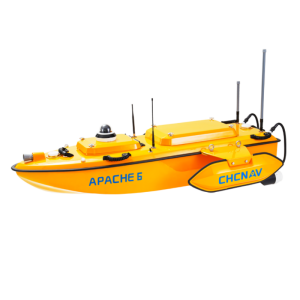
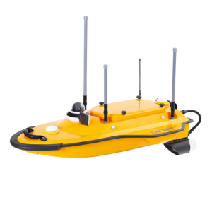
Figure 1. The Apache 6 USV from CHC Navigation (the latest model).
When conducting Multibeam bathymetric surveys with an unmanned surface vessel, marine survey professionals highlight three major points of concern:
- How secure is their investment given the cost of Multibeam echosounders?
- Does the USV offer sufficient flexibility to handle a variety of bathymetric survey scenarios?
- What about the final accuracy of the high-resolution 3D bathymetric survey?
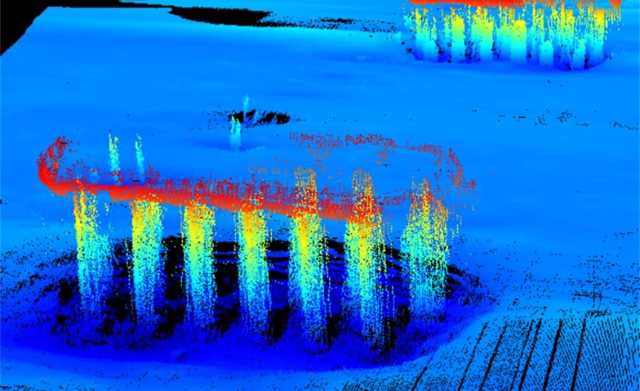
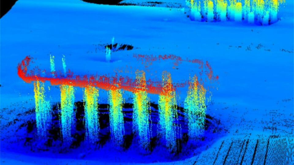
Figure 2. The bridge section piling data acquired by Apache 6 during the survey.
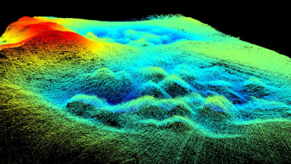
During underwater terrain mapping, marine survey professionals often need to map dense underwater structures, such as bridge piers, as in the survey case in Shanghai. One of the main problems encountered is surveying the topography behind the piers and the internal topography of the dense structures.
When it is difficult to achieve this with traditional crewed boats, hydrographers now have the option of deploying USVs. USVs reduce survey time, improve work efficiency, and produce high-resolution 3D data to meet the requirements of the most demanding marine infrastructure projects. The CHCNAV APACHE6 USV is an innovative and fully integrated solution for 3D bathymetric surveys, underwater objects, and offshore.
Do you have questions about this case study?
Get in touch with CHC Navigation | CHCNAV, and they would be happy to answer any questions you have about pricing, suitability, availability, specs, etc.


