Join 40,000+ geospatial professionals and get technology news delivered straight to your inbox every week. Subscribe today.

deepdive-understanding-uas-lidar-technology-and-the-the-dji-zenmuse-l1-header.png

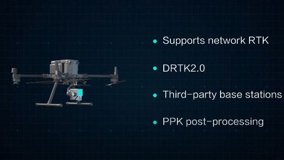
Understanding UAS Lidar Technology and the the DJI Zenmuse L1

DJI ENTERPRISE

Join DJI Geospatial Channels & Solution Manager Simba Wang, as he explains how drone Lidar Technology works and the advantages of this technology in aerial surveying projects. By the end of the video, you will not only understand the foundations of the technology but also you will know which scenarios Lidar is suitable for, and how to collect accurate data with the DJI Zenmuse L1.

More from DJI ENTERPRISE
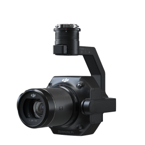
DJI Zenmuse P1
DJI Enterprise Blog
Like us on Facebook
Follow us on Twitter
Follow us on LinkedIn

Do you have questions about this case study?

Get in touch with DJI ENTERPRISE, and they would be happy to answer any questions you have about pricing, suitability, availability, specs, etc.

Ask a question

DJI ENTERPRISE team is happy to assist.

DJI ENTERPRISE

We're available on all weekdays and usually reply within 1-2 working days.

Please provide detailed information. Your input helps DJI ENTERPRISE assist you effectively.

Let us know a little about you and your contact information.

Do you represent a company or organization?

Before we proceed, would you be interested in subscribing to our newsletter?

By completing this form, you acknowledge and agree to abide by our Terms and Conditions, Privacy Policy and Cookie Policy.

Thank you for your message! Our team tipically to respond to inquiries within 1-2 business days.