The Usage of Commercial Drones For Land Surveying
Land surveying is an incredibly challenging and complex job as the world continues to meet problems of land scarcity and a growing population. Land surveyors have long since mapped territories utilizing a range of traditional methods and tools such as manned flights, satellite data, robotic total stations, GPS receivers, retroreflectors, 3D scanners, handheld tablets, digital levels, subsurface locators, GIS, and surveying software.
Today the use of commercial drones or UAVs (unmanned aerial vehicles) for land surveying has become common practice. Drones capture data that can be used in a wide-variety of mapping applications:
- Automated mapping – by establishing ground control points UAVs are able to plan a flight path allowing the drone to fly autonomously.
- Cadastral surveying – establishing property boundaries consisting of land and building is valuable information for real estate. UAV generated imagery, with low acquisition data costs, will help to identify boundaries and property assets.
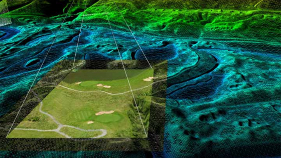
- LiDAR mapping – capturing precise digital representation of objects, buildings, and the ground. Traditional LiDAR units need to be mounted onto manned vehicles due to the heavy weight. LiDAR drone solutions are cost effective when compared to mobile mapping systems.
- Volumetric calculations – UAVs are excellent tools for volumetric applications resulting in greater reference points, safer data collection methods and accurate readings.
Below is a list of the advantages of the usage of unmanned aerial vehicles for surveying and mapping.
Reduce Time Spent Collecting Data
Collecting land data using traditional surveying methods has been to date one of the most time-consuming elements for many projects.
The advancement of drone technology is changing the nature of a land surveyors role, effectively allowing them to accomplish more in less time.
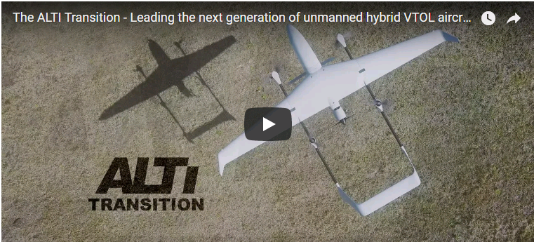
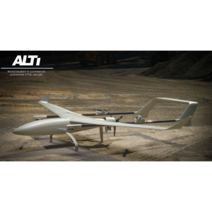
The Transition, a VTOL (vertical take-off and landing) hybrid commercial UAV, with an impressive endurance of up to 11-hours enables a surveyor to collect a vast amount of data in a single flying session. Assisting in reducing the number of man-hours in the field required to collect crucial data.
View Real-Time Spatial Data
The immediate future will see land surveyors become experts at analyzing spatial data in the field.
The advancement of UAV technology is providing surveyors with the opportunity to capture remotely-sensed, real-time geospatial data. This, in turn, is helping to generate essential data for GIS applications.
The use of integrated imaging payloads into UAVs is becoming increasingly important for image capturing. With the ALTI Transition, you are able to interchange between a wide range of payloads with a large open payload bay, with a maximum payload weight of 1.5kg.
Survey Areas Quickly And Safely
Unmanned aerial systems allow surveyors to deploy rapidly and map just about anywhere, this is especially effective when it comes to remote and rural areas. This method is helping to limit the environmental risks to surveyors associated with mapping out unknown areas.
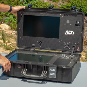
The ALTI Transition has a modular ‘rapid deploy’ airframe allowing setup and flying within a few short minutes, no bulky and complex launch and recovery hardware is required. The entire system packs into a compact case, ready for transport with massive cost-savings and fewer hands required. Setup and fly in under 10 minutes.
Do you have questions about this case study?
Get in touch with ALTI Unmanned Aircraft Systems, and they would be happy to answer any questions you have about pricing, suitability, availability, specs, etc.


